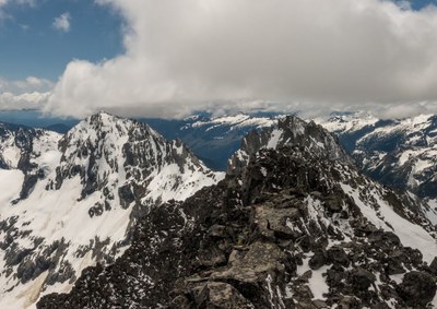
Mount Fernow/Southwest Slope
The highest peak in the Entiat Mountains, Mount Fernow offers a challenging, strenuous scramble. Your routefinding skills will be tested in the 22 miles and nearly 6,000 feet of elevation gain.
getting there
Drive SR-2 east to Coles Corner. Head north on SR-207 toward Lake Wenatchee, turning right at the southeast end of the lake. Turn left onto Chiwawa River Road (Forest Road 62) and follow it over 25 miles, passing the Alpine Meadow Campground. Look for Phelps Creek road branching on the right and follow it about 2.5 miles to the Phelps Creek trailhead (4,100).
APPROACH
Hike Phelps Creek trail about 3.5 miles to Leroy Creek. After crossing the creek look for a trail headed up to the right. Follow this steep, dusty trail 1.9 miles up to Leroy Basin with good camping (6,100 ft).
ASCENT ROUTE
From Leroy Basin camp, head north to a slight saddle in the ridge. This is a cross-country route that ascends heather and scree. Cross the saddle and drop ~100 feet then traverse north up ~400 feet to a small lake (a possible bivy campsite alternative). Continue north up ~200 feet and across another slight saddle. Descend ~700 feet, traversing Gloomy Glacier (what remains of it), and climb the slope on the northeast side to another basin. Then ascend slopes which start as a steep gully then become gentler with possible snow patches to a saddle in the ridge south of the summit. Head north towards the summit skirting obstacles to climb on reasonable terrain.
DESCENT ROUTE
Descend the climbing route.
TRIP PROFILE
| SEGMENT | TIME(HR) | ELEVATION GAIN (FT) |
|---|---|---|
| Trailhead to Camp | 3-4 | 2,000 |
| Camp to Summit | 7-9 | 3,900 |
| Summit to Trailhead | 6-7 | 800 |
EQUIPMENT
Helmet. A short scramble rope might be useful as well as a harness if any 4th class variations in routefinding warrant it.
NOTES
An ice axe and crampons may be needed for the approach may be needed, depending on time of year and conditions.
- Suitable Activities: Climbing
- Climbing Category: Basic Alpine
- Seasons: June, July, August, September, October
- Weather: View weather forecast
- View avalanche forecast.
- Difficulty: Basic Alpine Climb
- Length: 22.0 mi
- Elevation Gain: 5,900 ft
- 9,249 ft
-
Land Manager:
Okanogan-Wenatchee National Forests
Glacier Peak Wilderness, Entiat Ranger District (OWNF)
- Parking Permit Required: Northwest Forest Pass
- Recommended Party Size: 4
- Maximum Party Size: 6
- Maximum Route/Place Capacity: 6
- USGS Holden
- USGS Trinity
- Green Trails Holden No. 113
- Trails Illustrated Glacier Peak Wilderness
- Green Trails North Cascades Lake Chelan No. 114SX
There are no resources for this route/place. Log in and send us updates, images, or resources.
