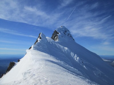
Mount Jefferson/Jefferson Park Glacier
An intermediate mountaineering climb to the summit of Oregon's Mount Jefferson via the Jefferson Park Glacier with a gain of 5,897 feet. This is the second most climbed route on Mount Jefferson.
Driving Directions
Drive I-5 south through Portland (possibly bypassing Portland via I-205) to Salem. Head east on Oregon SR 22, passing the Detroit ranger station (permits are self-issue at the trailhead). Proceed 10 mi east of Detroit (after milepost 60), and turn left on Whitewater Road (Forest Road 2243) and take this 7.5 mi. to its end.
Approach
Hike the Whitewater Trail 1.5 mi to the intersection with the Jefferson Park Trail. Hike east 2.5 mi to the intersection with the Pacific Crest Trail, and up the tributary of Whitewater Creek to camping sites.
ascent Route
Ascend the east side of the Jefferson Park Glacier via the line of least resistance. Climb to a saddle between the main peak and a prominent point north of the summit. Climb a narrow ridge south to the summit.
Descent Route
Descend the climbing route or an alternate route via the Whitewater Glacier back to Jefferson Park.
Equipment
Standard glacier gear.
- Suitable Activities: Climbing
- Climbing Category: Intermediate Alpine
- Seasons: April, May, June, July, August, September, October
- Weather: View weather forecast
- View avalanche forecast.
- Difficulty: Intermediate Mountaineering Climb
- Length: 15.0 mi
- Elevation Gain: 5,897 ft
- 10,497 ft
-
Land Manager:
Willamette National Forest
Mount Jefferson Wilderness
- Parking Permit Required: Northwest Forest Pass
- Recommended Party Size: 12
- Maximum Party Size: 12
- Maximum Route/Place Capacity: 12
- USGS Mount Jefferson
There are no resources for this route/place. Log in and send us updates, images, or resources.
