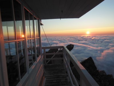
Mount Pilchuck/East Ridge
A moderate scramble of 10 miles round trip with 2,800 feet of gain off of the Mountain Loop Highway. Scramble Iodine Gulch to Bathtub Lakes. Turn around here or continue on then to the lookout on the summit of Mount Pilchuck.
getting there
From SR-92 in Granite Falls, turn left onto the Mountain Loop Highway. Drive 10 miles to the Verlot Ranger Station which is on the left. Drive 4.6 miles past the ranger station, turn right onto Forest Road 4020, signed for Boardman Lake, Ashland Lakes, and Bear/Pinnacle Lake. At a junction reached in 2.7 miles, take the right fork, Forest Road 4021, and drive 1.4 miles to another junction. Stay right and follow this rough road to the trailhead (2,700 ft).
- The gravel roads leading up to the trailhead have many potholes, so be sure your car can handle it or drive slowly and avoid them as best you can.
- The parking lot can hold about 15 cars.
- There are no toilet facilities at the trailhead.
Approach & Ascent
Bathtub Lakes (4,760 ft)
6.5 miles round trip, 2,000 feet of elevation gain
Difficulty: Strenuous 2, Technical 2
Hike the Bear Lake Trail to it's junction with the Pinnacle Lake Trail, turn left and hike to Pinnacle Lake. Walk around the southwest shore of Pinnacle Lake to Iodine Creek, follow Iodine Creek up through Iodine Gulch to it top, turn right, and continue a short distance to Bathtub Lakes.
Mount Pilchuck (5,340 ft)
10 miles round trip, 2,800 feet of elevation gain
difficulty: Strenuous 3, Technical 3
From bathtub Lakes, continue scrambling west to the lookout on the summit of Mount Pilchuck.
Information for LEADERS
- Mount Pilchuck is also done as a day hike and as a snowshoe trip via Heather Lake. If you are planning a scramble that plans on ascending or descending via the regular trail please check the Mount Pilchuck route/place and coordinate with other leaders to be sure our groups do not overlap on the trail.
- Suitable Activities: Scrambling
- Seasons: June, July, August, September, October
- Weather: View weather forecast
- Difficulty: Technical 3, Strenuous 3
- Length: 10.0 mi
- Elevation Gain: 2,800 ft
- 5,340 ft
-
Land Manager:
Mount Baker-Snoqualmie National Forest
Darrington Ranger District (MBSNF)
- Parking Permit Required: Northwest Forest Pass
- Recommended Party Size: 12
- Maximum Party Size: 12
- Maximum Route/Place Capacity: 12
- Green Trails Mountain Loop Highway No. 111SX
- Green Trails Granite Falls No. 109
- USGS Verlot
This is a list of titles that represent the variations of trips you can take at this route/place. This includes side trips, extensions and peak combinations. Not seeing a title that fits your trip? Log in and send us updates, images, or resources.
- Bathtub Lakes
There are no resources for this route/place. Log in and send us updates, images, or resources.
