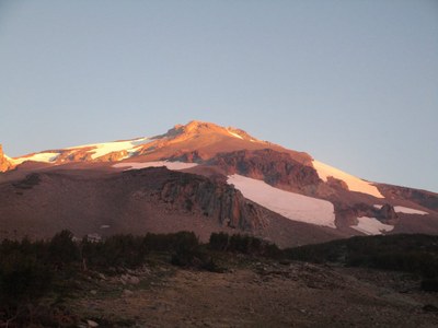
Mount Shasta/Clear Creek
A strenuous 16-mile, 7,800-foot scramble up the southeast side of Mount Shasta to its 14,179-foot summit. Located in northern California, Mount Shasta is one of the southernmost Cascade volcanoes and one of the highest. The Clear Creek route is non-technical—a snow scramble in early spring to mid summer, and a scree to Class 3 rock scramble in late summer. It is considered one of the prettiest routes on Mount Shasta, with dramatic early morning sunrises, meadows, red rock, and views of Mud Creek Canyon.
getting there
Take the McCloud exit off I-5 onto SR-89 just south of Mount Shasta City. Drive east 13 miles and turn left onto Pilgrim Creek Road (3 miles past McCloud). Drive 5 miles and turn left onto Widow Springs Road, drive 5 miles, cross over Forest Road 31 where the road changes to Road 41N61, and continue 1.5 miles to the trailhead at the end of the road (6,400 ft).
- High clearance, 4WD vehiclesD are a must. The road to the trailhead includes ballast gravel and 4-5 sandbars that eat smaller cars.
approach
Hike the Clear Creek Trail northwest through gradually thinning forest where wildflowers are often present until Labor Day. The trail follows Mud Creek Canyon and views open onto the mountain at around 8,000 ft. After crossing above the canyon, there are campsites in the Clear Creek Meadows, among shrubby trees, between 8,300 and 8,600 feet. This is a good base camp, because a mountain spring comes from the ground here. While gathering water, please take care not to step on the fragile mosses and plant life growing around the spring.
ascent route
From base camp, the trail heads west and northwest on the Wintun Ridge to bivy spots at 9,000, 10,000 and 11,000 feet. All can hold several small tents or bivy bags, and have wind block berms.
From the 11,000-foot bivy spot, the route heads northwest to Mushroom Rock at ~13,000 ft. The route is scree and rock, which requires careful footing and a good attitude about “one step forward/half a step back.” Rocks rolling down from above can be an issue on this stretch. Helmets are recommended above 11,000 ft. Mushroom Rock, also called UFO Rock, is a large red rock shaped like a mushroom (or UFO), that serves as an excellent rest stop and a safe waiting area for those not choosing to summit.
From Mushroom Rock, there are several possible routes:
- One that bears significantly right (north) and skirts the Wintun Glacier on a steep scree over rock slope. This is not recommended. Slips and rock fall are hazards, and inexperienced parties have found themselves off route on the Wintun Glacier.
- One that bears left (west) from Mushroom Rock. There is a headwall with Class 4 scrambling that may require a fixed line.
- One that heads slightly left, northwest. This is the “middle” route with Class 2-3 scrambling, up to ~13,700 feet, where a steep trail heads north (climbers' right) to the summit ridge. It switchbacks steeply up the summit cone with some exposure and fumaroles below, and loops around to the true summit.
descent route
The "middle route" is the preferred descent route to Mushroom Rock. From Mushroom Rock, descend climbers’ right for an easy plunge step on scree, and then traverse across to high camp.
equipment
Helmets. Ice ax and crampons depending on the season.
notes
- Guidebook: Best Climbs Cascade Volcanoes by Jeff Smoot (Falcon Guides 2012).
- This route tends to be less crowded than Avalanche Gulch, another non-technical route.
- The trailhead is often closed until late summer because of snow blocking the road.
- Many parties do the 5,700-foot hike from base camp to the summit in one day. Three days and two camps is good for acclimatization.
- Consider bagging Lassen Peak along with Mount Shasta. It's 5-mile round trip day hike with 2,000 feet of elevation gain.
- Suitable Activities: Scrambling
- Seasons: July, August, September, October
- Weather: View weather forecast
- Difficulty: Rock Scramble
- Length: 16.0 mi
- Elevation Gain: 7,800 ft
- 14,179 ft
-
Land Manager:
Shasta-Trinity National Forest
Mount Shasta Wilderness, Mount Shasta Ranger District (STNF)
- Parking Permit Required: see Land Manager
- Recommended Party Size: 8
- Maximum Party Size: 12
- Maximum Route/Place Capacity: 12
- Wilderness Press Mt. Shasta Wilderness
- USGS Mt Shasta, CA
There are no resources for this route/place. Log in and send us updates, images, or resources.
