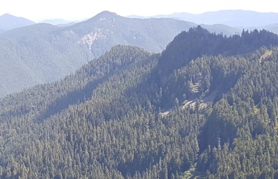
Gove Peak
A scramble of 7 miles with 3,300 feet of gain.
getting there
Drive to Enumclaw via SR 164 or SR 169 then take SR 410 to Buckley and then SR 165 to its road end through Wilkeson and Carbonado. Follow signs to Carbon River Ranger Station and continue three miles to the trailhead.
approach & ascent
Hike the Green Lake Trail to Green Lake. Just before the lake when trail begins to descend to lake, leave trail and head up in a SSE direction eventually coming out on the ridge that leads to Gove Peak. Run the ridge in a NNE direction staying on the top of the ridge as much as possible. The "summit " of Gove Peak is the 5310 ft point at the north end of the ridge.
Notes
- The summit is the point marked Gove Peak on the USGS Mowitch Lake map (5,310 ft), but the high point on the ridge is the 5,560 ft contour about a half mile to the southwest.
- There is a more scenic, if longer, approach from the Mowich Lake Trailhead by dropping off the saddle to the east of Eunice Lake. This also allows to to add Paul Peak to your trip.
- Suitable Activities: Scrambling
- Seasons: Year-round
- Weather: View weather forecast
- View avalanche forecast.
- Difficulty: Winter Scramble, Strenuous 3, Technical 2
- Length: 6.0 mi
- Elevation Gain: 3,310 ft
- 5,310 ft
-
Land Manager:
Mount Rainier National Park
Mount Rainier Wilderness
- Parking Permit Required: National Park Entrance Fee
- Recommended Party Size: 12
- Maximum Party Size: 12
- Maximum Route/Place Capacity: 12
- USGS Mowich Lake
- Green Trails Mount Rainier Wonderland No. 269SX
This is a list of titles that represent the variations of trips you can take at this route/place. This includes side trips, extensions and peak combinations. Not seeing a title that fits your trip? Log in and send us updates, images, or resources.
- Gove Peak and Peak 5560
- Peak 5560
- Gove Peak and Paul Peak
- Gove Peak, Peak 5560 and Paul Peak
There are no resources for this route/place. Log in and send us updates, images, or resources.
