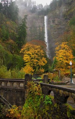
Multnomah Falls, Angels Rest, Devils Rest & Wahkeena Falls
Hike to any of the waterfalls or loop hike through the waterfalls and lookouts above Multnomah Falls Lodge and the wonderfully scenic Columbia River Gorge. With its three separate drops Multnomah Falls is Oregon's most recognizable and arguably most awe-inspiring waterfall. It is also the tallest waterfall in Oregon and the most visited natural recreation site in the Pacific Northwest.
Getting There
Mutlnomah Falls Trailhead
Take Exit 31 off I-84 into the Multnomah Falls parking area. Walk south underneath the interstate and railroad tracks to the Multnomah Falls Lodge and Visitor Center.
Wahkeena Falls Trailhead
Take Exit 28 off of I-84 and turn left onto the Historic Columbia River Highway. Drive 2.5 miles east to the parking area along the north side of the highway. The trail starts on the south side of the highway.
Angels Rest Trailhead
Take Exit 28 off of I-84 onto the Historic Columbia River Highway. The trailhead is at the junction of the Historic Columbia River Highway and East Bridal Veil Road.
On the Trail
Multnomah Falls
2.5 miles round trip, 870 feet of elevation gain, 895 ft high point
The trail starts at Mulnomah Falls Lodge, a historic building that served early automobile travelers in 1925. From the base of the falls, enjoy views of the lower and main tiers of Multnomah Falls and the picturesque span of the Benson Bridge. From here, the trail is a gently sloped 0.2-mile paved path to the Benson Bridge that was built in 1914 by Simon Benson, one of the builders of the old highway. This part of the trail has one switchback, and one small flight of a few stairs that blocks the way to wheelchairs beyond the lower falls viewpoint. Pass below a rock net where the seasonal Shady Creek Falls splashes down a cliff just west of Multnomah Falls. Continue to the top of the falls hiking through a lush forest of maple, alder, Douglas fir, red cedar, ferns, and moss.
Multnomah Falls, Angels Rest, Devils Rest & Wahkeena Falls
10-mile loop, 2,500 feet of elevation gain, 2,450 ft high point
Notes
- Timed Use Permits are required for parking in the spring and summer.
- Toilets are available near lodge.
- Multnomah Falls is fed by underground springs from Larch Mountain. The flow over the falls varies, but is usually highest during winter and spring.
- This is area is one of the best places in the Columbia River Gorge National Scenic Area to study geology exposed by floods.
- Suitable Activities: Day Hiking, Trail Running
- Seasons: Year-round
- Weather: View weather forecast
- Difficulty: Moderate
- Length: 10.0 mi
- Elevation Gain: 2,470 ft
- 2,450 ft
- Land Manager: Columbia River Gorge National Scenic Area
- Parking Permit Required: None
- Recommended Party Size: 12
- Maximum Party Size: 12
- Maximum Route/Place Capacity: 12
- Green Trails Columbia River Gorge West No. 428S
This is a list of titles that represent the variations of trips you can take at this route/place. This includes side trips, extensions and peak combinations. Not seeing a title that fits your trip? Log in and send us updates, images, or resources.
- Angels Rest
- Devils Rest
- Angels Rest & Devils Rest
- Multnomah Falls
- Wahkeena Falls
- Multnomah Falls & Wahkeena Falls
- Multnomah Falls & Wahkeena Falls Loop
- Multnomah Falls & Devils Rest
- Multnomah Falls & Devils Rest Loop
- Larch Mountain
- Franklin Ridge
- Multnomah Falls & Larch Mountain
- Multnomah Falls, Larch Mountain & Franklin Ridge
- Multnomah Falls, Larch Mountain & Franklin Ridge Loop
There are no resources for this route/place. Log in and send us updates, images, or resources.
