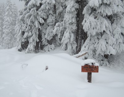
Nason Ridge Peak #1
A strenuous snowshoe trip at Stevens Pass, climbing 2,400 feet to a ridgeline and Peak 5576 (aka Nason Ridge Peak #1). This route is partly road walk, partly steep climb up a wooded ridge. Good opportunities for routefinding.
driving directions
Drive to the parking area along the north side of westbound Highway 2. If coming from the Puget Sound lowlands, drive east over Stevens Pass to the Stevens Pass Nordic Center and use the U-turn access to return westbound to the parking area.
snowshoeing route
From the parking area along the north side of westbound Highway 2, travel up the Smith Brook Road, enjoying local views of peaks and trees. Upon first reaching 4,000 ft, head straight uphill to bypass a long switchback, achieving the road again at 4,300 ft. Continue east-southeast along the road until it takes a sharp turn northeast. From here follow the route of the Nason Ridge Trail as it ascents steeply up the first peak, gaining 1,000 feet from the road to Peak 5576 (aka Nason Ridge Peak #1).
- Suitable Activities: Snowshoeing
- Snowshoeing Category: Intermediate
- Seasons: January, February, March, April, December
- Weather: View weather forecast
- Difficulty: Strenuous
- Length: 7.0 mi
- Elevation Gain: 2,400 ft
- 5,576 ft
- Land Manager: Okanogan-Wenatchee National Forests
- Parking Permit Required: None
- Recommended Party Size: 12
- Maximum Party Size: 12
- Maximum Route/Place Capacity: 12
- Green Trails Benchmark Mtn No. 144
- USGS Labyrinth Mtn
- Green Trails Alpine Lakes West (Stevens Pass) No. 176S
There are no resources for this route/place. Log in and send us updates, images, or resources.
