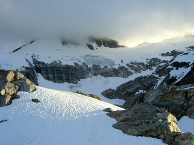
Primus Peak/Borealis Glacier
A Grade II, Class 2-3 glacier climb in the North Cascades.
Getting There
Drive SR-20 to Marblemount for trip permits for Klawatti Zone at Park Ranger Station. Continue on SR-20 to Colonial Creek and park at the Thunder Creek Trailhead (1,200 ft).
APPROACH
Hike the Thunder Creek Trail for approximately 6 miles, making sure to stay on this trail at the junction with the Panther Creek Trail ~1.6 miles from the trailhead. Continue on to McAllister Camp. A bridge over Thunder Creek was destroyed during the 2017-18 winter. A logjam is located ~0.25 mile upstream from the original bridge. From a place where a side trail used to lead to the bridge continue ~0.25 mile to where the trail is slightly above the creek level (N 48.61478, W -121.05388). Leave the trail and descend steeply down ~50 feet. From here head directly towards the creek crossing side channels over logs. The creek here is split into two main channels with an island between them. There are multiple ways (logs) to reach the island. The second channel had only two possible logs to cross on in 2019 and it is possible this section will need to be waded across in the future. Once on the other side bushwhack along the creek to the site of the old McAllister Camp. (Allow 30-60 minutes to cross the creek. If using a phone app for navigation, the OpenTopoMap layer shows the climber's boot path leading up the ridge to the lake.)
The ridge is long, cliffy, and brushy but manageable. Follow camp way trails heading up towards the ridge to find the start of the faint climber's trail that follows most of the ridge but it is easy to lose in a couple of places. With careful routefinding one can avoid anything more than a few Class 3 sections. The trickiest obstacle is a small cliff section at ~4,000 ft. It is easier to find on the way up then down — consider taking a GPS way point. The second tricky section is located between a rocky open spot at 4,750 ft and the upper heather slopes (5,000 ft). Continue up the ridge for a total of just over 2 miles to the toe of the Borealis Glacier at 6,000 ft. There is good camping here. Allow an entire day to make this camp.
ASCENT ROUTE
From camp traverse around the right (northwest) side of the lake at the toe of the lower Borealis Glacier, scrambling on rocks as needed until you can get around and above the like. Ascend gentle slopes to climber's right until you can cut left and gain the upper Borealis Glacier, heading above cliff bands and an obvious icefall. Traverse up and left toward Tricouni and cut up the col between Tricouni and Primus (Lucky Pass, 7,200 ft). From the col, ascend the east ridge of Primus (class 2-3).
DESCENT ROUTE
Descend the climbing route.
TRIP PROFILE
| SEGMENT | TIME (Hours) | ELEVATION GAIN (FeeT) | Distance (MIles) |
|---|---|---|---|
| Trailhead to Camp | 7-9 | 4,800 | ~8 |
| Camp to Summit | 3-4 | 2,500 | ~1.5 |
| Summit to Trailhead | 9-11 | ~9.5 |
EQUIPMENT
Ice axe, crampons, standard glacier travel gear.
NOTES
- This is a strenuous climb as a two day trip. A three day trip would be more moderate and also allow for tagging Tricouni on the second day.
- The recommended time frame is mid- to late summer.
- Suitable Activities: Climbing
- Climbing Category: Basic Alpine
- Seasons: July, August
- Weather: View weather forecast
- Difficulty: Basic Alpine Climb
- Length: 19.0 mi
- Elevation Gain: 7,300 ft
- 8,508 ft
-
Land Manager:
North Cascades National Park
Stephen Mather Wilderness
- Parking Permit Required: None
- Recommended Party Size: 6
- Maximum Party Size: 6
- Maximum Route/Place Capacity: 6
- USGS Forbidden Peak
There are no resources for this route/place. Log in and send us updates, images, or resources.
