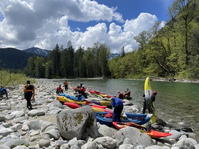
Skykomish River (North Fork): Trout Creek to South Fork
Putting in at the Index-Galena Road washout and taking out at the Power Lines just below the town of Index makes for a fun mostly Class II packraft run with some Class III drops sprinkled in. Llama Ledges, a Class III+ rapid, awaits those who continue past the Power Line take out and down to the confluence with South Fork.
FLOW
- NOAA Gauge: NF SKYKOMISH--AT INDEX T INDEX (SNIW1)
- 2,000 - 4,000 cfs: Runnable
- 72 fpm average gradient
PUT-IN
- Trout Creek: From the town of Index, drive Index-Galena Road until it ends at a washout. There is ample roadside parking. Put in just below a Class IV rapid formed at Trout Creek.
-
TAKE-OUTS
- Index Bridge: The bridge at the entrance to the town of Index is the first and easiest take-out—it's on river right. Parking is at the town park across the street.
- Power Lines: Continue below the town bridge for 0.5 mile for a fun Class III addition. Take out on river right just under the first set of power lines. Parking is at a pull out for 3-4 vehicles on Reiter Road. From town, take Avenue A west past the climbing walls until the road becomes Reiter Road. If yo've gone to River Park Road you've gone too far.
- South Fork Confluence: Beware that if you do not take out at Power Lines you will soon enter a Class IV rapid. It is only about 0.25 mile paddle to the confluence. Parking for this take-out is on the side of SR-2 just west of the bridge over the south Fork Skykomish River.
ON THE RIVER
The Skykomish has highly variable flow rates after rain events. It can spike from 2,000 to over 40,000 cfs in a few hours. pay attention to the weather forecast leading up to and during a trip planned for the Skykomish is critical. This is one of the most diverse half day river trips that starts with a short technical canyon and ends with a broader river with some power. The North Fork offers a diverse range of paddling experiences over a relatively short section of river. Below the bridge in Index, the river continues for another 1.5 miles with more good Class II and III rapids, including Llama Ledges, before joining with the South Fork Skykomish River.
Notes
- Visit American Whitewater's Skykomish, N. Fork: 2. Bear Creek (Drumb-beater) to South Fork Confluence web page for more information.
- Suitable Activities: Packrafting
- Seasons: Year-round, March, April, May, June, October, November
- Weather: View weather forecast
- Difficulty: Class III River
- Length: 6.0 mi
- Land Manager: Land Manager Varies
- Parking Permit Required: see Land Manager
- Recommended Party Size: 12
- Maximum Party Size: 12
- Maximum Route/Place Capacity: 12
There are no resources for this route/place. Log in and send us updates, images, or resources.
