Ohanapecosh Campground
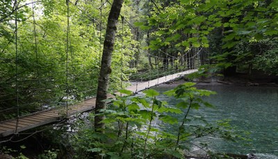
A campground on the southeast corner of Mount Rainier National Park that is surrounded by old growth forest and crossed by an exceptionally beautiful snow-fed river.
getting there
Drive to 3 miles north of the Mount Rainier National Park boundary on SR-123. It's 42 miles east of the park's Nisqually Entrance.
about the campground
Ohanapecosh Campground in Mount Rainier National Park is a perfect place to basecamp for day hikes on the east side of the mountain as it is just a short drive from Sunrise, Crystal Mountain, the Tatoosh Range, and the Goat Rocks and a short walk from popular hikes to Silver Falls and Grove of the Patriarchs. Visitors to this area are delighted by the beautiful old-growth forests, tumbling waterfalls, and historic sites along the way as they trek to reach sub-alpine meadows, where colorful and profuse wildflower displays are seen during the months of July & August.
notes
- Ohanapecosh Campground is not accessible in winter.
- This large campground has 188 individual sites for RV or tent camping.
- There is drinking water, but no electric hookups.
- Use extra caution with food storage, as bear and other animals inhabit the area around the campground.
- Seasons: June, July, August, September
- Weather: View weather forecast
- 1,914 ft
- Land Manager: Mount Rainier National Park
- Parking Permit Required: National Park Entrance Fee
- Recommended Party Size: 12
- Maximum Party Size: 200
- Maximum Route/Place Capacity: 200
- Green Trails Mount Rainier Wonderland No. 269SX
- Green Trails Mt Rainier East No. 270
There are no resources for this route/place. Log in and send us updates, images, or resources.
