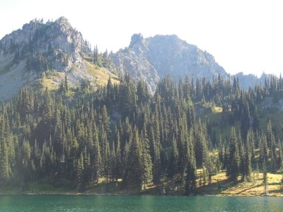
Crystal Lakes (Mount Rainier)
A moderate, forest to meadow hike of 6 miles with 2,300 feet of elevation gain. On a clear day view Mount Rainier before entering a beautiful basin with wildflower meadows, and views of surrounding peaks and ridges. Usually snow free earlier than other similar elevation trails in the Mount Rainier area.
Getting There
Drive SR-410 to 36 miles south of Enumclaw, enter Mount Rainier National Park, and continue 4 miles to the trailhead and parking areas on the north and south sides of the should of the highway (3,200 ft).
On the Trail
Crystal Lakes
6.0 miles round trip, 2,300 feet of elevation gain
Hike 1.3 miles on the Crystal Lakes Trail and go straight to stay on the Crystal Lakes Trail. Reach Lower Crystal Lake (5,400 ft) in another 1.0 mile and Upper Crystal Lake (5,800 ft) in another 0.7 mile. Sourdough Gap is in another mile with fabulous views of Mount Rainier.
Crystal Lakes to Chinook Pass
7.0 miles one-way, 2,300 feet of elevation gain
This trail connects with the Pacific Crest Trail at Sourdough Gap. These two trails can be combined for a glorious alpine lake outing with a car shuttle.
- Suitable Activities: Day Hiking
- Seasons: June, July, August, September, October
- Weather: View weather forecast
- Difficulty: Moderate
- Length: 6.0 mi
- Elevation Gain: 2,300 ft
- 5,830 ft
- Land Manager: Mount Rainier National Park
- Parking Permit Required: None
- Recommended Party Size: 12
- Maximum Party Size: 12
- Maximum Route/Place Capacity: 12
- Trails Illustrated Mount Rainier National Park
- Green Trails Mt Rainier East No. 270
- Green Trails Mount Rainier Wonderland No. 269SX
This is a list of titles that represent the variations of trips you can take at this route/place. This includes side trips, extensions and peak combinations. Not seeing a title that fits your trip? Log in and send us updates, images, or resources.
- Crystal Lakes
- Sourdough Gap
- Crystal Lakes & Sourdough Gap
- Crystal Lakes to Chinook Pass
- Sourdough Gap: Crystal Lakes to Chinook Pass
There are no resources for this route/place. Log in and send us updates, images, or resources.
