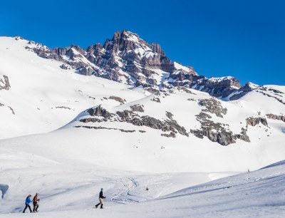
Mazama Ridge (Mount Rainier)
A variable length ski or snowshoe tour (usually less than 6 mi) with variable elevation gain (usually between 1,500 ft and 2,000 ft). This tour takes you to a broad ridge that sits above Paradise with views of the Tatoosh Range, Stevens Canyon, and Mount Rainier.
getting there
From SR-7 in Elbe, turn east onto SR-706, both known as the National Park Highway. Continue through the Nisqually Entrance of Mount Rainier National Park. Be prepared to pay the fee just after entering the park. Drive 19 miles to Paradise.
In winter, ALL drivers in the park are required to carry snow chains or equivalent traction devices—this includes those with a 4-wheel or all-wheel drive vehicle. Those without a 4-wheel or all-wheel drive vehicle may be required to install them at Longmire or beyond.
Ski route
At the southeast corner of the Paradise parking lot, find the continuation of the summer road and route leading down into Paradise Valley. From here, proceed to the third creek crossing and then follow a snowshoe/ski track uphill along the Skyline Trail (summer). The top of the ridge will level out. There are multiple options from top of Mazama Ridge:
- Ski easy rolling slopes downhill towards Reflection Lakes and return via the Paradise Valley Road.
- Ski back down into the Paradise Valley choosing variable aspects and slope difficulty.
- Ski the bowls that drop southeasterly off the Paradise Glacier Trail (summer) into the Stevens Creek canyon below. Make multiple yo-yo's up and down these moderate blue-style runs.
- Tour further uphill towards Cowlitz Rocks and the Paradise Glacier. This makes for a longer tour, but grants more green to moderate difficulty runs.
Return to the Paradise lodge back via Edith Creek or Paradise Valley Road.
Snowshoe ROUTE
As you travel up the hillside from the Paradise parking lot head to the right. You'll stay above the summer road and cross Edith creek on a wide footbridge above ice-cloaked waterfalls. From the bridge head east, traversing around the head of Paradise Valley to approach the steep wall of Mazama Ridge. Climb the ridge and snowshoe as much of it as you desire for the best views.
Information for LEADERS
This area is used by our branches to host snow field trips and is a generally popular winter exploration area. Please check other routes/places to ensure we don't have multiple Mountaineers groups going to the same area.
- Suitable Activities: Backcountry Skiing, Snowshoeing
- Snowshoeing Category: Intermediate
- Seasons: January, February, March, April, May, December
- Weather: View weather forecast
- View avalanche forecast.
- Difficulty: Moderate, M1 Intremediate Ski
- Length: 6.0 mi
- Elevation Gain: 2,000 ft
- 6,000 ft
- Land Manager: Mount Rainier National Park
- Parking Permit Required: National Park Entrance Fee
- Recommended Party Size: 12
- Maximum Party Size: 12
- Maximum Route/Place Capacity: 12
- USGS Mt Rainier East
- Green Trails Mt Rainier East No. 270
- Green Trails Paradise No. 270S
- Green Trails Mount Rainier Wonderland No. 269SX
There are no resources for this route/place. Log in and send us updates, images, or resources.
