Pigeon Peak
Pigeon has a long approach and then a very brushy and slow traverse. There is not much of a view the peak is merely a flat treed ridge with a steep cliff at the end. It is considered to be the worst peak of the 100 Rainier Peaks.
getting there
Check with ranger station in Enumclaw for road updates. As of 2012, the only road approach was to drive SR 410 south from Enumclaw and turn right on Forest Road 74 (about 1.5 miles south of Greenwater). In ~0.25 mile, turn left on Forest Road 75. Follow Forest Road 75 over Haller Pass and keep going until a junction with Forest Road 7550. Turn south on Forest Road 7550 and park at the blockage.
approach & ascent
northern loop trail
16 miles round trip (3 miles can be biked) with 2,500 feet of elevation gain, 4,280 ft high point
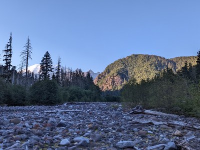
From the blockage on Forest Road 7550 bike or hike for 1.5 miles until road becomes impassable for bikes, and continue on the road which is somewhat overgrown. Continue to the Park Border on an old abandoned trail that may be flagged in parts. It stays mostly in the forest on the east side of the West Fork of the White River. In about 1.5 miles from the national park boundary, come to the Northern Loop Trail. Turn right (west) crossing the river where possible and continue to 4,000 ft, ascend to ~4,200 ft and follow the best terrain until reaching the end of the ridge and the "summit" of Pigeon Peak (4,300 ft). There is no true summit, just a long and flat treed ridge with a steep cliff to the west.
Fording the White River
10 miles round trip (3 miles can be biked) with 2,500 feet of elevation gain, 4,280 ft high point
In late summer and early fall it may be possible to cross the White River at approximately 2,900 ft. There may be several possible crossing locations depending on log locations and positions. If this can be accomplished safely it will save considerable time and effort. From the blockage on Forest Road 7550 bike or hike for 1.5 miles until road becomes impassable for bikes, and continue on the road which is somewhat overgrown until ~2,900 ft at the river's edge. Once across the river follow the ridge. You may find elk or deer paths leading upward. You may choose to return via the Northern Loop Trail route to make it a loop trip.
- Suitable Activities: Scrambling
- Seasons: Year-round
- Weather: View weather forecast
- Difficulty: Strenuous 3, Technical 3
- Length: 16.0 mi
- Elevation Gain: 2,500 ft
- 4,300 ft
- Land Manager: Land Manager Varies
- Parking Permit Required: Northwest Forest Pass
- Recommended Party Size: 8
- Maximum Party Size: 12
- Maximum Route/Place Capacity: 12
- USGS Greenwater
- USGS Sunrise
- Green Trails Greenwater No. 238
- Green Trails Mt Rainier East No. 270
- Green Trails Mount Rainier Wonderland No. 269SX
There are no resources for this route/place. Log in and send us updates, images, or resources.
