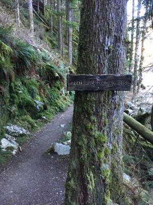
Pratt River Connector & CCC Trails
An easy hike in the Alpine Lakes Wilderness along the Middle Fork Snqoualmie River. These trails are primarily in the forest, following along the river most of the way with occasional mountain vistas on a clear day, with the Pratt River Connector Trail staying closer to the river than the CCC Trail. If you're looking for a long day hike or a backpacking trip, hike the Pratt River Trail all the way to Pratt Lake.
getting there
Take Exit 34 off of I-90 and turn left onto 468 Ave SE. In a half mile, turn right onto SE Middle Fork Road (Forest Road 56). Drive 12 miles to the Middle Fork Trailhead (1,000 ft).
on the trail
Pratt River Connector Trail
6.6 miles round trip with 50 feet of elevation gain
Hike southwest and downstream along the Middle Fork Snoqualmie River on the Pratt River Connector Trail (No. 1035). In 3.3 miles reach the Pratt River Trail and a backcountry campsite. Turn around here or continue southeast along the Pratt River on primitive trail.
CCC Trail
6.8 miles round trip with 50 feet of elevation gain
Cross Forest Road 56 (Middle Fork Snoqualmie River Road) and hike north, then west, and then southwest on the CCC Trail (No. 1264), an old forest road, downstream along the Middle Fork Snoqualmie River. Reach Forest Road 56 again in 3.4 miles. Turn around here or walk west on the road 0.1 mile west and pick up the CCC Trail continuing west as far as desired.
Pratt River to Pratt Lake
25 miles round trip with 3,500 feet of elevation gain
Hike the Pratt River Connector Trail (No. 1035) 3.3 miles to the camp at the start of the Pratt River Trail (No. 1035) and continue on the Pratt River Trail 9.1 miles to Pratt Lake (3,385 ft).
notes
- Combine the CCC Trail and CCC Road Trail for a long one-way day hike with a car shuttle or key exchange.
- Suitable Activities: Backpacking, Day Hiking
- Seasons: March, April, May, June, July, August, September, October, November
- Weather: View weather forecast
- Difficulty: Easy
- Length: 7.0 mi
- Elevation Gain: 200 ft
- 1,100 ft
-
Land Manager:
Mount Baker-Snoqualmie National Forest
Alpine Lakes Wilderness, Snoqualmie Ranger District (MBSNF)
- Parking Permit Required: Northwest Forest Pass
- Recommended Party Size: 12
- Maximum Party Size: 12
- Maximum Route/Place Capacity: 12
- Green Trails Mt Si No. 174
- Green Trails Skykomish No. 175
- Green Trails Middle Fork Snoqualmie No. 174SX
This is a list of titles that represent the variations of trips you can take at this route/place. This includes side trips, extensions and peak combinations. Not seeing a title that fits your trip? Log in and send us updates, images, or resources.
- Pratt River Connector Trail
- Pratt River
- Pratt River Trail
- Pratt River to Pratt Lake
- CCC Trail
- Upper CCC Trail
- CCC & CCC Road Trail
- Middle Fork Snoqualmie River
There are no resources for this route/place. Log in and send us updates, images, or resources.
