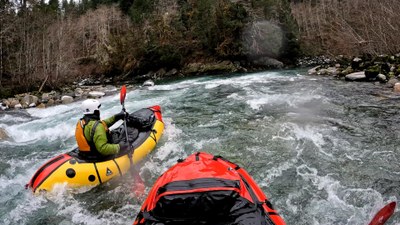
Sauk River: White Chuck River to Darrington
A classic Class III+ river section in the North Cascades near Glacier Peak and the Mountain Loop Highway. It can be run most of the year.
FLOW
- NOAA Gauge: SAUK--NEAR SAUK (SAKW1)
- 1,500 - 2,000 cfs: Low but still very fun.
- 2,000 - 6,000 cfs: Runnable.
- 6,000 - 15,000 cfs: Runnable with caution.
- The SAUK--ABOVE WHITE CHUCK (WCHW1) NOAA gauge is directly above the put-in. It may give additional information on the river's state, but there are no recommend flow ranges based on this gauge.
PUT-INs
- White Chuck Boat Launch: From Darrington, drive the Mountain Loop Highway south for about 9 miles. Cross the Sauk River bridge, turn left onto N Sauk River Road, cross the White Chuck River bridge, in 0.25 mile there is a large parking lot and bathrooms. Northwest Forest Pass is required.
- Rocky Road: Before N Sauk River Road, park at the Beaver Lake Trailhead and carry boats along the trail 500 feet to a small use trail that drops down to the river just above Rocky Road Rapid (Class III) at 48.1691,-121.4708.
TAKE-OUTs
- Below Old Sauk North Trailhead: This is the first convenient take out below Whirlpool. There is a small clearing and eddy on river left. You need to be in the main channel on the left of a big island as you get near. Taking out here makes for about a 6.5 mile stretch. There is parking for 2 vehicles at a pull out on the side of the road at 48.2163,-121.5629.
- Backman County Park: Take the Clear Creek Road to this boat launch and parking area. There is space for about 8 cars. There are no Toilets.
- Darrington: On the southwest side of the Sauk Prairie Road bridge over the Sauk River is a dirt parking area. The boat launch is under the bridge. The river may also be accessed on the southeast side of the bridge.
ON THE RIVER
This reach has three sections with distinct differences in difficulty. You can choose your own adventure, although putting in below Whirlpool Rapid is not easy because of the steep embankment.
The reach from White Chuck (or Rocky Road) down to the bottom of Whirlpool Rapid is Class III+ at moderate or high levels. Not including Rocky Road Rapid, there are nine distinct Class III drops, some of which are long and continuous. Jaws marks the start of three back to back drops, where capsizing at the top would result in a long swim to the run out. Whirlpool is a long ramp with sizable waves that could turn into haystacks at high flow. There are some very strong eddy lines at the bottom in the whirlpools at the bottom. This is a 3 mile reach.
From the bottom of Whirlpool Rapid to Backman County Park campground is a 5 mile stretch of Class II+. This stretch is characterized by many long ramps with short floats in between. There are some holes that form at moderate to high flow that will eat a packrafter. It is active and fun, yet not as intimidating as the upper stretch.
On the stretch from Backman Park to the Mill Bridge in Darrington, things calm down another level. This is a relatively easy Class II stretch with more float time in between drops. This is a 3 mile stretch.
Notes
- When this run is too high for your comfort, the Silly Stilly may be in good flow and is of very similar character.
- The Whirlpool rapid may be scouted from the road at a small pullout.
- Learn more on American Whitewater's Sauk: 2 - Whitechuck River to Darrington web page
- Suitable Activities: Packrafting
- Seasons: April, May, June, September, October, November
- Weather: View weather forecast
- Difficulty: Class III+ River
- Length: 10.5 mi
- 1,025 ft
-
Land Manager:
Mount Baker-Snoqualmie National Forest
Darrington Ranger District (MBSNF)
- Parking Permit Required: see "Put-Ins" & "Take-Outs" sections (above)
- Recommended Party Size: 6
- Maximum Party Size: 12
- Maximum Route/Place Capacity: 12
- Green Trails Mountain Loop Highway No. 111SX
There are no resources for this route/place. Log in and send us updates, images, or resources.
