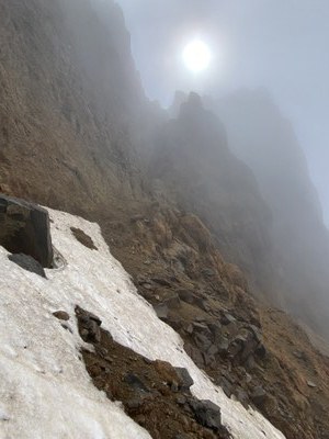
Seward Peak
A seldom climbed, Class 4 scramble up the third summit of the Black Buttes near Mount Baker in the North Cascades.
GETTING THERE
From the SR-542 (Mt Baker Highway) and SR-9 roundabout junction, continue east on SR-542 for 2.3 miles. Turn right onto Mosquito Lake Road, drive 4.8 miles, and turn left on Middle Fork Road. Drive 9 miles and turn left onto Forest Road 38. Drive far as road conditions allow. There is limited parking (1-3 cars) typically found at switchbacks. The road is heavily washed out at 3,000 ft and is unpassable by most vehicles.
APPROACH & Ascent
Hike Forest Road 38 to 3,700 ft. Follow a climbers trail or bushwhack north to gain a ridge at ~4,400 ft. Follow the the path on the ridge until it peters out at ~5,600 ft. Follow the path of least resistance in a generally northeast direction towards the west flank of Seward Peak. Near 7,300 ft look southeast for a short gully with access to the Black Butte ridge line. Ascend the dirty gully, with the option to go through a squeeze tunnel if following the gully proper. Some climbers may choose to rope up for the gully. Gain the ridge and follow it north along Class 2 terrain to the summit.
DescENT
Rappel the gully and retrace your steps.
NOTES
- This route sees little traffic and consequently the gully is full of loose rock.
- Water is typically available at multiple locations between a tarn at 5,800 ft and Seward Peak.
- Spring snow may provide a convenient snow ramp through the gully. Alpine ice may be a concern late season for the approach to the gully.
- This route description differs from the one in Fred Beckey's in Cascade Alpine Guide, Vol. 3.
- Suitable Activities: Climbing
- Climbing Category: Basic Alpine
- Seasons: May, June, July, August, September
- Weather: View weather forecast
- Difficulty: Basic Alpine Climb
- Length: 13.0 None
- Elevation Gain: 5,500 ft
- 8,005 ft
-
Land Manager:
Mount Baker-Snoqualmie National Forest
Mount Baker Wilderness, Mount Baker Ranger District (MBSNF)
- Parking Permit Required: None
- Recommended Party Size: 12
- Maximum Party Size: 12
- Maximum Route/Place Capacity: 12
- Green Trails Mount Baker Wilderness Climbing No. 13SX
- USGS Mt Baker
- USGS Baker Pass
- USGS Groat Mtn
- USGS Twin Sisters Mountain
There are no resources for this route/place. Log in and send us updates, images, or resources.
