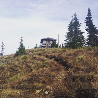
Shriner Peak
Shriner Peak is a strenuous, 8.4 mile round trip day hike with 3,400 feet of elevation gain. The trail is a steady steep climb through forests, burns and south facing meadows, up a ridge to the historic Shriner Peak lookout tower. In winter and early spring this is a scramble.
getting there
From Enulclaw, drive 40 miles east on SR-410. At the fork continue straight onto SR-123 and drive 7.4 miles. Park in the pullout on the right. Cross the highway and walk ~80 yards southeast to the trailhead (2,400 ft).
- Suitable Activities: Day Hiking, Scrambling
- Seasons: Year-round
- Weather: View weather forecast
- View avalanche forecast.
- Difficulty: Strenuous, Winter Scramble, Snow Scramble, Strenuous 3, Technical 2
- Length: 8.4 mi
- Elevation Gain: 3,435 ft
- 5,835 ft
- Land Manager: Mount Rainier National Park
- Parking Permit Required: National Park Entrance Fee
- Recommended Party Size: 12
- Maximum Party Size: 12
- Maximum Route/Place Capacity: 12
- Green Trails Mount Rainier Wonderland No. 269SX
- Green Trails Mt Rainier East No. 270
- USGS Mt Rainier East
There are no resources for this route/place. Log in and send us updates, images, or resources.
