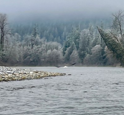
Skagit River: Copper Creek to Rockport
Also known as the Skagit Eagle Float, this casual stretch of river is near Marblemount along the North Cascades Highway. There are only a couple rapids and short wave trains of easy Class II, but solid packrafting skills are needed to avoid the log jams that line the banks in a few places.
FLOW
- NOAA Gauge: SKAGIT--CASCADE RIVER AT MARBLEMOUNT (CSCW1)
- 1,500-12,000 cfs: Runnable.
- Gradient: 9 fpm
PUT-INS
- River Mile 84.1, Copper Creek: To reach this access continue upstream on SR-20 to Mile 111.7 where there is a dirt road, NPS Road 213, heading south to the river—it's just before you reach the Ross Lake Recreation Area sign. Follow the dirt road and take the left fork to a takeout about 200 yards from the highway. Parking options are limited here. If you have a large group, extra vehicles should be parked at the other access point you're using. This makes for a 16.7 mile float.
- River Mile 78.2, Marblemount: This access is the primary put-in for Eagle floats. In the town of Marblemount at SR-20 Mile 106, the road makes a hard 90° bend. Instead of following the main highway, continue straight across the bridge over the Skagit River following the sign for the fish hatchery. Cross the river and 0.24 mile from town reach the Marblemount public access on the downstream river left side of the bridge. This makes for a 10.8 mile float.
TAKE-OUT
- River Mile 67.7: The most popular take-out for the Skagit Eagle Float is at Howard Miller Steelhead Park in Rockport downstream river right of the SR-530 bridge. To reach this access from SR-20 Mile 97.7, turn right at the Rockport General Store onto SR-530. In 0.25 mile, before crossing the bridge over the Skagit River, turn right into the park. There are restrooms, a boat ramp, and camping available.
ON THE RIVER
Recreational boaters are drawn to this section every year between December and February for eagle watching. With one of the highest concentrations of overwintering eagles in the United States, the short section of river between Marblemount and Rockport can be home to over 500 eagles during the peak of the season in mid January.
Although one can use the access at Copper Creek for a longer trip, the most popular section is between Marblemount and Rockport which runs through the Skagit River Bald Eagle Natural Area, a preserve of approximately 10,000 acres.
Notes
- At most flow levels this is a predominantly a Class I river float. At other flow levels it may become Class II and obstacles may be present at the Skagit River's confluence of the Cascade River and a couple other constrictions.
- Watch for wood build up at rivers edge and for gravel bars.
- Learn more on American Whitewater's Skagit, Copper Creek to Rockport web page.
- Suitable Activities: Packrafting
- Seasons: Year-round
- Weather: View weather forecast
- Difficulty: Class I-II River
- Length: 16.0 mi
-
Land Manager:
Land Manager Varies
Skagit River Bald Eagle Natural Area
- Parking Permit Required: see "Put-Ins" & "Take-Outs" sections (above)
- Recommended Party Size: 12
- Maximum Party Size: 12
- Maximum Route/Place Capacity: 12
- Green Trails North Cascades Ross Lake No. 16SX
This is a list of titles that represent the variations of trips you can take at this route/place. This includes side trips, extensions and peak combinations. Not seeing a title that fits your trip? Log in and send us updates, images, or resources.
- Skagit River: Marblemount to Rockport
- Skagit Eagle Float
There are no resources for this route/place. Log in and send us updates, images, or resources.
