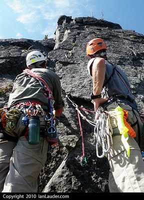
Slippery Slab Tower/Northeast Face
A pleasant 6.5 mi, 3,400 feet gain, hike along the Pacific Crest Trail, to a short but fun climb. Nice views and access to a couple of lakes. Bugs! Gully leading to climb can be intimidating for some. Times: 6-7 hr trailhead to summit.
getting there
Drive US-2 13.2 miles east of Skykomish. Turn right off US-2 onto Forest Road 6095 at the big sweeping left-hand turn just before the US-2 changes to four lanes and starts the final climb to Stevens Pass. Drive Forest Road 6095 for 1.5 mile, staying left at all road junctions, to the Tunnel Creek Trailhead, Trail No. 1061, (3,100 ft).
APPROACH
Hike Tunnel Creek Trail (No. 1061) 1.6 miles to the Pacific Crest Trail (PCT) junction at Hope Lake (4,400 ft). Take the PCT south for 3.8 mi to Trap Pass (5,800 ft). Follow the climbers trail heading south along the east side of the ridge for 0.5 mile, then scramble uphill to the east base of the steep, rocky pinnacle of Slippery Slab Tower.
Alternate Approach
This climb can be done via the Surprise Creek Trail (No. 1060) as one long day or as a relaxed two day trip with camping available at Surprise Lake. For this approach, drive US-2 10 mi east of Skykomish to the Big Bridge. Turn right (south) on unmarked road spur at milepost 58.7 and cross the railroad tracks. Turn right on a spur road and go another 0.2 mi to a small parking lot. Walk the road about .25 mi to Surprise Creek Trailhead at 2,200 ft. The lake is reached in ~4.7 mi. From near the outlet of the lake, the trail switchbacks 0.75 mi to join the PCT. Turn left on the PCT and proceed to Trap Pass. This approach involves approximately 900 additional feet of elevation gain in about the same distance.
ASCENT ROUTE
Ascend a gully 100 feet up and right to a spacious belay area in a clump of trees. Rope up here.
Climb a rock face directly upwards. After 40 feet of mixed Class 4 and Class 5, move to the left to easier climbing and continue for another 20 feet to a belay tree. Then climb a 10-foot face and scramble to the summit.
DESCENT ROUTE
Descend the climbing route and rappel from belay trees. Or do one double rope rappel straight down from upper belay tree.
TRIP PROFILE
| SEGMENT | TIME (HOURS) | ELEVATION GAIN (FEET) |
|---|---|---|
| Trailhead to Pass | 4 | 3,500 |
| Pass to Summit | 2-3 | 700 |
| Summit to Trailhead | 4 |
EQUIPMENT
Standard rock equipment, small to medium alpine rack.
NOTES
- Be careful of small loose rocks near the summit and in the gully.
- Suitable Activities: Climbing
- Climbing Category: Basic Alpine
- Seasons: May, June, July, August, September, October
- Weather: View weather forecast
- Difficulty: Basic Rock Climb, Strenuous 2, Technical 2, Basic Experience Climb
- Elevation Gain: 4,200 ft
- 6,400 ft
-
Land Manager:
Mount Baker-Snoqualmie National Forest
Skykomish Ranger District (MBSNF)
- Parking Permit Required: Northwest Forest Pass
- Recommended Party Size: 12
- Maximum Party Size: 12
- Maximum Route/Place Capacity: 12
- USGS Stevens Pass
- Green Trails Stevens Pass No. 176
- USGS Scenic
There are no resources for this route/place. Log in and send us updates, images, or resources.
