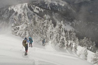
Union & Jove Peaks
In winter this is a moderate winter scramble or backcountry ski trip. In la spring through fall, this is an easy to moderate, non-technical alpine scramble trip when done in summer or fall. The views from Jove Peak are better than those from Union Peak.
getting there
Drive SR 2 to the Smith Brook Road turn off and parking area, 4.2 miles east of Stevens Pass (3,190 ft). If coming from the east, drive Stevens Pass Nordic Center and use the U-turn access for SR 2 westbound to the parking area. In spring summer and fall, drive up the Smith Brook Road to the Smith Brook Trailhead (6,000 ft).
spring/summer scramble route
5.0 miles round trip with 2,400 feet of elevation gain
The route starts at the Smithbrook Trail on Smithbrook Road. After approximately 0.3 mile on the trail to Union Gap, depart the trail and bushwhack northeast to gain Union Peak's Southeast ridge. Follow the ridge to the Union Peak summit. From Union Peak, descend meadows on the North Ridge 700 feet to the 5,200 ft saddle between Union Peak and Jove Peak. Then ascend meadows on Jove Peak's South Ridge 800 feet to the its summit.
Winter scramble & ski ascent route
Union Peak (5,696 ft)
10 miles round trip with 3,000 feet of elevation gain
Travel west along the shoulder of the highway ~0.2 mile to the Smithbrook Road (3,160 ft). Turn right on the Smith Brook Road and follow it 2.8 miles up to the big switchback below Union Peak and Union Gap (4,040 ft). At the switchback follow a bearing of 323° up toward Union Gap to 4,500 ft. The terrain is steep here, the trees are thick, but if you get it right, there is a trail switchbacking up this area. Follow the trail if you find it, it’s easier than blazing your own route. At 4,500 ft, follow a bearing of 35° up a steep rib to 5,200 ft and the prominent southeast ridge of Union Peak. This is a steep slope with some avalanche potential. In firm snow conditions it’s also tricky to skin up, so if you're skiing, you may want to boot up the ridge. At 5,200 ft, follow the southeast ridge (323°) to the 5,700-foot summit of Union Peak.
jove peak (6,007 ft)
11 miles round trip with 3,300 feet of elevation gain
union & jove peaks
11 miles round trip with 4,000 feet of elevation gain
Follow the route to the summit of Union Peak above. Travel ~0.5 mile down the north ridge to a 5,180-foot saddle before ascending the southwest ridge of Jove Peak (6,007 ft).
ski descents
- The safe: Retrace the ascent route. In tricky snow conditions or foggy weather, this is the option least likely to cast you into an epic.
- The exciting: Ski the south face of Jove. This is a big, open, fairly steep slope. Notice that there are no big trees populating the bottom of these slopes—they’ve all been knocked down and replaced by saplings. Ski the avalanche clearings, and then the path of least resistance through the lower forests to the snowmobiling road leading to Rainy Pass. When you reach the road, turn right and head uphill to Rainy Pass (~2 miles). From the pass it’s a 5-mile glide down to the car (all downhill except one quarter-mile shuffle).
- The adventurous: Ski the western slopes of Jove down to Janus Lake, then work your way back to Union Gap (the map shows one of several ways to do this), and descend back to the Smithbrook Road.
Information for LEADERS
Many popular snowshoe and ski routes utilize Smith Brook Road parking area where this route begins. Review these other routes to be sure your trip will not conflict with others and encourage carpooling within your group.
- Suitable Activities: Backcountry Skiing, Scrambling
- Seasons: Year-round
- Weather: View weather forecast
- View avalanche forecast.
- Difficulty: Winter Scramble, Strenuous 2, Technical 1
- Length: 10.0 mi
- Elevation Gain: 3,300 ft
- 6,007 ft
-
Land Manager:
Mount Baker-Snoqualmie National Forest
Henry M Jackson Wilderness, Skykomish Ranger District (MBSNF)
- Parking Permit Required: Northwest Forest Pass
- Recommended Party Size: 12
- Maximum Party Size: 12
- Maximum Route/Place Capacity: 12
- Green Trails Alpine Lakes West (Stevens Pass) No. 176S
- Green Trails Benchmark Mtn No. 144
- USGS Labyrinth Mtn
This is a list of titles that represent the variations of trips you can take at this route/place. This includes side trips, extensions and peak combinations. Not seeing a title that fits your trip? Log in and send us updates, images, or resources.
- Jove Peak
- Union Peak
