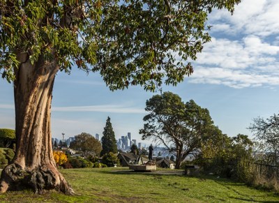
South Magnolia
An urban adventure that explores two glacially deposited hills atop Magnolia Bluff on city streets and stairways.
on the trail
south Magnolia Stairways
4.5 miles round trip, 646 feet of elevation gain
Start and finish at Magnolia Village taking in views west from ever sloughing Perkins Lane West. Readers and architecture buffs may stop at Magnolia Library en route to the up and down of glacial deposits through Pleasant Valley. Ella Bailey Park will please kids and others who've navigated the 405 stairs up and 327 down. This urban hike follows Walk 13 in Seattle Stairway Walks, South Magnolia.
Magnolia Boulevard Viewpoints
2.0 miles round trip, 100 feet of elevation gain
An easy two mile walk along Magnolia Bluff overlooking Elliott Bay with very little elevation gain. Enjoy views of the Space Needle, along Seattle's waterfront to Alki Point and Bainbridge Island, and Mount Rainier if the weather permits.
- Suitable Activities: Day Hiking, Urban Walking
- Seasons: Year-round
- Weather: View weather forecast
- Difficulty: Easy
- Length: 4.5 mi
- Elevation Gain: 646 ft
- 354 ft
- Land Manager: City of Seattle
- Parking Permit Required: None
- Recommended Party Size: 12
- Maximum Party Size: 16
- Maximum Route/Place Capacity: 16
- Seattle City Map
This is a list of titles that represent the variations of trips you can take at this route/place. This includes side trips, extensions and peak combinations. Not seeing a title that fits your trip? Log in and send us updates, images, or resources.
- South Magnolia Stairways
- Magnolia Grand Tour
- Magnolia Boulevard Viewpoints
There are no resources for this route/place. Log in and send us updates, images, or resources.
