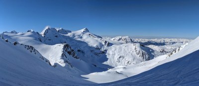
Spearhead Traverse
A spectacular, challenging ski traverse high in the Spearhead and Fitzsimmons ranges in British Columbia, Canada. It is a 20-25 mile route between the Blackcomb and Whistler ski areas, traversing 13 glaciers and 9 passes, and typically done in 2 to 4 days. This a long traverse across and under many steep slopes so pay close attention to avalanche conditions along the route.
getting there
Drive BC-99 to the Whistler/Blackcomb Ski Resort. Park in public parking or pay to park at a Whistler/Blackcomb resort.
ski route
Start by riding the Blackcomb Gondola, the Glacier Express chair, and Showcase T-bar to gain ~5,000 feet of elevation and get to the top of the Blackcomb Ski area (use a single ride Blackcomb backcountry lift ticket). Boot up a small hill and traverse across the top of Blackcomb glacier to the ski area boundary gate. Ascend to the Spearhead-Blackcomb Col. Ski down toward the Decker Glacier and then up and over the eastern shoulder of Decker Mountain toward Mount Trorey. Then traverse around the eastern side of Mount Trorey across the Trorey Glacier towards Mount Pattison. Continue on the Trorey Glacier passing Mount Pattison on the east side climbing (possibly boot packing) a short chute up and over the south shoulder of Mount Pattison.
Stay high on the Tremor Glacier climbing up to the narrow Tremor Shudder Col and over onto the Platform Glacier. Continue the high traverse on the Platform Glacier heading toward Quiver Peak. Pass on the west side of Quiver Peak through the Quiver-Ripsaw Col. There are good campsites near the top of Ripsaw Glacier.
Traverse and descxend the Ripsaw Glacier on its western side to get to the southeast gap in Ripsaw Ridge and descend (possibly a boot pack) onto the Naden Glacier. Travel across the Naden Glacier passing Macbeth on the skier's right to the Macbeth Couloir Ridge Col. Ski down the Macbeth Glacier skier's left, staying close to Couloir Ridge and to the col between Couloir Ridge and Mount Iago. This leads to the rooftop ridge, a narrow, exposed ridge between the Macbeth and Iago Glaciers. Follow the ridge towards Mount Iago to an easier route down onto the Iago Glacier (many often boot down the "easier route" onto the glacier). Either descend to the Iago Glacier and skin up the gentler center of the Iago Glacier or stay high and traverse up the ridge to the top of the Iago Glacier. Continue up the eastern slopes of Mount Iago to the gap in the East Ridge.
Descend to the Diavolo Glacier and then ascend the glacier keeping Mount Iago and Mount Fitzsimmons on skier's right Climb the Benvolio Glacier on the south slopes of Mount Benvolio to the Benvolio-Fitzsimmons Col on the east side of Mount Benvolio to the Fitzsimmons Glacier. Traverse high on the Fitzsimmons Glacier toward Overlord Mountain.
Traverse around Overlord Mountain staying above the rock spire on its east shoulder and continue around to its Northwest Ridge, cross it and descend tto the west facing slopes of Overlord Glacier. Ski down Overlord Glacier to the east and then continue east up the glacier to the Fissile-Whirlwind Col just south of Fissile Peak. From the col, descend the gentle valley towards Russet Lake and the new Kees and Claire Hut on Cowboy Ridge. Climb up past the new hut across the ridge and start descending into the Melody Creek drainage.
There are two options from here, (1) climb up and over the Musical bumps (Oboe, Flute, and Piccolo) ski groomed runs to Whistler Village or (2) take the Singing Pass back-country trail down the west side of Melody Creek to Whistler Village. The first option involves more climbing but better skiing.
notes
- Guidebook: Exploring the Coast Mountains on Skis, 3rd ed by John Baldwin (John Baldwin 2009). Be sure to get John's map of the area, Backcountry Whistler.
- Guidebook: Spearhead Backcountry Atlas by Matt Gunn (Cairn Publishing 2021). Online preview and info: spearheadbackcountry.com.
- The weather can change quickly and be extremely cold. Temperatures below 0°F are common. Poor weather combined with the travel though extensive avalanche terrain makes for a route that is dangerous and difficult to follow. Review the weather forecast and Canadian avalanche forecast, and plan accordingly.
INFORMATION FOR LEADERS
CONSIDERATIONS FOR INTERNATIONAL TRAVEL
- Start by reviewing the latest regulations.
- Everyone will need a passport or other valid ID such as a NEXUS card.
- NEXUS cards can save a lot of time but only work if everyone in the car has one.
- Make sure your vehicle insurance is valid for Canada.
- Make sure your health insurance is valid for Canada.
- Border crossing regulations are strict in both directions. Know what you’re allowed to take and declare everything to avoid problems.
- You may be able to save time by checking alternate border crossings. Find apps that show updated times and other good tips.
- Suitable Activities: Backcountry Skiing
- Seasons: January, February, March, April
- Weather: View weather forecast
- View avalanche forecast.
- Difficulty: M3G Expert Glacier Ski
- Length: 25.0 mi
- Elevation Gain: 6,000 ft
- 8,520 ft
- Land Manager: Land Manager Varies
- Parking Permit Required: None
- Recommended Party Size: 12
- Maximum Party Size: 12
- Maximum Route/Place Capacity: 12
- John Baldwin Backcountry Whistler
- CNTS Whistler 92J/2
- Green Trails Whistler No. 92J1S
- Clark Geomatics Garibaldi Park
This is a list of titles that represent the variations of trips you can take at this route/place. This includes side trips, extensions and peak combinations. Not seeing a title that fits your trip? Log in and send us updates, images, or resources.
- Spearhead Fitzsimmons Traverse
There are no resources for this route/place. Log in and send us updates, images, or resources.
