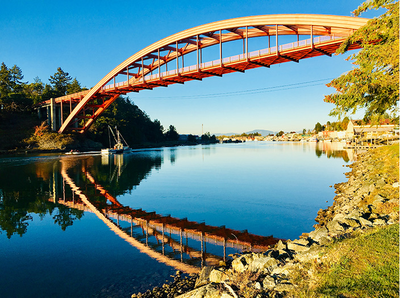
Swinomish Channel
Sea kayak an 11-mile salt water channel, the smallest of the three entrances to Puget Sound. It's the waterway that makes Fidalgo Island an island, from Dugualla Bay at the south end to Padilla Bay at the north end.
Launch Points
- Swinomish Boat Launch near Anacortes
- Pioneer Park in La Conner
On the Water
The Swinomish Channel is partly natural and partly dredged. Before being dredged, it was a collection of shallow tidal sloughs, salt marshes, and mudflats known as Swinomish Slough. Here are a few “rules of thumb” that will help predict current direction in the Swinomish Slough from La Conner.
- North of La Conner: The current flows north from La Conner two hours before Rosario max ebb. The current flows south from the Swinomish boat launch two hours before Rosario max flood.
- South of La Conner: The current flows Southerly from La Conner 2½ hours after Seattle high tide. The current flows north from Goat Island three hours after Seattle low tide.
- Suitable Activities: Sea Kayaking
- Seasons: Year-round
- Weather: View weather forecast
- Difficulty: Sea Kayak II/III
- Length: 11.0 nm
- Land Manager: Land Manager Varies
- Parking Permit Required: see Land Manager
- Recommended Party Size: 12
- Maximum Party Size: 12
- Maximum Route/Place Capacity: 12
- Sea Trails Deception Pass and Skagit Bay WA101
- NOAA Bellingham to Everett No. 18423
There are no resources for this route/place. Log in and send us updates, images, or resources.
