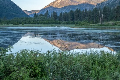
The Okanogan
Think birds, flowers, trees, and geology. The Okanogan is a wild destination in north central Washington. Many birds and flowers can be found there that don't occur or are rare west of the Cascades. The geology is unique and fascinating too.
About the Okanogan
The Okanogan River divides this area into two mountainous sections and runs from Brewster on the Columbia River north to the Canadian border. The river flows along a geologic fault between two terranes that crashed into the west coast of North America, helping to form Washington. To the east is the Okanogan Highlands, and to the West the Okanogan Cascades. The vegetation changes from Sagebrush scrub in the valleys through dry grasslands into Ponderosa Pine forests and then forests of Western Larch, Douglas Firs, and Lodgepole Pine. Rural agricultural lands dot much of the area. High areas even reach into some alpine habitats. Numerous lakes, creeks, and rivers dot this landscape, creating a lot of diversity in the flora and fauna. The evidence of glaciation, as well as continental drift, is abundant.
On the Trail
The Okanogan Highlands and the Sinlahekin Valley are full of nature. This country is wild and worth exploring on a multiday trip to allow exploring many locations and focus on finding birds, looking for wildflowers, unique trees, and exploring the geologic history of Washington. Drive between sites and hike up to five miles at each one.
- Long Swamp & Chopak Mountain: Long Swamp is an extensive area of bog and willows with coniferous forests surrounding it. A small, two-site Forest Service campground is at the intersection Forest Road 39 and Forest Road 300. Several trailheads into the Pasayten Wilderness occur along this road. The swamp can be outstanding for birds and is one of the sites where Boreal Chickadees have been spotted in Washington. The Chopaka Mountain Natural Area protects several state-listed plant species. This area is west of Loomis.
- Sinlahekin Valley: This valley runs south from Loomis, and connects with Conconully and Omak. The Washington Department of Fish and Wildlife manages much of the valley and this preserve is the oldest state wildlife area. Several primitive campgrounds and numerous small lake are along the road. The long hiking trail running down the valley allows hiking through this wild country. This area was glaciated during the Pleistocene and numerous features show the evidence of continental drift.
- Okanogan Highlands: A network of roads run northeast from Tonasket toward Chesaw and Molson. Travel Havillah Road, Mary Ann Creek Road, Davies Road, and a few others for birds, flowers, trees, and mammals. The Tavern in Chesaw is a good stop for lunch, and Molson has an interesting historical museum. In addition, several trails start at the Highland Sno-Park along Havillah Road, and several dirt roads provide access to the national forest.
- Lost Lake & Vicinity: The Forest Service has a campsite at Lost Lake, and several trails extend from this area. A hike to the big tree botanical area takes one to some 900-year-old western larches and through beautiful forests. Beaver and Beth lakes often have nesting Common Loons and Barrow's Goldeneyes in the spring and summer.
- Brewster, Cameron Road, and lower Okanogan River: The Brewster area is good for birds wintering along the Columbia River. The Cameron Lake Road extends up and over the lower parts of the Okanogan Highlands. This is excellent birding at any time of year and gives access to various habitats. Stay on the road, because much of this are is private land. The area along the lower Okanogan River near Omak has many geologic features that show evidence of continental drift.
Land Managers
- The U.S. Forest Service manages lands in the Okanogan Cascades and the Okanogan Highlands. A Northwest Forest Pass or National Lands Pass is required for some areas.
- The Washington State Department of Fish and Wildlife manages lands in the Sinalakin Valley and Mary Anne Creek Road. A Discover Pass is required.
- The Washington State Department of Natural Resources. A Discover Pass is required.
- The U.S. Bureau of Land Management.
- The southern part of the Okanogan Highlands is on the Colville Reservation. You can drive the public roads but do not enter the reservation lands without the appropriate permits and permissions.
Notes
- Washington State's DNR Okanogan web page was good information about the area's geology.
- The Okanogan Highland Alliance website, particularly information in the "Education" section.
- Field Guide: A Birder's Guide to Washington by Washington Ornithological Society (American Birding Association 2015).
Information for Leaders
Scheduling & Permits
- This route allows multiple bookings. Please check scheduled trips listed below in the "Activities" tab to see if there is another group already booked on the same day. Leaders are expected to contact the leader(s) of existing trips to ensure there are no concerns or conflicts, according to The Mountaineers Outdoor Ethics Policy. Please review our Group Size & Multiple Bookings page for guidance.
- Suitable Activities: Day Hiking, Naturalist
- Seasons: Year-round
- Weather: View weather forecast
- Difficulty: Easy
- Land Manager: Land Manager Varies
- Parking Permit Required: see Land Manager
- Recommended Party Size: 12
- Maximum Party Size: 16
- Maximum Route/Place Capacity: 16
- WA DNR Omak
- WA DNR Oroville
This is a list of titles that represent the variations of trips you can take at this route/place. This includes side trips, extensions and peak combinations. Not seeing a title that fits your trip? Log in and send us updates, images, or resources.
- Sinlahekin Valley
- Sinlahekin Wildlife Area
- Okanogan Highlands
- Okanogan Cascades
There are no resources for this route/place. Log in and send us updates, images, or resources.
