Tubal Cain Mine, Buckhorn Lake & Marmot Pass
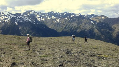
This 17.5 mile moderate backpack with 2,700 feet of elevation gain ascends flower-strewn meadows to ridges with expansive views across the Dungeness River gorge to the Olympic mountains range. Hike the Tubal Cain Mine Trail to Buckhorn Lake, Buckhorn Pass and Marmot Pass.
on the trail
Hike Tubal Cain Mine trailhead, the first mile of the trail passing under some 10-foot-tall rhododendrons, which present a lovely display in the early spring. At about 3 mi, a boot track to the left heads up to some World War II aircraft wreckage in Tull Canyon, and at 3.5 mi and 4,350 ft the trail passes the site of the old Tubal Cain mine, now just some wooden pipes, rusty wire and equipment. Nice camps sites are just past the old mine site and before crossing Copper Creek. Soon after crossing the creek, the canopy opens and the trail begins to switchback steeply through flower fields with expanding views ahead to Buckhorn Peak.
At 5.5 miles, a junction takes off left to darkly forested Buckhorn Lake - modest camps are 0.5 mi off the main trail. Continuing on the trail, the meadows and views expand until the trail reaches the broad ridgetop of Buckhorn Pass at 7 mi and 5,700 ft. Enjoy dramatic views across the gorge of the Dungeness River to the peaks of the main Olympics range. Unless snowmelt ponds remain, you'll need to carry water from Copper Creek to camp here, but the rewards are great! Continue rambling along the ridge tops, finding your way up the boulder fields to the top of 6,950 ft Buckhorn Pass, and beyond to the saddle of 6,100 ft Marmot Pass at 8.75 miles.
notes
- This is a nice alternative to the busy route to Marmot Pass from the Big Quilcene Trail.
- The same trailhead provides access to a seldom-used west-side trail to the top of 6,280 ft Mount Townsend, a well worthwhile half-day addition to your Marmot Pass backpack. From here, the 360-degree panorama takes in not only the Olympics but also the Strait of Juan de Fuca, the Hood Canal and the Cascades.
- Can be done as a day hike with a key exchange.
- Suitable Activities: Backpacking
- Seasons: June, July, August, September, October
- Weather: View weather forecast
- Difficulty: Moderate
- Length: 17.5 mi
- Elevation Gain: 2,700 ft
- 6,100 ft
-
Land Manager:
Olympic National Forest
Buckhorn Wilderness, Hood Canal Ranger District (ONF)
- Parking Permit Required: Northwest Forest Pass
- Recommended Party Size: 12
- Maximum Party Size: 12
- Maximum Route/Place Capacity: 12
- Green Trails Tyler Peak No. 136
- Green Trails Olympic Mountains East No. 168S
- Custom Correct Buckhorn Wilderness
- Trails Illustrated Olympic National Park
There are no resources for this route/place. Log in and send us updates, images, or resources.
