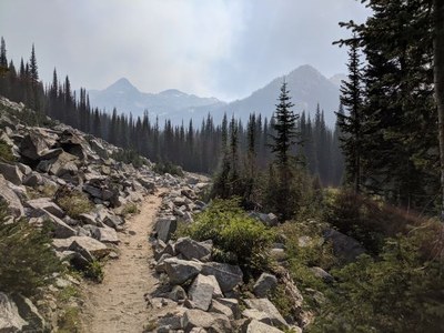
West Lostine River Loop
A moderately strenuous backpack in Oregon's Wallowa high country and Eagle Cap Wilderness. Enjoy grand scenery, stunning granite peaks, lakes, wildflower-filled meadows, sparkling streams, wildlife, forests, and more.
Getting there
From OR-82 at Lostine, drive south 14.0 miles on Lostine River Road (it becomes Forest Road 8210) to the Bowman/Frances Lake Trailhead (5,200 ft). Leave a car here if you plan to car shuttle. Continue the 3.3 miles to the Two Pan Trailhead (5,600 ft).
on the trail
A classic Wallowa Mountain backpack with trails along several lovely high lakes (Steamboat, Swamp, and Chimney to name a few), sparkling, meandering and cascading streams, small to expansive meadows filled with subalpine and alpine wildflowers, potential wildlife sightings (pikas, goats, elk and more), scattered forests, and high passes with wide-ranging views.
The backpack begins at Two Pan trailhead and ends at Bowman trailhead in the Lostine valley, with a short car shuttle or road walk between trailheads. A variety of camp settings and water sources are abundant. The loop is a great 4-6 day backpack with rich opportunities for photography, nature enjoyment, and rewarding Wallowa mountain scenery.
notes
Recommended guidebooks in addition to our 100 Classic Hikes in Oregon:
- Backpacking Oregon: From Rugged Coastline to Mountain Meadow 2nd ed by Douglas Lorain (Wilderness Press 2007) - see Lostine-Minam Loop.
- 100 Hikes/Travel Guide Eastern Oregon 3rd ed by William L. Sullivan (Navillus Press 2015) - see Chimney & Steamboat Lakes.
- Hiking Oregon's Eagle Cap Wilderness 3rd ed by Fred Barstad (Falcon Guides 2014) - see the excellent trail section details for West Fork Lostine, Copper Creek, North Minam River, Bowman Trail, and Chimney Lake.
- Suitable Activities: Backpacking
- Seasons: July, August, September, October
- Weather: View weather forecast
- Difficulty: Moderate/Strenuous
- Length: 36.0 mi
- Elevation Gain: 6,900 ft
-
Land Manager:
Wallowa-Whitman National Forest
Eagle Cap Wilderness, Wallowa Valley Ranger District (WWNF)
- Parking Permit Required: Northwest Forest Pass
- Recommended Party Size: 6
- Maximum Party Size: 6
- Maximum Route/Place Capacity: 6
- Green Trails Wallowa Mountains No. 475SX
- Imus Geographics Wallowa Mountains
- USGS Steamboat Lake, OR
- USGS North Minam Meadows, OR
- USGS Chief Joseph Mountain, OR
- USGS Eagle Cap, OR
This is a list of titles that represent the variations of trips you can take at this route/place. This includes side trips, extensions and peak combinations. Not seeing a title that fits your trip? Log in and send us updates, images, or resources.
- Lostine North Minam Loop (Eagle Cap Wilderness, Oregon)
There are no resources for this route/place. Log in and send us updates, images, or resources.
