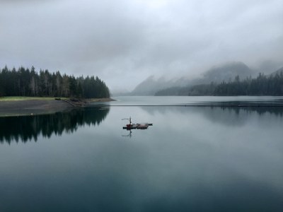
Wynoochee Lake
Small streams and waterfalls, the Wynoochee River, Wynoochee Lake, old-growth and second growth forests are all part of the experience along this 16 mile loop trail that follows the lake shore.
getting there
From Olympia, drive north on US-101. In ~19 miles, exit towards Matlock and drive ~15 miles on Dayton-Matlock Road. In Matlock, continue straight at the junction onto the Matlock-Deckerville Road that turns into the Boundary Road. Drive 8.8 miles, turn right turn onto Cougar-Smith Road and drive ~5.5 miles. Turn right onto Forest Road 22 and drive 15 miles. Turn left to stay on Forest Road 22, drive a short distance, and turn right on Forest Road 2294. Drive ~1 mile to the Coho Campground (250 ft).
on the trail
In a loop around the lake, the 16-mile Wynoochee Lake Shore Trail follows 4 miles along the lake shore, extends another 2 miles upriver to a bridge over the Wynoochee River, then returns to the Coho campground in 8 miles on the opposite side of the river/lake.
Information for Leaders
Scheduling
- If you are scheduling this as a non-stewardship related activity, please limit your group size to the default party size. The maximum party size is for use by stewardship trips only, and includes both participants and leaders. Group size maximums do not reflect how stewardship trips are run (in smaller groups of participants and leaders), but allow for leaders to register the activity in our system.
- Suitable Activities: Day Hiking
- Seasons: April, May, June, July, August, September, October
- Weather: View weather forecast
- Difficulty: Moderate
- Length: 16.0 mi
- Elevation Gain: 1,150 ft
- 950 ft
-
Land Manager:
Olympic National Forest
Hood Canal Ranger District (ONF)
- Parking Permit Required: Northwest Forest Pass
- Recommended Party Size: 12
- Maximum Party Size: 22
- Maximum Route/Place Capacity: 12
- Green Trails Grisdale N. 198
There are no resources for this route/place. Log in and send us updates, images, or resources.
