Yakima Skyline Ridge
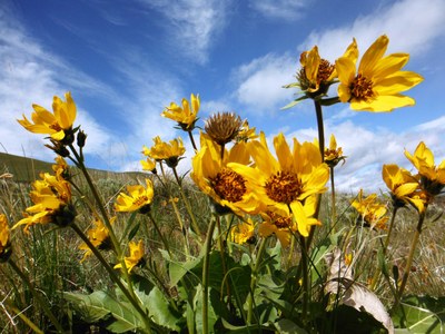
Hike up to eight miles round trip from Buffalo Road on the Yakima Skyline Trail in the L. T. Murray State Wildlife Area. This is some of the best desert hiking in Washington where you'll see lots of wildlife, a full palate of colors produced by blooming flowers in spring, and views of Mount Stuart, Mount Rainier, Mount Adams and Mount Hood.
Getting There
Take Exit 26 off of I-82, turn right onto Harrison Road, and drive 1.9 miles. Turn right onto Wenas Road, drive 2.8 miles, bear tight at the junction onto Gibson Road. In 0.3 mile, turn right onto Buffalo Road, and then turn left into the parking area. Park here or continue through the gate (be sure to close it behind you) and drive 1.5 miles to the trailhead.
On the Trail
Hike up to the ridge from wherever you parked and follow the ridge as far as desired enjoying views of the canyon. It's up to 8 miles round trip and 1,200 feet of election gain. Gracie Point (3,200) ft is the high point and as far as most go.
- Suitable Activities: Day Hiking
- Seasons: March, April, May, June, July
- Weather: View weather forecast
- Difficulty: Moderate
- Length: 8.0 mi
- Elevation Gain: 1,000 ft
- 3,000 ft
- Land Manager: Wenas Wildlife Area
- Parking Permit Required: Discover Pass
- Recommended Party Size: 12
- Maximum Party Size: 12
- Maximum Route/Place Capacity: 12
- USGS Selah
- USGS Pomona
- USGS Wymer
- WA DNR Yakima
- Green Dot Maps (wdfw.wa.gov)
This is a list of titles that represent the variations of trips you can take at this route/place. This includes side trips, extensions and peak combinations. Not seeing a title that fits your trip? Log in and send us updates, images, or resources.
- Yakima Skyline Trail
- Yakima Skyline Ridge/Gracie Point
There are no resources for this route/place. Log in and send us updates, images, or resources.
