Trip Report
Alpine Scramble - Central Cowlitz Chimney
Early start scramble hampered by a misty fog and busy trail head. Finishing with great views and a photogenic Marmot
- Sat, Aug 13, 2022
- Alpine Scramble - Central Cowlitz Chimney
- Banshee Peak & Cowlitz Chimneys
- Scrambling
- Successful
-

- Road suitable for all vehicles
-
There is still snow covering parts of the trail up to Panhandle gap. The water crossings can be a bit dicey. Overall the trail was in great condition except for the larger water crossings.
With a long day planned I decided we needed an early start. I figured 6 am at the trail head would do it. Nope at 6 am the trail head parking was completely full. According to one of the participants there was parking for maybe ten vehicles at 545 am but it rapidly filled. Luckily for us we had gotten most of our group into two vehicles so we got the last spot and a spot on the road pullout across the street.
Weather wise our day was not off to a great start. What was supposed to be a partly sunny day was starting out as a damp misty fog. The cold fog was a slight relief over the heat of the last couple weeks and perfect to ascend the trail in.
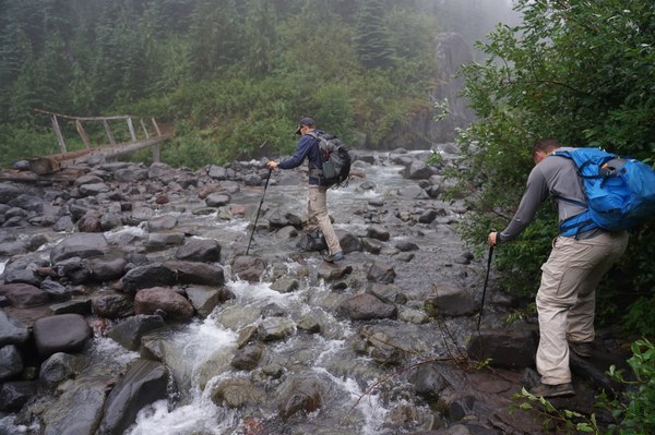
Even though the plan was to take a moderate pace up the trail to conserve energy for the day we ended up going a bit faster than planned to stay warm. At this pace we made rapid time to our first water crossing at Frying Pan creek. Normally you can easily get to the bridge to cross the creek. Due to the late snowmelt this year the creek is flowing at a pretty good rate and had risen up blocking full access to the bridge. Luckily you can easily hop on rocks sticking up out of the water and reach the bridge to cross the far deeper area.
Crossing Frying Pan creek
Once across the creek we continued our faster than planned pace to Summerland. We arrived at Summerland right at two hours into our journey. Unfortunately upon our arrival Summerland was still shrouded in the damp misty fog. No views were to be had. At this point we took a long break so we could use the facilities at the camp as well as let participants change from trail runners to boots for the journey onto Panhandle gap.
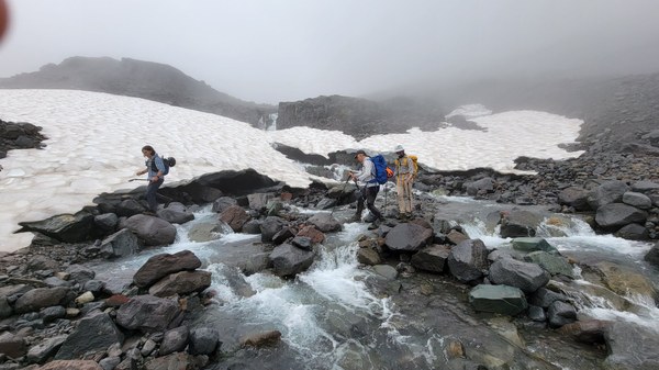
On our way to Panhandle Gap the plan was to stop and filter water. Due to the coolness of the day so far we found we were all still doing fine on water. Not to mention there was ample water flowing for most of the way up to the gap at least until you passed the tarns located below Panhandle Gap. The trip to the Gap was uneventful except for crossing the near raging river flowing from the glacial and snow melt above. The bridge though in place was this time nearly unreachable. We found a slightly better crossing just upstream of the bridge.
Crossing the "stream" on route to Panhandle Gap
Photo by Matthew Pahs
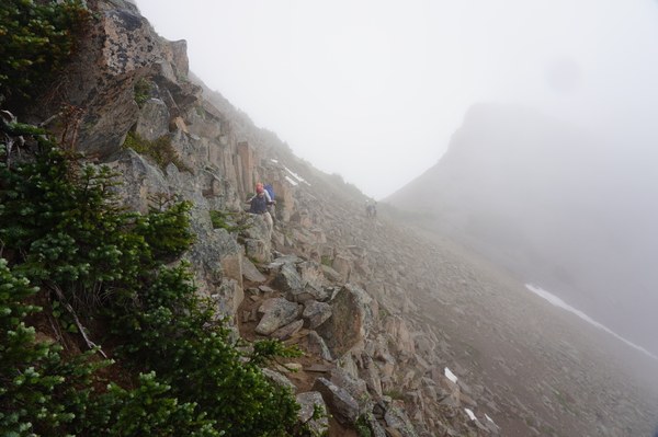
Once across the river we continued onto Panhandle Gap. Just before we reached the gap we decided to change from the standard route in and attempt to venture due East through the saddle formed by Point 6945 and the unnamed peak directly East of Panhandle Gap. We figured this might be a slight time and elevation gain savings over the standard route. This route was fairly easy and all on rock. It had some exposure but was easy travel for the most part and we came out just East of the unnamed peak and on route to Banshee peak.
Non standard route located NE of Panhandle Gap
At this point we were in open country but we could not see any of the days goals due to the persistent mist that was still hanging around. Occasionally the sun would break through giving us hope of views from the peaks. Unfortunately due to the mist the vegetation we were now moving through was covered in moisture. It wasn't long at all until we all had wet pant legs and boots.
Moving through wet meadows towards Banshee peak.

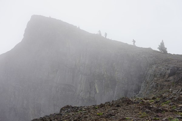
For our route to Banshee peak we decided to use the cliffs to our left as a handrail to guide us up. This worked very well and we arrived at a mist enshrouded Banshee peak. From this route in Banshee is just a walk up.
Banshee final summit push.
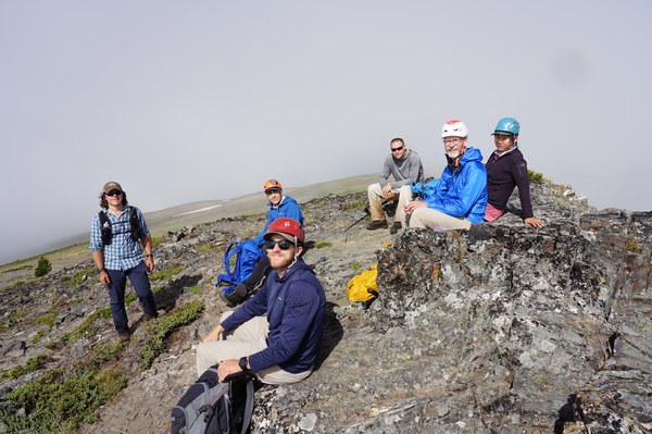
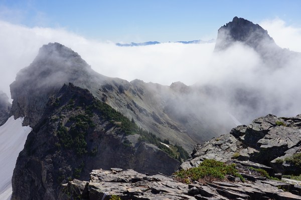
No idea how this happened but nearly exactly as we sat down on the summit of Banshee for a break the clouds and mist dissipated. I of course took full credit for this and was congratulated by the group for the excellent arrival time to make this happen. We now had views and could see our next objective in the distance.
Group photo Banshee peak summit
Next objective Cowlitz Chimney Central peak, left.
After a quick bite to eat we regrouped and headed for the saddle below us and onto Cowlitz Chimneys central peak. The route was fairly easy given the very soft soil/sand that allowed us to nearly plunge step down the side of Banshee towards the saddle located between Banshee and Cowlitz Chimneys central peak. Along the way we did encounter a group of mountain goats. They proceeded to always stay directly in front of us and right on the route we wanted to take up the peak. Luckily they moved lower as we moved higher.
At the saddle, mountain goats heading up the peak.
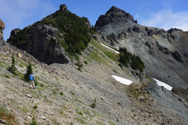
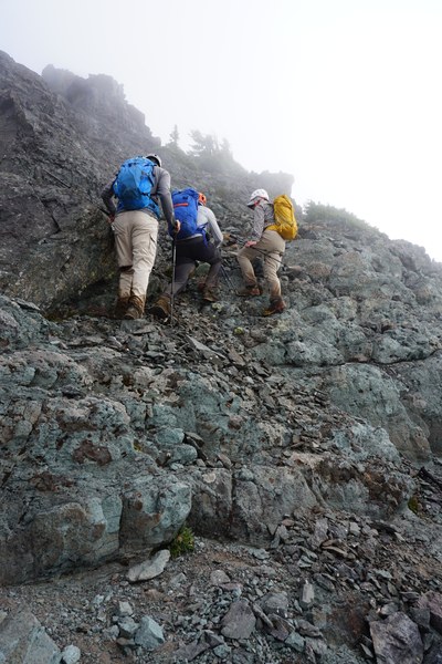
Once we cleared the saddle it appeared this peak would be an easy straight forward scramble. The route appeared very clear. It was as we got on it that we realized why it is advised to only take a small group of experienced scramblers up this peak. Everything is loose on the way up. Rocks are slipping and rolling around you with each movement. To counter this we attempted to stay close together but for some sections we had to send small groups up while the rest of us stayed out of the fall line.
Nearing final summit block of Cowlitz Chimneys central peak.
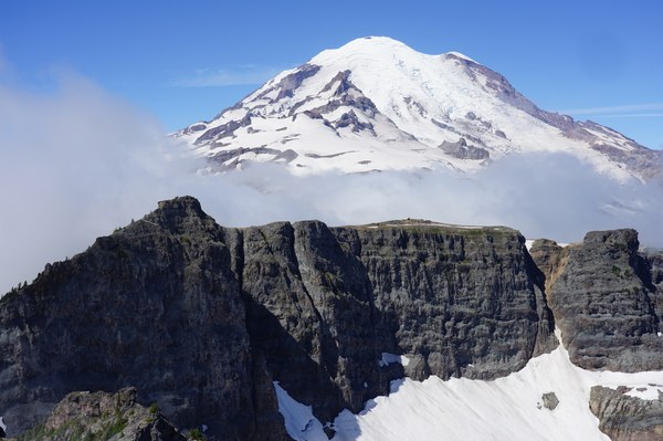
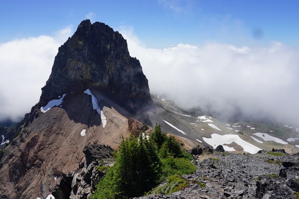
Once on the summit the skies once again cleared offering us great views back towards Banshee and of Cowlitz Chimneys main peak. We took a nice long break and ate some summit treats before starting our return trip.
Banshee peak with some larger mountain in the background.
Cowlitz Chimneys main peak.
The return trip was uneventful for the most part. Since we did not need to go back over Banshee we tried to stay lower and work our way back to Panhandle Gap. Unfortunately we initially went a bit to low and had to ascend back up the hill to go over some cliff bands that would completely block our progress. While doing this we ran into yet another herd of mountain goats that did not seem to mind us going slightly above them in the least.
Returning to Panhandle Gap location below Banshee peak. Mountain goats below us.

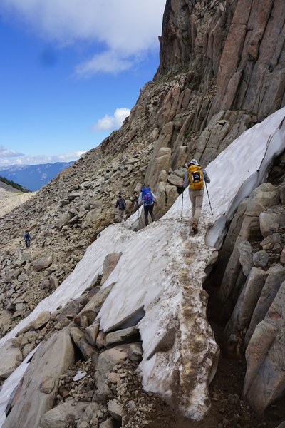
Once we cleared this section it was easy travel back to the gap. For our return trip we decided to go the standard route south of the peak located next to the gap. This decision was made in part because Panhandle Gap is the highest point on the Wonderland trail and all the participants wanted to make sure they also accomplished that one for the day. Once we got there and took some photos it was time to return back to Summerland via the Wonderland trail. However, there was one little final surprise that the trail had to offer us directly off the gap. Snow was blocking the trail. There was a path over it but we were not so sure about it. It was obviously melting out under neath next to the exposed rock so we cautiously crossed over it and then proceeded back down the trail.
Wonderland trail blocked by snow. Terrible runout below and melting out.
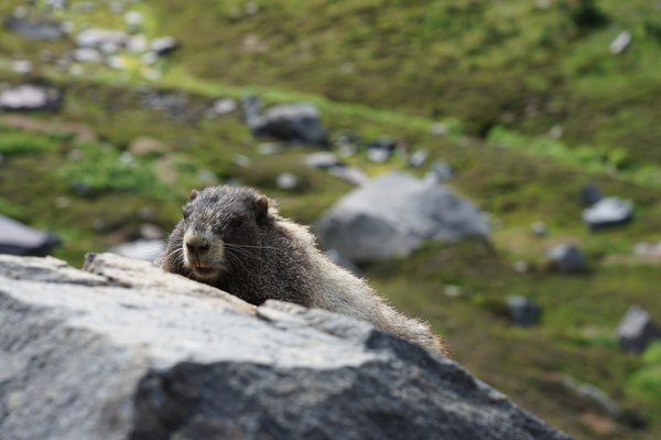
After that the trail back to our water crossing was nice and easy. Upon arriving at the raging river we once again elected to cross at the spot we used earlier. There were many groups attempting to cross a very deep section and reach the remains of the bridge. We all agreed our crossing was a better spot and easier than what we were seeing people attempt to do. Once across we returned to Summerland where we once again took a break while some of the participants changed back to trail runners. As a final good bye from Summerland we met a very happy Marmot who posed for us all to get some great photos.
Photogenic Marmot
The trip back to our cars went very quickly. We arrived back at the trail head just after 4 pm.
Total trip time was just under 10 hours with lots of breaks at summits and two long breaks at Summerland.
Elevation gain 4,600 feet.
Distance around 15 to 16 miles depending on the tracker.
 Jerrick Linde