
Trip Report
Alpine Scramble - Norse Peak
An early spring snow scramble to a Rainier 100 peak that beat all expectations - thanks the variety of interesting terrain/conditions, better than anticipated weather, and an awesome group of scramblers!
- Sun, Apr 3, 2022
- Alpine Scramble - Norse Peak
- Norse Peak
- Scrambling
- Successful
-

- Road suitable for all vehicles
-
Weather: Our weather forecast for the day called for temperatures in the mid-30 degrees, 50% chance of snow, and 10-15MPH winds with gusts up to 25MPH. A Winter Weather Advisory was in place beginning at 11AM in anticipation of an incoming storm front later that night. Luckily, the weather held out for us for the duration of our trip! We experienced only light snow, moderate wind, and even still had decent summit views of the closest surrounding mountains.--Snow Conditions: We experienced a lot of variable surface conditions all day. We found everything from solid freeze/melt crust, to 1-2 inches new powder over the crust, to deep wind drifted piles of snow. The trail from the summer trailhead, up to about 5,400ft, was mostly clear of snow. Areas of the west facing ridge to Norse Peak were already melted out as well.--Avalanche: The avalanche forecast for the day was overall Moderate, driven by the problem of wind slabs above tree line. Risk was Low near/below tree line. The ridgeline to Norse Peak has large cornices and some have started to melt/break off already. Except for wind loaded pockets, the snow felt very consolidated and there did not appear to be enough new snow to trigger an avalanche.
Our group of 7 was led by Sherrie Trecker and myself as assistant (an unofficial mentored scramble experience for me). We met up at 8:30AM at the Norse Peak summer trailhead, about 2 miles prior to the Crystal Mountain ski area. The parking for the trailhead is only a small pullout, but we stacked 5 of our vehicles in the pullout and the remaining 2 chose to park on the shoulder of the road. Our intended route was an out/back to Norse Peak following roughly the summer trail.
--
From the pullout, it is a 2 minute walk up the NF road (gated) to a sign indicating the Norse Peak Trail. The trail leads up a series of very gradual switchbacks from ~4,000 feet to 5,600 feet in about 2 miles. The switchbacks were low in snow (none to begin with). We added microspikes about 3/4 of the way up the switchbacks as the remaining snow was very compacted/icy in the early morning. After the switchbacks end, the summer trail turns south and makes a long traverse towards the ridgeline that runs to Norse Peak. Here we started to find a couple fresh inches of powder over the consolidated snow crust and any prior tracks (if there were some) had been wiped out as a result. We removed microspikes due to them balling up in the light powder. We did some slight side hilling and meandered through the burned trees (left from the 2017 fire). Generally we navigated on the path of least resistance and gradually gaining in elevation up to the base of the ridgeline at ~6,400 feet.
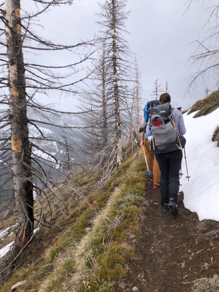
Photo Credit: Cindy Hong
--
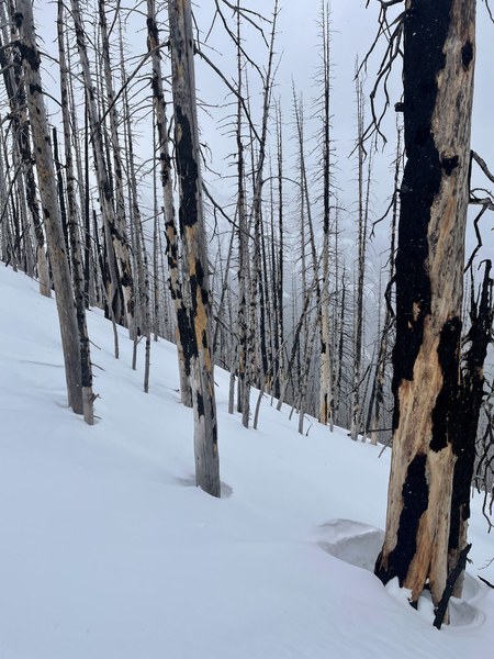
Photo Credit: Sherrie Trecker
--
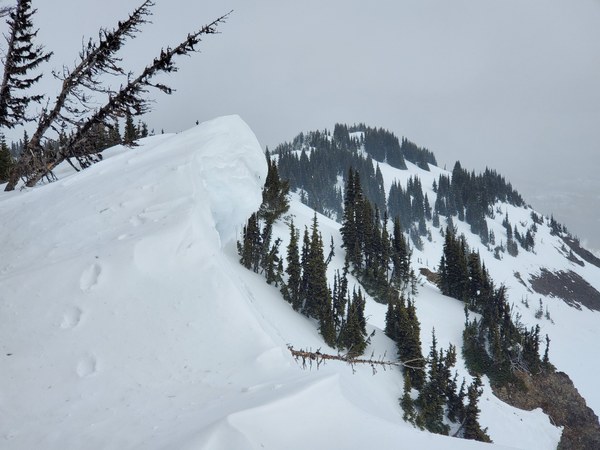
Before gaining the ridge, we stopped to discuss route options as a group. Effectively we could gain the ridge to our climber's left, direct ahead, or to our climber's right. With mostly consolidated snow and low avy risk near/below tree line, our group consensus was to take a direct, straight line up the steep slope ahead. The snow surface on this slope was very compacted/icy and we used our ice axe, helmet, and put back on microspikes to ascend. We did not bring crampons, but if we had them we may have used them for additional traction on this slope. On the top of the ridge, we continued walking south towards the Norse Peak summit. There were many large cornices, especially on the east side of the ridge overhanging the bowl to Big Crow Basin. The west side of the ridge was already melted out and we were able to mostly stay on the rock to give the cornices a wide margin.
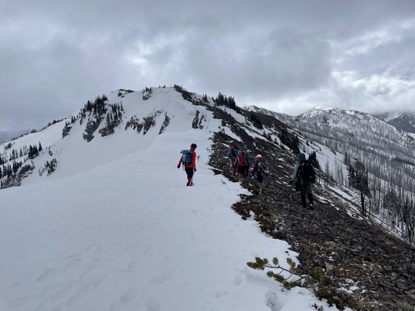
Photo Credit: Sherrie Trecker
--
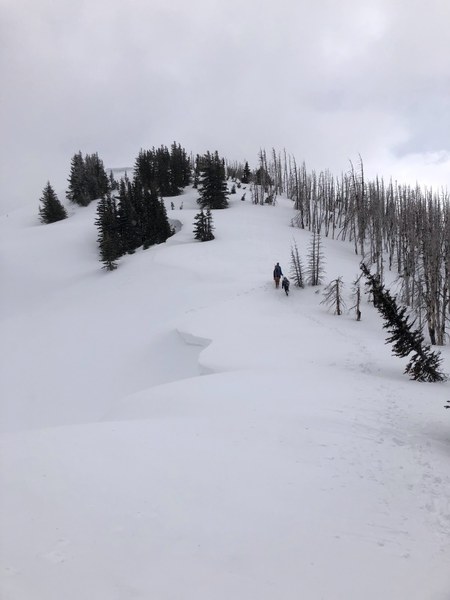
Photo Credit: Cindy Hong
--
From the summit we were lucky enough to still have a few cloudy views of the neighboring mountains. With light snow and moderate winds, we took quick summit pictures and decided to descended to a more protected spot back down off the ridge for a lunch break.
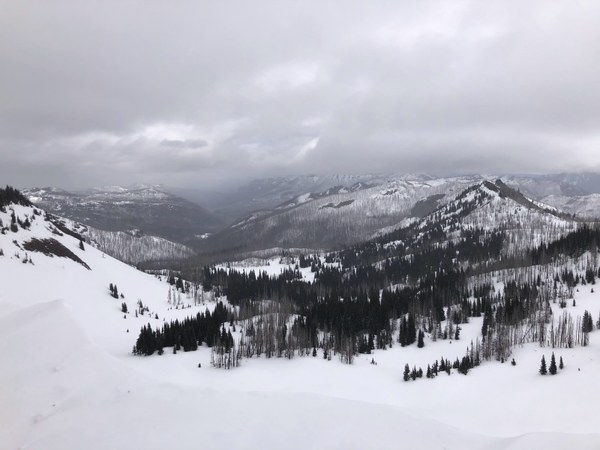
Photo Credit: Cindy Hong
--
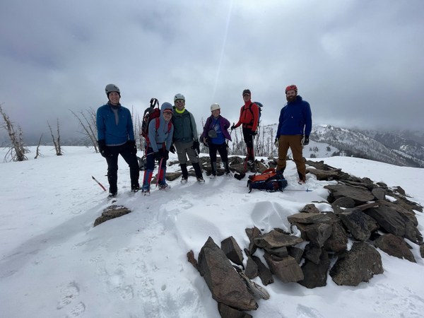
Photo Credit: Sherrie Trecker
--
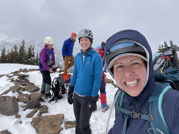
Photo Credit: Sherrie Trecker
--
Instead of taking our ascent route directly back down the steep slope, we followed the ridge a bit longer around towards the north end of the Big Crow Basin bowl. The cornices on this part of the ridge seemed the most concerning (visibly drooping) and had the most narrow margin to avoid. Once towards the north side of the bowl, there was an easy, snowy "ramp" down off the ridge. Our descent route could also be used as an easy ascent (noted above as the climber's left option to gain the ridge).
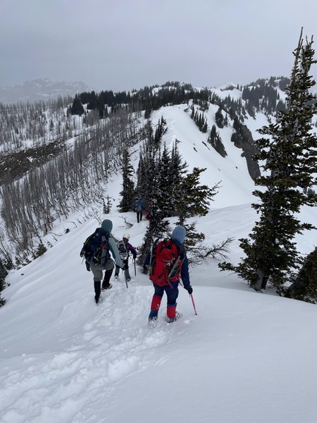
Photo Credit: Sherrie Trecker
--
--
After a brief lunch stop, we put away our helmet and ice axe and did some more tromping through the snowy trees to connect back to the trail. We then made the final, uneventful descent on the switchbacks to return to the trailhead. Total trip stats: 6 hours, 8 miles, and 3,000 feet of elevation gain. Some of my favorite mountains days are the ones that turned out unexpectedly more awesome than I had imagined. Today was one of those kind of days - thanks to Sherrie, a great group of scramblers, interesting route/conditions, and decent weather!
 Sarah McClellan