Trip Report
Alpine Scramble - Three Way Peak
Fun scramble with lots of veggie belays. Did a bonus scramble of Yakima Peak afterwards
- Mon, Aug 12, 2019
- Alpine Scramble - Three Way & Yakima Peaks
- Three Way Peak
- Scrambling
- Successful
-

- Road suitable for all vehicles
-
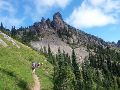
Took the PCT from Chinook Pass up past Sheep Lake and Sourdough Gap to our turnoff. Trail is in great shape. Our off path scramble required the use of veggie belays but once on the summit block, easy scrambling from there.
We had a group of 9. Straightforward hike up the PCT through Sourdough Gap. We turned off the trail about 1/4 mile after going under Three Way Peak to the obvious low point of the ridge. We scrambled up the ridge to the right side of the low point. We did have to scramble around a large rock outcropping which can be done either from the right or left side. We had a chute that we had to ascend occasionally using a veggie belay, but once up the chute, it was straightforward to the summit. The summit has a little exposure, but nothing too crazy. We came back the same way except once at the low point of the ridge we were able to find another gully to come down so if you will be scrambling Three Way, be aware that you can go either right or left onto the low point of the ridge. We then descended back to PCT, Sourdough Gap, Sheep Lake, and then to Chinook Pass. The GPS track is here: https://www.gaiagps.com/datasummary/folder/b531a36bfd11cec058ed1190184fb471652d8b46/?layer=GaiaTopoRasterFeet
5 of us decided to scramble up Yakima Peak from the same trailhead. We found a path up the meadow to the north ridge below Yakima. We crossed the ridge and then traversed down to a path that would eventually lead us to the west ridge. Coming up the ridge, we scrambled up and around a few rock outcroppings. Generally by staying to the right of the ridge, and occasionally dropping 20-30 feet below the ridge got us to the summit block. At the summit block, you can friction scramble on the left side of the block or scramble up some brush on the right side to the summit block. The summit itself is sizeable and flat so a good place to take some pictures of Mt. Rainier, Naches Peak, and other surrounding mountains. We descended the same way we came up. 1 hour 50 minutes to the top, but 1 hour coming down. Our GPS track is here:
https://www.gaiagps.com/datasummary/track/d17cc51b36dd2b858850842af8f62bdd8cc6b3c5/
 Paul Kallmann