Trip Report
Backcountry Ski/Snowboard - Rat Trap Pass
Fun exploration on a sunny day. Road conditions were a challenge past Darrington and the mileage of this route is clearly a lot more than indicated so we didn't reach Rat Trap Pass and the meadow area.
- Mon, Feb 17, 2020
- Backcountry Ski/Snowboard - Rat Trap Pass
- Rat Trap Pass
- Backcountry Skiing
- Successful
-

- Road recommended for high clearance only
-
Note: Mileage estimates based on the mountaineers.org route and the guidebook The Snowshoe Routes Washington guidebook by Dan Nelson were clearly lower than the actual mileage to Rat Trap Pass and the high meadows we had hoped to explore. When we reached the Crystal Lake / Mountain Meadow trailhead turnoff, we were already at least 2.5 miles in (from the FR23/FR 27 junction) as measured by various people's different GPS devices/smartphones. We continued on another 1.5 miles before deciding to retrace our steps given our pace of travel. West of us there had continually been a valley and/or steep dropoff as we ascended - even at 4+ miles in we were nowhere near the flank of the ridge we had intended to climb up. Literally there was no way we could have gone west. Based on my research with Gaia and other sources, I put together this Gaia route: https://www.gaiagps.com/public/1SdEHthofD7mqwZ7reZI74Yt
My route features what appears to be an unused / defunct road that peels off to the west from FR 27. I saw it on Google Maps' satellite imagery and read about it on a random trip report off the internet, FWIW! We determined using the Gaia app we were possibly .25 miles or so from this road when we decided to turn around. Since we never actually saw this road, I am not sure if it exists or if it does exist, how overgrown it might be! Dan Nelson's snowshoe guidebook mentions a "road" but doesn't describe it very much at all. I would estimate that overall this route would be closer to 9 miles, possibly 10 miles round-trip.
From our rendezvous at Moe's coffee shop on N. Olympic in Arlington (highly recommended!) we drove on the Mountain Loop Highway, which was not plowed and had a few inches of fresh snow, then turned onto Forest Road 23 (White Chuck Road) and headed east for 5-6 miles. This road was also unplowed and under several inches-1 foot of snow. This road was a VERY challenging drive: there were branches, trees loaded with snow leaning into the road, and several fallen trees which we had to cut through with a saw and hatchet then drag off the road! I had phoned the Darrington ranger station earlier in the week and they had said that FR 23 was open and they had no information on FR 27.
Finally, after a painfully slow drive along FR 23, we reached the parking lot for the White Chuck Bench Trail, about .2 mi before the junction of FR 23 and Forest Road 27 (marked as 2700 on some maps). FR 27 leads up to Rat Trap Pass. Our intention had been to skin up FR 27 past the Crystal Lake trailhead, then begin looking for the flank of the ridgeline to the west in order to ascend it and check out the meadows. However, we ultimately decided to turn around and descend before we got to a point where it would make sense to leave the road.
- Coordinates where we started: 48.1782, -121.3599. Elevation 1541'.
- Coordinates where we turned around: 48.2004, -121.3809. Elevation 2951'.
- My Strava data is here.
Ascending FR 27:

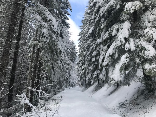
Deep snow - at first wetter and sticky, but increasingly fluffy and powdery-- awaited us. We ended up pushing through drifts of up to 2 feet! The sun came out and we enjoyed sunshine and blue skies, with intermittent peek-a-boo views of the surrounding peaks. A beautiful place. Our descent was uneventful - since the snow was so deep we mostly were in downhill mode gliding in our skin track and occasionally slogging along the flatter spots. In the final 1.5 miles or so the rising temperature and sun had really softened and thinned out the snow - it was quite mushy with obstacles poking out and exposed dirt in spots. We saw very dense woods on both sides of FR 27 the entire way, plus 2 striking waterfalls. Although the slopes next to FR 27 are quite steep, they are thickly covered with trees and we decided that avalanche risk was low since slabs couldn't form there. We also observed no signs of avalanche activity while traveling.
The start of our ascent - White Chuck Bench Trail parking lot, FR 23.
 Gabrielle Orsi