Trip Report
Basic Glacier Climb - Eldorado Peak/Inspiration Glacier
We were within 100 ft of the summit, but turned around due to route conditions.
- Sat, Jul 29, 2023 — Sun, Jul 30, 2023
- Basic Glacier Climb - Eldorado Peak/Inspiration Glacier
- Eldorado Peak/Inspiration Glacier
- Climbing
- Turned Around
-

- Road suitable for all vehicles
Our party of 9 (3 instructors and 6 students) met at the Eldorado trailhead at 6:30 am to distribute group gear and do a quick review of the trip plan before heading out. The weather forecast called for a sunny Saturday, partly cloudy Sunday, and low winds for both days. Despite that, the weather was cool and cloudy.
At 7 am, we started walking back down the road we’d just driven to see if we could find a good river crossing. We weren’t able to find any recent beta on crossing other than people wading through — but were happy to discover that the usual crossing is very much in. It’s 200’ back from the trailhead and is marked with a laminated sign on the ground warning of crossing dangers. There were three water crossings total, all well marked with pink flagging.
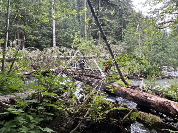
We continued following the flagging all the way to the trailhead. By 8:30 am, we were at the boulder field, although not without incident — a couple of us got stung about 1/4 mile before the end of the wooded trail. If you follow us in the near future, I’d encourage you to move quickly if you hear buzzing!
The boulder field was pretty uneventful. We found bits and pieces of the mythical right side trail, but generally found those sections to be muddy and overgrown. Around 4,180’, we found a short trail on the right that skips the the boulder problem in exchange for veggie belays and slippery feet. I’m not sure which is better.
We reached water at the top of the boulder field at 10 am around 5200’. A family of marmots whistled and watched our every move from the nearby boulders. By 11 am, we reached the notch at 6200’. Everyone descended the notch with care, and we continued through the rocks until 12:15 pm, almost 7,000’. Intermittent snow/glacier began around 6,700’ but we navigated around it to reach a high point on the rocks. The sky was still pretty cloudy and gray, with only a few brief cloud breaks. Visibility was good.
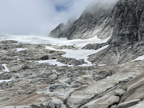
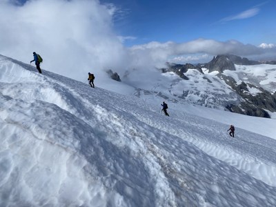
We took a long break here to eat lunch, change into boots and get roped up. We had to navigate bare ice right as we got on the glacier, but travel was pretty straightforward after that, and the skies cleared briefly. Snow conditions: mashed potatoes. The boot pack crossed at least 3 step-over crevasses, which was unusual for this time of year based on my previous Eldorado trips. It took us about an hour to reach camp at 7,600’.
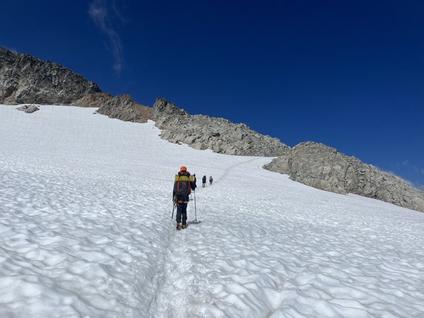
Along the way, we ran into several parties descending. Most were eager to tell us about the unusual conditions they encountered and challenges with summiting. Many recommended transitioning to the rocky ridge from the glacier. One party had stayed on the glacier the entire time and said it was spicy. None of the parties we talked to had successfully crossed the icy and unprotectable knife edge. Some said they had summited by booting up the side of the knife edge from the snow bowl beneath the summit, using pickets to protect the route.
This didn’t sound like July conditions! I have traveled up a portion of the rocky ridge in late August when crevasses start to take over the upper glacier, so I was familiar with it — but even then the transition back to snow was straightforward and the knife edge was quite passable. We also noted it was a little late in the day to find most groups heading down from camp, around 2 pm.
About the camp: We needed a permit to stay overnight. It’s completely melted out, so no need to camp on snow at this time. There are several tent sites at 7600’, and also some really nice camp sites a little higher up the rock if you’re looking to get away from the crowd. An ursack or bear vault is required for food storage. There is a composting toilet. The views are incredible. 5 stars.
It was cool, cloudy and windy at camp. We got an InReach weather forecast to see if Sunday would be any better and found it to be less than accurate. The forecasted current conditions showed far less wind and clouds than we were actually experiencing. It showed virtually the same conditions for Sunday morning. Neither day looked like it would be the clear, sunny summit day we had hoped for.
By 4 pm we had set up camp, found a good water source in the rocks above, and made a plan to start up toward the summit and scope out conditions.
We navigated across a snowbridge at 8,250’ to transition to rocks and explore the ridge line above.
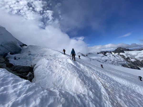 There was a faint bootpack on the glacier alongside the rock, but clouds obscured the top of it from view. All we could see is that the top portion of the bootpack appeared to be disconnected from the bottom so we didn’t want to continue up the snow.
Around 8,600’, the rock becomes more vertical. We relied on the occasional cloudbreak to see what was above us. While the rock above looked climbable, it was steeper terrain than what we’d just come up and we decided it wouldn’t be wise to continue exploring that unknown terrain with Basic students and no rock pro.
We looked for a way to rejoin the bootpack and found we could easily transition back to snow around 8,550’.
 It was almost 6 pm by then, so we descended back to camp to rest and prepare to head up again the next morning.
I woke up at 4:45 am and found cleared skies and no wind outside my tent. An unexpected surprise! We watched an amazing sunrise as we drank our coffee and tea, and then started back up the glacier at 6:45 am.
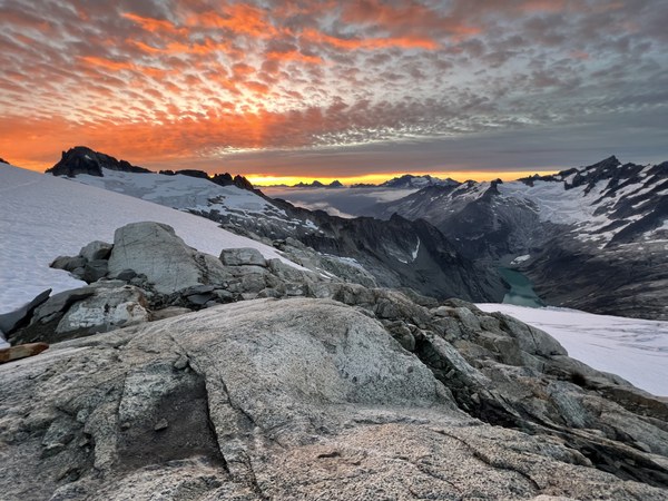
My branch’s Climbing Chair sent an InReach message to warn us of the icy knife edge and safety incidents from two days before. We crossed the knife edge option off our list and hoped the bootpack from the snow bowl would go instead.
The snow had refrozen overnight and travel was easy. On the way up, I could see how the path connected beyond the 8,250’ snow bridge. Crevasses forced it close to a few moats — too close for my comfort! We knew the transition to rock was easy, and the students were starting to get pretty quick with their transitions after our exploration the day before — so we headed back to the rocks. Half an hour later, we were at 8,550’, roped up and back on the snow.
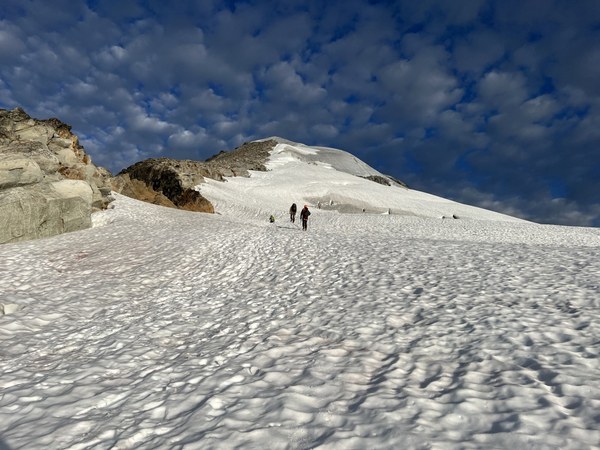
The path crossed some low-angle ice. Again, much different conditions than I’d seen here before! I pounded in 5 pickets to protect the icy spots and the steep climb from there to the snow bowl.
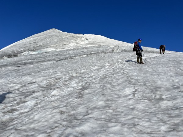
Although the pickets were nice to have on the way up, I was mostly placing them to protect us on the way back down. The last picket was in the snow bowl just below the knife edge, which we all reached by 9 am. My trip leader remarked that this was starting to feel like an intermediate climb.
We traversed under the knife edge to another rock ridge to weigh our options.
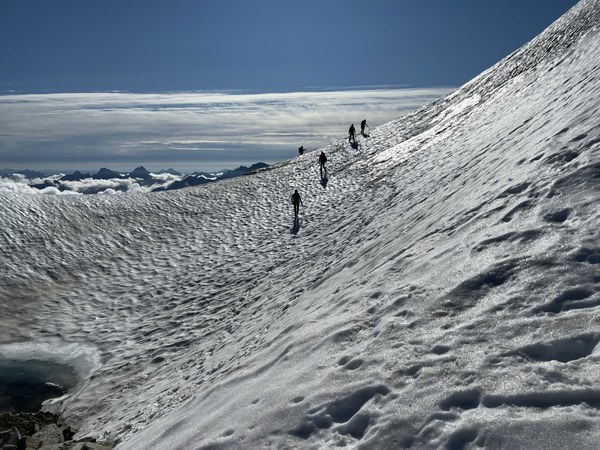 There were two bootpacks on the northwest face under the knife edge of the summit ridge line. Both were steep, and crossed ice and a narrow crevasse near the top. We evaluated the fall line and how we’d protect it, and brainstormed how we’d get back down. We had 4 pickets and 2 ice screws left. Hmmm … reaching the summit was feeling less and less like a Basic climb.
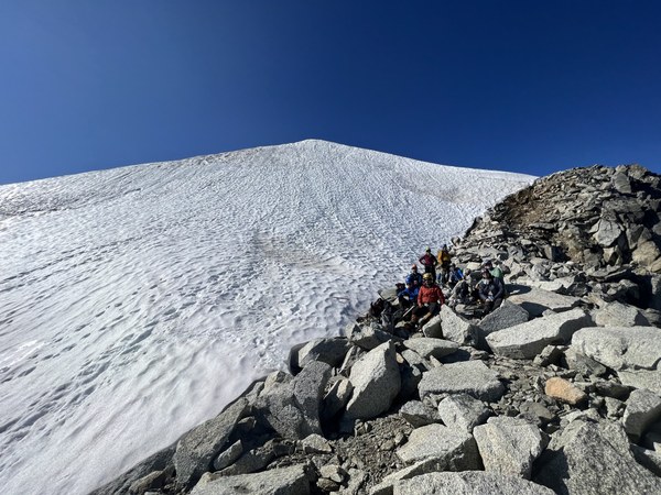
The rocks we were sitting on led directly to rock summit block. I went exploring. Would it go? Yes. Was it safe? Well, it was quite exposed and a fall could be consequential. Maybe I could set up a belay or a handline. We talked it through and decided using a rope in the loosely stacked rocks was too big of a rockfall safety concern, and the fall line was too consequential to do with students unroped.
While we deliberated, another party started climbing the snowy bootpack leading up the side of the knife edge. We watched them use their ice axes as ice tools and struggle to place protection. Another party had started up the knife edge and were crouched low and in dagger mode.
I got a message from another branch member asking me to check my email. I had one bar of service (yay, Verizon!) and the email came through. It was the safety incident report from two days earlier. It reviewed what our Climbing Chair had said about the knife edge and confirmed our suspicions about the challenges of descending. “This is beyond the scope of the basic curriculum,” the report said. We agreed.
So … that was it. We had made it to 8800’ and would not continue the last 68’ to the summit. We shared some gummies and prepared to head back down.
We left our high point at 10 am, retraced our steps, and were back at camp at 11:45.
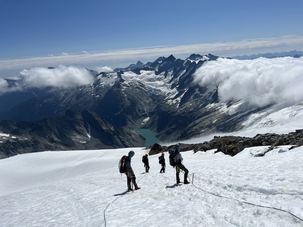 After packing up, it was just under 5 hours to descend back to the trailhead from camp. We took some extra time near the bottom of the glacier, cutting steps in the ice and taking care not to step into the small crevasses that had opened over the previous 24 hours. We collected our shoes at 7,000’ and then continued on the snow until it ran out around 6,700’. We followed the same slippery side trail to skip downclimbing the boulder problem. And once we were back in the trees, we heard the buzzing and moved quickly to avoid getting stung again. A ranger stopped us on the way out to check our permit and ask about our food storage situation.
All in all, it was a really fun and challenging trip with some interesting conditions. I’m bummed that our students didn’t get to summit, but I think they learned way more than they would have if it was the usual Eldorado climb.
 Amy Arnold