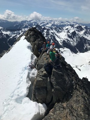
Trip Report
Basic Glacier Climb - Mount Anderson/Eel Glacier
Fun trip with strong group that ticked majority of Olympics todos
- Fri, May 31, 2019 — Sun, Jun 2, 2019
- Basic Glacier Climb - Mount Anderson/Eel Glacier
- Mount Anderson/Eel Glacier
- Climbing
- Successful
-

- Road suitable for all vehicles
-
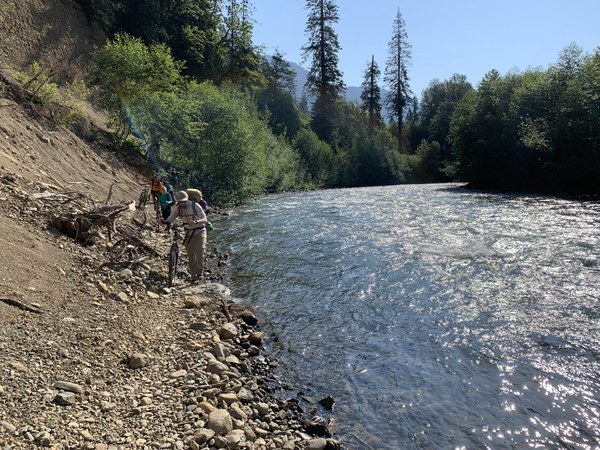
Road washout now has good pass around near river - depending on water level, no need to hike up.
Trail in good condition, was snow free up until Honeymoon Meadows CG, then patches of snow up until Anderson Glacier basin / lake. Stream crossing on logjam, and staying low allows to quickly re-join trail and avoid much bushwacking.
Route in ok condition, Flypaper Pass snow finger had just couple of more days of hot weather ahead of it until it melts out. No bergshrund, Eel glacier in good condition. Easy climb with good snow up until summit block itself.
Rough timeline:
- Gathered at Why 101 / Dosewallips Rd junction 7:45, caravaned to end of Dosewallips Rd with plenty of parking space available (that was Friday morning),
- Started biking up the road at 8:45AM, arrived at old Ranger Station / Dosewallips CG 10:30AM
- Left bikes behind and started hiking at 10:55AM; Arrived at Honeymoon Meadows CG at 3:35PM. Overall, Car to Campground in 6h50m
- On Saturday, we left camp at 5:05, arrived at Anderson Pass at 6:15, at top of Flypaper Pass at 9:15. Arrived at summit at 10:55 (CG to Summit in 5h50m),
- Left from summit at noon, got back to campground at 4:30PM. Overall, 11h25m including a bit over 1h on summit.
- Hiked out of camp on Sunday at 6:35AM, arrived at cars at 11:15AM (4h40m), just it time for lunch and pies at Halfway House .25 miles south on Hwy 101.
Checklist:
- Biked with >35lb packs. It was awesome on way down :)
- Hiked on trail with wildflowers abound. Even I noticed it.
- Hung food from bear wires (luckily, we did not have to carry bear canisters).
- Crossed a river on logjam.
- Bushwacked. Some of us enjoyed it so much, we decided to hike to trail nearby (La Crosse Pass) to check out how the stream crossing looked like there.
- Seen a bear (it run away quickly, so I believe only 2 of us actually seen it) and majestic Elks.
- Postholed, but just a bit (at the time, snow with that offering was at around Anderson Pass elevation).
- Climbed into glide cracks in snow cover.
- Played hike and seek on summit block.
- Enjoyed solarium like sun exposure and heat. But that came with great 360 degree views tradeoff.
We did not encounter too many bugs. We did not have to butt-scoop on logs. And not much loose rock. But overall, I think we checked lots of boxes!
Now some useful info. We biked the road, and IMO that was good decision.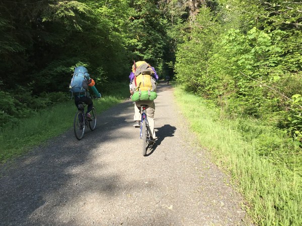 Tom was on a trip in area previous year and discovered an alternate washout bypass - instead of hiking up, with bikes, we took a path along stream. It is hard to miss if you're looking for it, and worth checking it out (as it depends on stream level).
 It has short steep section (somebody dropped fixed line, would be useful if wet), but hey - occasion to practice team work:
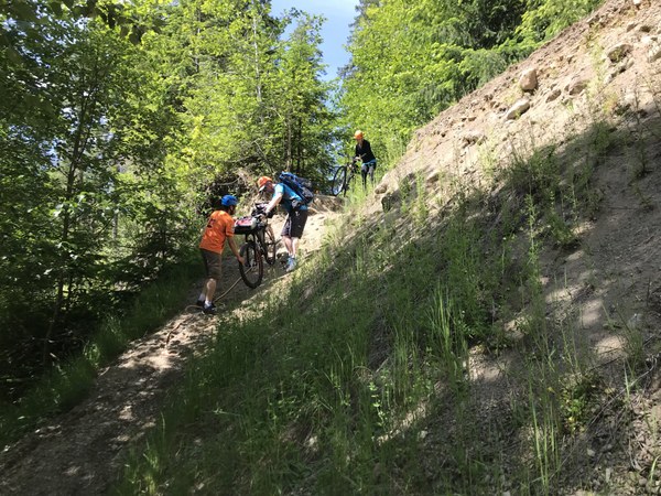 Past that, there were some sections where we had to push bikes - either too steep to ride, or road is too damaged.
Hiking to Honeymoon Meadows camp was just following trail. There is large stream crossing past Diamond Meadows campground, which is much improved comparing to what it was 2 years ago - no need to butt scoop on sketchy log: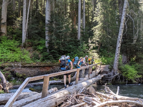 Also comparing to 2 years ago, we arrived at the camp just following the trail.
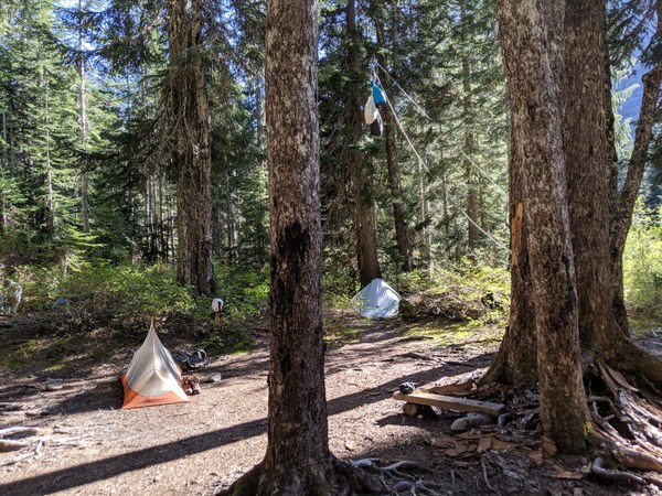 Campground welcomed us with bear wires in good shape, flat camping spots, nearby stream and peek-a-boo views of our objective.
Re stream crossing here: on hike to CG, we did see large logjam, but we also checked out other options. There is fording path, but stream was too strong to our liking. We also read report of some other party crossing stream via La Crosse Pass trail, roughly at 3627', and we hiked there, but discovered it much less convinent than log jam: a lot of bushwacking, and we'd still need to get our feet wet.
We left next morning at 5AM, and crossed the stream via logjam just below camp: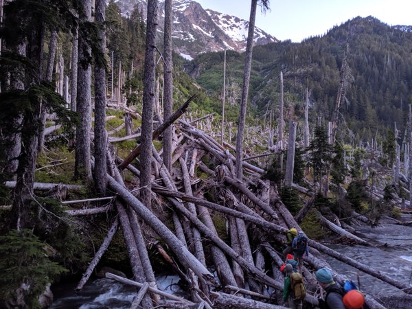 Trick is to stay relatively low / close to stream once you cross it. You can see a flat spot from trail between log jam and campground, and we aimed for that - literally had to bushwack for just 300' or even less.
Then you follow trail. We've seen bear - run away too fast to snap a photo. Soon after that we were welcomed to this sunrise view: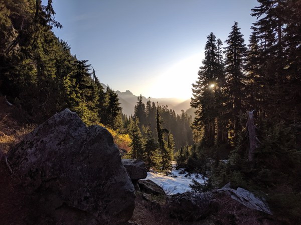 Once you reach Anderson Pass, or flat area before it, go right / up and find a trail. It was partially snow covered so we almost missed it.
Reaching the basin of lake and Anderson Glacier, we could see crux and biggest unknown of the trip: snow conditions on Flypaper Pass: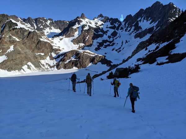 Bypassing still mostly frozen lake, and avoiding avalanche runout paths, we got to bottom of it and decided to go up the right side snow finger:
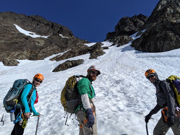 We were ready to set up belay, but there was no need - snow was supportive enough and it was easy to kick steps.
Once up flypaper pass, we roped up and dropped onto glacier - carving right to save elevation as much as possible. There was one crack in snow we had to navigate (ie get inside it), it looks quite technical on photo (taken on way back) but was easy: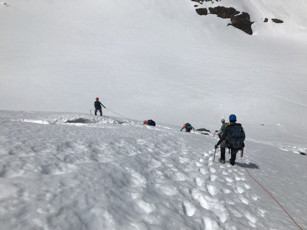
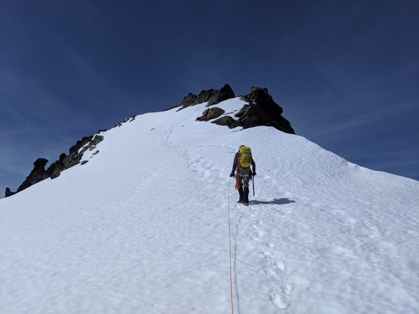
Snow highway to summit: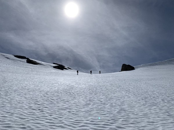
We spent a bit over 1h on summit. Got time to play hide and seek: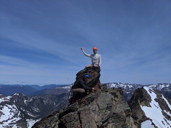
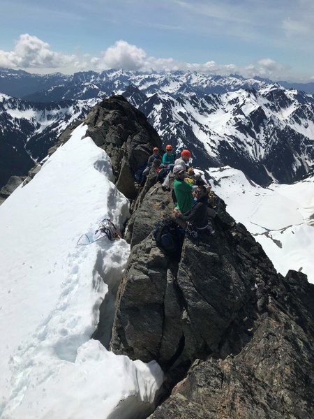
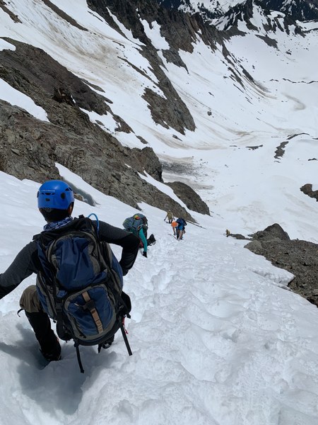
Descent was pleasant, but it got pretty hot by that time: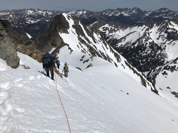 Steep snow on Flypaper Pass was still good enough to downclimb without setting up belay - self belay was sufficient:
 On hike out on Sunday morning we met a park ranger - yes, the permit paperwork was actually checked by someone, it was not just a dead weight in my pack :)
Overall, very good trip with very strong group to beatifull place without crowds. We did not see anyone until we got back to camp from summit - and this was the group we knew would be climbing Anderson a day after us.
 Krystian Walec