Trip Report
Basic Glacier Climb - Mount Logan/Fremont Glacier
A three-day climb of Mount Logan in the heart of the North Cascades.
- Sat, Jul 15, 2023 — Mon, Jul 17, 2023
- Basic Glacier Climb - Mount Logan/Fremont Glacier
- Mount Logan/Fremont Glacier
- Climbing
- Successful
- Road suitable for all vehicles
-
The Thunder Creek Trail is in good shape until Skagit Queen Camp (mile 15). Shortly after that the trail is obliterated by dense tree-fall through the steep section of switchbacks. Once the grade lessens the trail returns with only occasional blowdowns and brush to navigate.
The ford of Thunder Creek just before Thunder Basin Stock Camp (mile 18) is about knee deep.
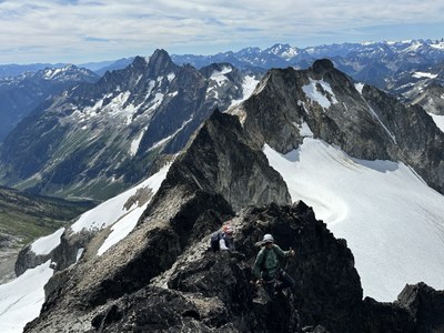
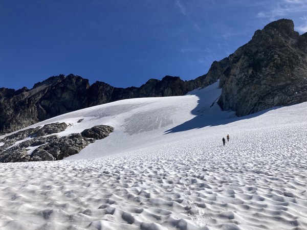
The Fremont Glacier is in good shape without open crevasses but there are many ice/water-filled cracks. Roping up is highly recommended. The current transition from glacier to rock is a simple step across.
Mount Logan is a majestic peak buried deep in the North Cascades. The climb itself is straightforward, with a mellow glacier crossing followed by a fun scramble with lots of exposure. If Logan was easy to reach it would be very popular; the long approach meant that we only saw three people past Skagit Queen Camp (mile 15).
Day 1. After getting permits in Marblemount our party of five set off from the Thunder Creek Trailhead around 9:15 a.m. Our ambition for the first day was to camp near to where the route leaves the trail before Park Creek Pass. (On USGS maps this is labeled Wyeth Glacier but it is now a rocky meadow.)
The trail was pleasant with only a couple steeper bits but the weather was warm and it took a toll on our pace. Soon after we passed Skagit Queen Camp we ran into massive blowdowns covering the trail and our progress slowed to a crawl. After a bit we met a descending solo climber who was doing Logan car-to-car (!) and we followed his recommendation to ignore the trail switchbacks and head straight up and rejoin the trail later.
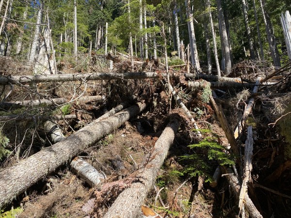 Photo: Tim Egan
After the worst of the blowdowns the trail leveled out and we made better progress. We soon reached the Thunder Basin Stock Camp (mile 18) where the trail fords Thunder Creek.
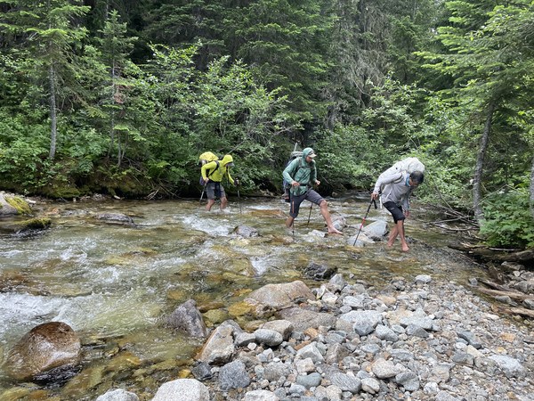 Photo: Max Mielke
After the crossing we realized that we were running late and shifted our plans to camp at Thunder Basin Hiker Camp (mile 19), the last official camp site before the route leaves the trail and heads cross-country. The camp is marked in different locations on the USGS map and the Gaia Topo map: we hiked past both places without finding the camp, gave up, and made a dispersed camp off the trail.
Day 2. We set off around 5:30 a.m. and after about a quarter mile we passed Thunder Basin Hiker Camp. We switchbacked up towards Park Creek Pass, out of the trees, and soon had great views to the west. When the switchbacks ended we left the trail and headed on a rising traverse towards the Fremont Glacier. The terrain was a lovely mix of talus, meadow, shrubs, small trees, and patches of snow.
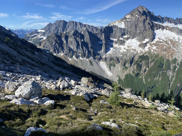 Photo: Tim Egan
We soon reached the Fremont Glacier, roped up, and trudged across to the rocky gully that goes to a low point in the summit ridge. Happily there was no moat to cross. We left our glacier gear where we got onto the rock but wore harnesses and carried one rope in case we wanted to rappel. (We didn't.)
The gully had some loose rock but the ridge was mostly solid. Once on the ridge we traversed towards the summit on ledges on the east side of the crest. Partway across we met a pair of climbers coming down and chatted a while.
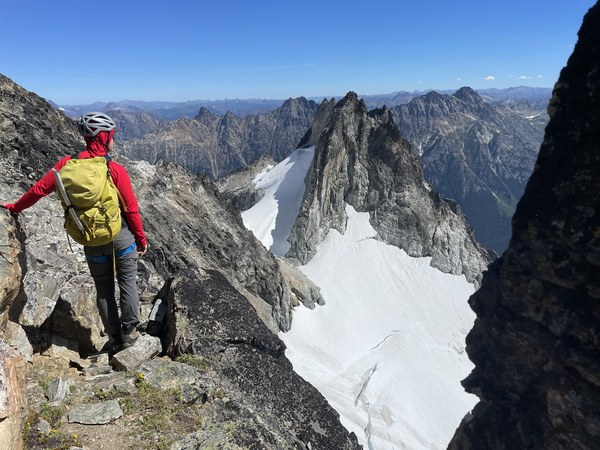 Photo: Max Mielke
The climb up to the true summit is straightforward, though steep and exposed. We reached the top around noon.
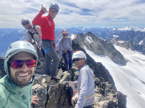 Photo: Tim Egan
Logan is in middle of the North Cascades and the views are spectacular everywhere you look.
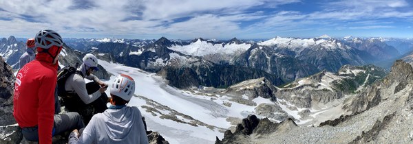 Photo: Tim Egan
After enjoying our time on the summit we reluctantly headed down knowing we still had a long trek ahead of us. We downclimbed, glaciered, traversed, switchbacked, and hiked back to our camp. We packed up, continued down the trail, forded Thunder Creek, and headed towards Skagit Queen Camp until we hit the first major blowdown. At that point we called it good and set up camp in the trees.
Day 3. We packed up and left camp around 6:00 a.m. It was nice to get past the blowdowns in the morning while we were still fresh. Although it was mostly downhill, 16 miles is still a long hike out. We got back to the cars around 3:00 p.m.
Mount Logan is highly recommended as a summit but the approach is long.
GaiaGPS stats: 48.63 mi, 10,406 ft.
 Stephen Sugiyama