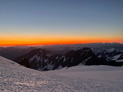
Trip Report
Basic Glacier Climb - Mount Olympus/Blue Glacier
Heat wave Olympus summit via Crystal Pass! GPS (including detour): https://caltopo.com/m/398S
- Sun, Jun 27, 2021 — Wed, Jun 30, 2021
- Basic Glacier Climb - Mount Olympus/Blue Glacier
- Mount Olympus/Blue Glacier
- Climbing
- Successful
-

- Road suitable for all vehicles
Day 1: Parking lot to Mile 13.3 Camp
The weather forecast didn’t look good. The first two days of the trip temperatures were expected to soar above 100 degrees. So we planned to cover as many miles as possible in the dark.
We met at South Renton Park and Ride at noon and by 5:30 PM we were ready to leave the Olympus parking lot. Usually there would be a huge line of cars to enter the park in the afternoon, but the heat wave scared most folks off.
The gorgeous old growth trees provided shade, but the heat still slowed us down. Luckily, there were ample opportunities to refill water from streams leading to the Hoh River. Biting flies and mosquitoes were a bit of a nuisance. There were several stream crossings that required balancing on logs or rocks.
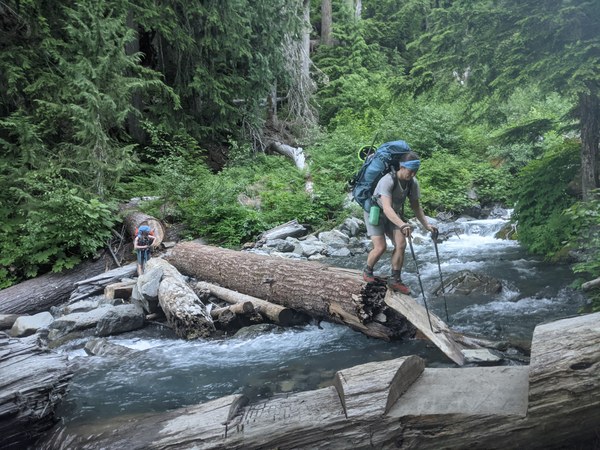
Too tired to continue to Elk Lake (our goal), we stopped at 13.3 campsite, which was lovely and quiet but had no bathroom.
Day 2: 13.3 Camp to Glacier Meadows (at mile 17.1) and scout lateral moraine
We left camp at 5:30 AM to try and beat the heat. This stretch of trail was uphill but had beautiful views, breezes, and was mostly shaded. A half mile before the Glacier Meadows campsite, there is a ladder going down a washout. The rope beside it is coreshot. Before the very bottom of the ladder, take the purple rope down to the right.
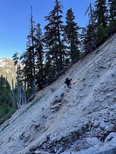
We reached camp at 9 AM and secured tent sites with partial shade.
In the afternoon we scouted out the lateral moraine, which is a knife edge ridge with a death drop off on either side. I’m very glad we scouted this out in the light! The key is to stay high on the ridge for a very long time (see GPS track) and to not drop down until you see a double carin.
Day 3: Glacier meadows to summit to 13.3 Camp
We left camp around 11 PM. The way down the moraine was very steep and not well cairned. We wore helmets. When we reached the glacier we roped up and wore crampons. We crossed the glacier and began to ascend just left of Snow Dome. The crevasses were small and easy to step over or navigate around.
The top of Snow Dome was quite steep and necessitated kicking steps. We then went up to Crystal Pass, and traversed South of Five Fingers Ridge.
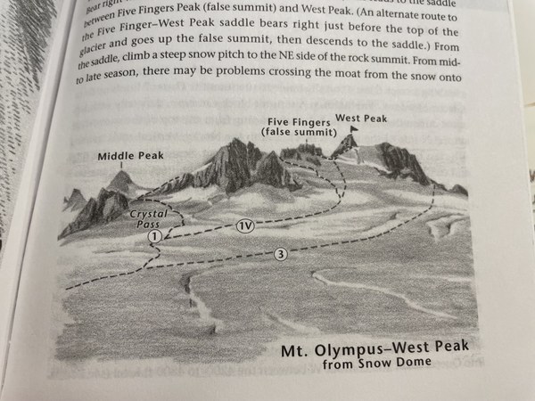
This is where we had a bit of trouble. There was not much of a boot path and we were the only team on the glacier. We missed the notch to the right of the false summit that would take us down an unexpectedly steep slope and then up to the true summit. We did a lot of walking back and forth checking out impassible paths. Below are some diagrams that would have been helpful (the first is from Jeff Smoot's Climbing Washington's Mountains, the second is from Olympic Mountains: A Climbing Guide by Olympic Mountain Rescue). 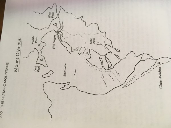
Luckily, we ran into a very kind team of two (Ian and Matt) and followed them on the correct pass (see GPS https://caltopo.com/m/398S) to the true summit. This is the picture of the pass to the right of the false summit that leads to the true summit:
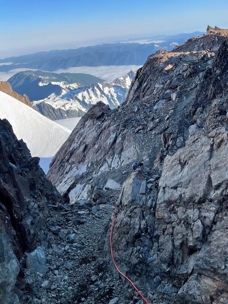
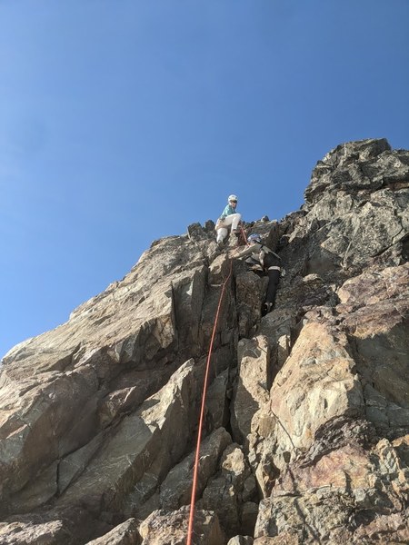
At this point, there wasn’t much of a moat and it was very easy to move from the glacier to the rock. The 5.4 north face rock climb had some loose rock. I tied into the middle mark of our 40 m glacier rope and Craig and Ali tied into both ends. The intermediate anchor is awkward and a bit precarious as it is just a boulder. I’d recommend skipping it if you have enough rope. I placed a #2, #1, and #.5 cam, but there were places for a variety of sizes. I recommend placing gear even though the climb is easy, as the rock quality is a bit sketchy. Here I am belaying Ali from the intermediate anchor, only about 10 meters up:
The summit was absolutely gorgeous and we could see the sea. Ian and Matt let us rap down the same route we came up on their 70 meter rope which got us to the bottom with much rope to spare. The rope got caught on a horn when pulled, so I re-led the route up to just above the intermediate anchor to free it. I then was lowered off the intermediate anchor on a non-locking carabiner I had to leave behind.
The snow was soft on the descent so two of us opted to take off our crampons. We refilled our water from a rocky stream on the bench of Snow Dome. We admired the gorgeous bright blue and very active glacier.
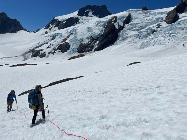
We stayed roped up all the way until the lateral moraine, as we had heard reports of falls into deep crevasses near the morraine in previous years.
We rested at Elk Lake until 6 PM then hiked out, stopping at Camp 13.3 just before dark.
Day 4: Camp 13.3 to Parking Lot
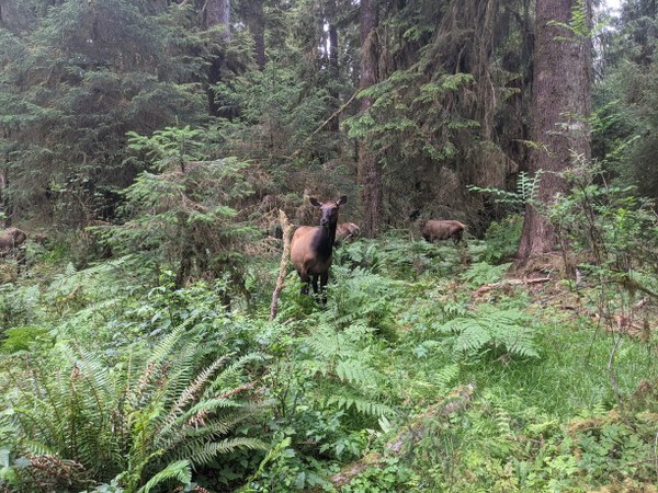
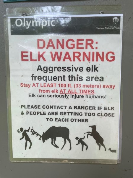
We left camp around 5:45 AM and reached the parking lot by noon. Along the way we noticed that the streams were quite a bit higher than they were on the way up. Close to the visitors center we saw a whole bunch of female elks. We admired them from a distance (there were many signs showing elk boxing humans in the parking lot).
Thank you Ali and Craig for a wonderful trip!
 Lauren Allen