Trip Report
Basic Snowshoe - Commonwealth Basin
Snowshoed Commonwealth Basin trail, crossed Commonwealth Creek, went to 3,950', had lunch & hiked out. Shared trail with many backcountry skiers.
- Sat, Mar 11, 2023
- Basic Snowshoe - Commonwealth Basin
- Commonwealth Basin
- Snowshoeing
- Successful
-

- Road suitable for all vehicles
-
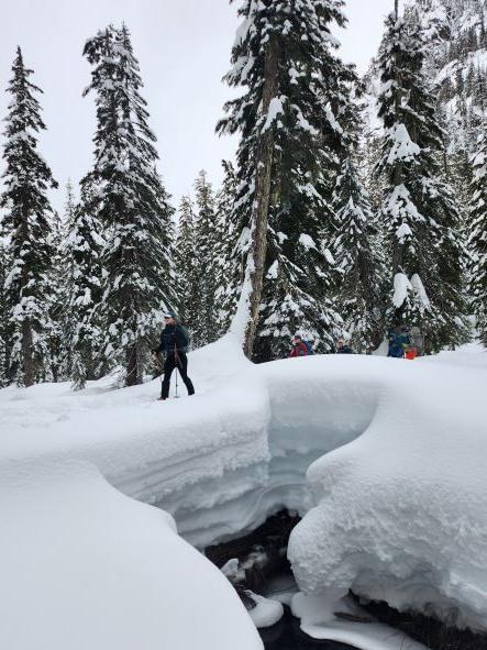
The Commonwealth Basin trail starts at about 3,000 feet, ascends in the vicinity of Commonwealth Creek, and reaches a largely flat, open forested area around 3,800-3,900 feet, surrounded by Guye Peak, Cave Ridge, Lundin Peak, Red Mountain and Kendall Ridge. The sides of the basin start climbing steeply at about 4,000 feet. A deep snow pack has developed, as is shown in cross-section of this photo of a snow bridge on fallen logs crossing Commonwealth creek. Although recent daily high temperatures were above freezing, we found snow bridges intact, and a few inches of fresh snow.
The Basin is a favorite area of back country skiers, and there are many braided ski tracks and secondary trails crossing and paralleling the main trail. It is a bit easier to stay on the main trail going up than coming down. While descending on the main trail, a bit below the boundary sign of the Alpine Lakes Wilderness area, we noticed a large Douglas fir, of about 40 inch diameter, deeply split for many feet along one side, and hollow inside. We can expect this to come down, likely across the trail, in the not too distant future.
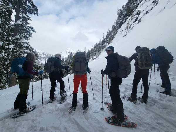
We met up at North Bend near Safeway, and proceeded to Snoqualmie Pass West Summit. On a Saturday morning during ski season with good weather, parking is crowded. We parked where we could find room and walked under I-90, meeting up again on the big snowbank on the other side, on the east side of Alpental Road, and assembled for a group photo.
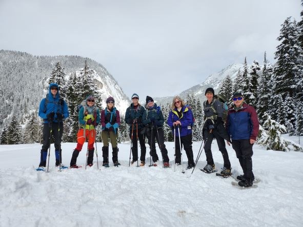
We were within sight of the unplowed entrance to the Pacific Crest trailhead parking lot, but took a well-traveled shortcut through the trees, entering the unplowed PCT parking lot next to the outhouse, up to its eaves in snow. We took the very start of the PCT trail to a signboard about avalanche danger, and took a left onto the Commonwealth Basin Trail. After about a third of a mile, the trail starts to climb.
The trail is shown on some topo maps as a dotted line, and about 0.4 mile from the PCT, the trail splits, meeting up again in about 0.2 mile. We took the fork to the left (west), closer to the stream, for photos at a couple of nice overlooks about 140 feet above the stream, with views of Guye Peak.
After rejoining the main part of the trail, we continued to climb. On the uphill-facing sides of some trees along the trail are signs saying "Caution", informing skiers that this is a multi-use (snowshoers) trail and to keep their speed under control. These signs are useful for confirming that one is on the Commonwealth Basin trail and not a side or parallel trail. Eventually, upward bound travelers on a near-level straightaway see a sign ahead that says "Alpine Lakes Wilderness", with a caution sign about 100 feet behind facing uphill. The trail levels off and in about 300 yards, is next to the creek. Continuing another hundred yards or so, there is a snow-covered log across the creek, which is an unsafe-looking crossing. Another hundred yards or so is another crossing with a big snow bridge on logs, much wider and well-used. This crossing is being used by National Forest Service Rangers bringing snowshoe tour groups into the basin.
We took a left here, crossing to the northwest side of the creek. Well-used paths continue on the climber's right (southeast) side of the creek, but on a previous trip, these were found to lead to the PCT where it traverses an obvious avalanche slope. The mapped trail is on the northwest side of the creek at this point. The Basin is flat valley bottom in much of this area, and a few well-traveled tracks led generally north. Where two of them joined, a young couple and children were playing in the snow, building a snowman. We took one track, passed a NFS Ranger-led group having lunch, thanked them for breaking trail, and found our own lunch spot a few minutes later.
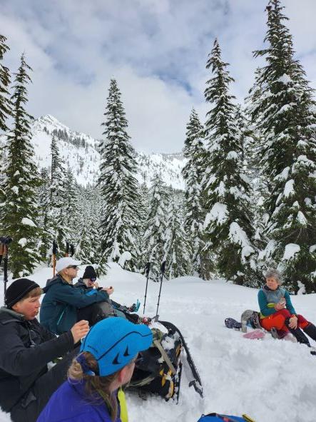
The leader's requirements for a lunch spot are: in the sun, out of the wind, big enough and level enough to accommodate the whole party, and with views of mountain peaks. These requirements are not always completely met. In this case, sun was in and out, but the other boxes were checked. We lunched with a good view of Red Mountain. Temperature was a little above freezing and wind was calm. We had three of the current year's Basic Snowshoe Course students in our group, and for all of them, this trip satisfied their post-course requirement for Mountaineers-led snowshoe trips to get their badges. Assistant Leader Angela French had baked celebratory cookies in honor of the occasion, and these were passed around and enjoyed for dessert.
After lunch, we headed south, starting on our in-bound track, then staying on high ground at a divergence. We again passed the people playing in the snow, having now built a snow fort, and crossed back over Commonwealth Creek.
With good weather and no time pressure, we decided to take a side trip from this point. For educational purposes, in order to see some avalanche terrain from a safe location, we followed a track toward the PCT. Stopping between the big trees near the edge of the woods, we looked across a slope of about 45 degrees, seeing where the ski tracks crossed it to the other side. We also had a nice view of Red Mountain. While most of us were looking that way, Jamie was looking up the slope at two skiers, crossing an area we had previously identified as avalanche terrain and took two photos. In her words, this is what she saw: "Front skier stumbles and there is a small avalanche / snow slide that happens about 2 seconds after this picture, maybe 10' wide and it goes about 10' down (like 2 person heights). Both skiers continue to use expletives and continue forward, eventually skiing out of view."
We made good time on the way out, averaging close to 1.5 mph overall while moving. Much of the appeal of this trip is the walk through areas of open mature forest, in addition to the peek-a-boo views of surrounding peaks through the trees. We had the bonus of some avvy education on this trip, and three Mountaineers are getting their Basic Snowshoe badges.
 Mike Forsyth