Trip Report
Day Hike - Lower Gray Wolf Trail
Successful Tacoma CHS hike to the Lower Gray Wolf River. All participants did well and enjoyed the hike.
- Fri, Jun 10, 2022
- Day Hike - Gray Wolf Trail
- Gray Wolf Trail
- Day Hiking
- Successful
-

- Road suitable for all vehicles
-
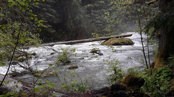
The Lower Gray Wolf trailhead is a bit hidden from the Forest Service Road, so it's important to follow the maps and guidebooks closely. We found the trail itself to be in pretty good condition for the first two miles. Recent heavy rains made the trail very muddy in places. The last two miles included several downed trees and a couple of narrow sections near the river where there had been some erosion. The last .4 miles looked steep, wet, slippery, and in poor condition, so we chose to turn around and did not go all the way to the bridge washout. (Someone had placed logs across the trail at the turn-around -- another indication that further travel was not advisable.) The river was running very high and fast.

Our group met at Sequim Bay State Park and caravanned to the trailhead. One turn, onto Forest Service Road 2880, is not marked and is easy to miss because there are a bunch of "Private Property" and "No Trespassing" signs. This is also the route to Royal Basin and Tubal Cain mine trails, so it would be nice if a sign was placed at the junction. The roads were in decent shape and passable for most cars. There is parking for about four cars at the trailhead. The trailhead is not well marked, so careful map and mileage tracking is important. The Lower Gray Wolf trail is a beautiful hike through the forest and down to the river. We saw calypso orchids, Sitka Valerian, Indian Paintbrush, a few rhododendrons, and lots of ferns and moss. The only wildlife sighting was one deer. The river was raging -- very high with all of the late spring rain. Because of the recent rain, the trail was muddy and we found trekking poles to be helpful. Several of the participants also wore gaiters. The planned route was 8.4 miles roundtrip, but we turned around at about mileage point 3.9 because the last .3 or .4 miles were up a steep, slippery, rocky slope, and the trail was not maintained. There were several nice campsites along the river and we were able to stop at a couple of them for snack and lunch breaks. Everyone did well navigating the muddy sections and we were able to maintain a good pace. The weather cooperated, and we had no rain! It was a fun, positive group and a great day on the trail.
 Marilyn Thompson