Trip Report
Intermediate Alpine Climb - Mount Jefferson/Jefferson Park Glacier
Successful summit up the Jefferson Park Glacier, across the knife-edge ridge, and up the summit pinnacle.
- Sat, May 26, 2018 — Mon, May 28, 2018
- Intermediate Alpine Climb - Mount Jefferson/Jefferson Park Glacier
- Mount Jefferson/Jefferson Park Glacier
- Climbing
- Successful
-

- Road suitable for all vehicles
-
Start Location: Woodpecker Ridge Trailhead
End Location: Woodpecker Ridge Trailhead
Elevation Gain: 6000ftApproach conditions:
Made the approach from Woodpecker Ridge trailhead. The Whitewater trailhead remains closed due to the summer 2017 fire damage. Woodpecker Ridge trail was a good alternative approach trail. There was substantial fire damage in the area – lots of downed burnt trees and significant trail tread damage. Same for the PCT section of the approach – lots of burn debris. Snow in Jefferson Park area above about 5600ft. We elected to camp by a stream just off the PCT rather than proceed to one of the lakes or one of the bivy sites at the edge of the JP Glacier. We were able to find some bare ground for two of our three tents. 3h10m from trailhead. There was one other party of backpackers camped near us, plus another pair that came by but didn’t plan to camp on snow.Route conditions:
Jefferson Park Glacier. We attained the bivy site by ascending the more eastern of two gullies leading to the toe of the glacier. We kept to climber’s left up the edge of the glacier. Glacier is in great shape. The double bergshrund indicated a route close beneath the Molar’s Tooth. There was a good snow bridge that led to the top of the glacier, which we climbed straight up. Bridge will probably be gone in 2-3 weeks. We used two rope teams of two on the glacier. It took about 5 hours from camp to the base of the knife-edge ridge.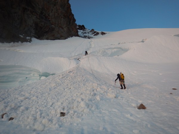
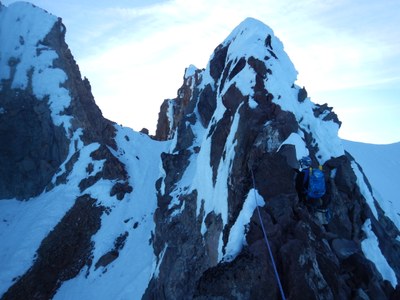
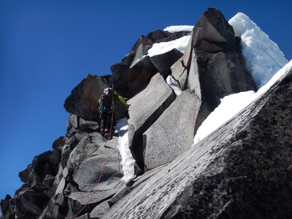
Knife-edge ridge. The knife-edge ridge was partially covered with snow and rime ice and partially exposed rock. We were able to sling several good horns and use rock pro to protect. We did climb one gendarme that was completely covered in snow and protected with pickets. For the knife-edge ridge the lead placed protection and the second rope team clipped in/pulled the protection. For the ridgeline between the knife-edge and the summit pinnacle we passed below the first gendarme (unroped) and then climbed over the second gendarme.
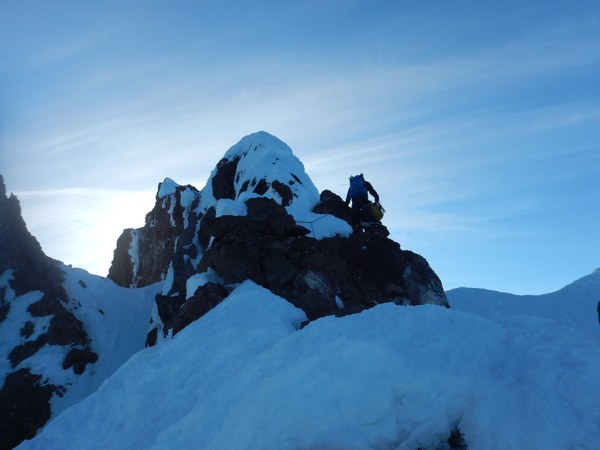
Summit Pinnacle. We set running belays over to and then up the lower right-to left ramp, using a mix of pickets and ice screws. We climbed rime ice and snow up to the ridgeline, rather than following the upper ramp/gully left-to-right. On the ridgeline we climbed good rock all of the way to the summit horn, protecting with slings and rock pro. Just shy of 11 hours to the summit from camp.
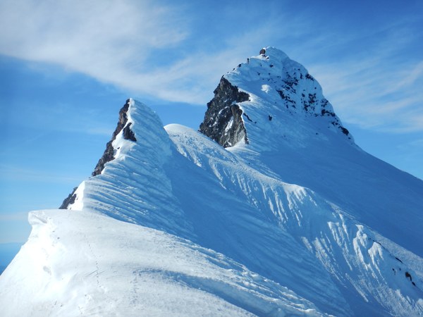
Rappel. We rappelled directly from the summit horn in the direction of the normal approach gully, augmenting the existing webbing and cordelette anchor. The rappel route was mostly an ice-filled gully, with lots of ice debris falling along the rappel route. At the bottom of the rappel was steep snow that required downclimbing around a rock outcropping.
Traverse to Red Saddle. From the snow ridgeline we made a slightly descending traverse over to Red Saddle. Initial slope angle below the line of traverse was near vertical, with the run-out angle improving as we approached Red Saddle (no-fall zone). We protected this traverse using a running belay with 8 pickets and a few ice screws. We used one rope for this traverse. There was frequent ice fall/debris from above during the course of the traverse but we were to avoid being hit. 3h15m from summit to Red Saddle.
Descent. We descended via the Whitewater Glacier. Immediately below Red Saddle we descended down and skier’s right along the least steep slopes. Cliffs and icy slopes forced us further south. We ended up descending the Waldo Glacier to get below rock cliffs and then moved back north. We climbed back up to the Whitewater Glacier and followed the glacier down, avoiding several crevasse fields. Crossed over to the Jefferson Park Glacier at about 8400ft, immediately above the bivy sites. We used one rope for the descent on Whitewater Glacier.
Time: 20h45m camp to camp.
General Activity Notes:
One other party camping at Jefferson Park on 5/26, although another couple walked through but elected to camp lower out of the snow. Only party on the mountain 5/27, except a skier/snowboarder pair on the upper Milk Creek Glacier. Lots of day hikers near the trailhead on 5/28.
Permits required?
NW Forest Pass at trailhead.
Driving / parking notes:
Ample parking at Woodpecker Ridge trailhead. Mostly just a wide area where the road ends. Remnants of fire damage from 2017.
Equipment notes:
Carried and used ropes (2-8MMx60m), ice axe, crampons. 8 pickets, 4 ice screws, second ice tool, rock pro. We elected to bring 2 60m ropes, primarily for the summit rappel – this was a good choice.
Required Skills:
Snow & ice climbing skills. Rock climbing in crampons, rock pro placement. Route-finding, hazard avoidance.
Weather Notes:
Day 1: mostly high overcast with some sun breaks.
Day 2: mostly sunny; very windy on the ridgeline, summit, and Whitewater Glacier, but warm in protected areas.
Day 3: mostly sunny and warm.
https://www.gaiagps.com/datasummary/track/12cf958b5db7b7e454c6f57c97d1c43c4986308c/?layer=CalTopo
 Curtis Stock