Trip Report
Mount Garibaldi/Brohm Ridge
Successful late season climb of Mount Garibaldi. High clearance 4x4 needed to get to the trailhead, large boulders may obstruct the road
- Sat, Jun 15, 2019
- Mount Garibaldi/Brohm Ridge
- Climbing
- Successful
-

- Road recommended for high clearance only
-
The road to the trailhead starts out friendly; just a typical forest road. The last 3 miles require a high clearance 4x4 as the logging companies no longer maintain those roads. My full size pickup was able to make it; so was a crossover, however the crossover had bottomed out a few times on the way down.
Some basic information on the climb:
- Trailhead(small parking area) is located at 49°49'51.2"N 123°05'17.8"W
- 17-18 miles
- Season is early according to locals April-May; there is a bergschrund on the headwall that opens as the season progresses, it is possible to skirt it on the east side.
- There is no alternate route on the right side of the shrund, it cliffs out
- Beautiful campsites along the ridgeline before the glacier
- sparse water sources; prepare to melt snow
Our group did this climb as a car to car utilizing a perfect weather window. We left Seattle around 5pm and arrived at the trailhead at roughly 11PM and car camped that night. The next morning we hit the trail at roughly 5am and began our ascent.
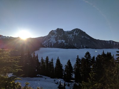
As we gained elevation we started to poke out of the marine layer and could start seeing the mountain itself, the first couple miles are all along a road that was developed to the chalet. Past the chalet the road continues but in our case it was partially covered in snow. We also discovered that some parts of the road had extremely slick mud.
The route up you will be able to follow a trail along the ridgeline, and stick to the south side of the ridge as you make you approach the mountain. There will be a light scramble across a gendarme before you hit the lunar dust like sand that leads to the camps at the top of the ridge (at the base of the glacier)
From the camp area continue due east across the glacier and avoid the rocky area on the right, traverse the steep snow slope and slowly ascend to a flat-ish area on the glacier. From here you will be able to see the headwall. At this point you generally will have two options; take the mellow snow to the west(climbers right) but risk rock fall or take the steep snow slope to the east of the shrund. We choose the steep slope on the east side (climbers left) of the shrund and used 4 pickets to protect the route up. Leave the pickets in for your descent.
From here continue along a ridge while being wary of cornices as you approach the summit block; depending on the year it seems that this could either be loose rock or snow. We had snow but a light layer that wore away after each climber had passed. This required some face in down climbing for a few students. Once passed this part you are at the summit.
This trip took 14 hours from car to car with several long breaks and a very strong group.
Skills that a group should be proficient in:
- Self arrest
- High dagger and low dagger with ice axe
- clipping through for a running belay
- seated belay/hip belay/belay from above
- general rope travel
- strong conditioning
 Michael Podeszwik