Trip Report
Mount Olympus/Blue Glacier
First team on the summit on a busy weekend in the Olympics!
- Sun, Jul 21, 2024
- Mount Olympus/Blue Glacier
- Climbing
- Successful
-

- Road suitable for all vehicles
-
- GPX with waypoints: https://caltopo.com/m/41BV0J4
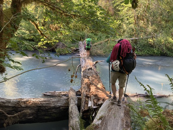
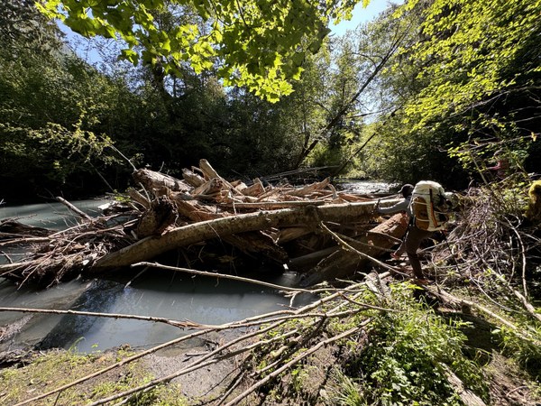
- Two log crossings (47.87716, -123.78743 and 47.87759, -123.78185) before Olympus Ranger Station. Feet stayed dry the entire time.
- Abundant mosquitos and flies at Glacier Meadows Camp. Ample running water. Toilet is in dire condition. Poop elsewhere if possible (Olympus Guard Station toilet is in good shape)
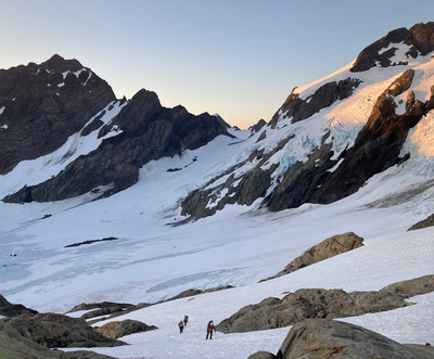
- Obvious avoidable crevasses on Blue Glacier, running water available 5900'-6200' along route
- Prominent boot back leading off of Blue Glacier onto Snow Dome and to summit via Crystal Pass
- Some rock sections easily scrambled with crampons on. We did not take off crampons until climbing the summit 5.4. Rock pitch took maybe 2 cams (0.4, #2) and 2 medium nuts. It could also be easily soloed.
- When climbing up, stay climbers right and set up your handline or belay to the right of the rap station, so parties descending can rap down climbers left and avoid ropes getting crossed. The rap station is positioned a little climbers left.
- We brought screws and pickets but used neither.
3 day private trip with some good friends.
Day 1
Hiked out from Hoh River Trailhead at 7am (plenty of parking, even though "Parking lot full" signs were up). Long flat hike in. Two big log crossings over the river just before Olympus Guard Station. See caltopo track for the waypoints. No wet feet. Ladder is in good shape, but the tree it is anchored into looks dead. No issues descending the ladder.
Reached Glacier Meadows camp just before 3pm.
DaY 2
Left Glacier Meadows camp just after 2am and reached the top of the moraine overlook at around 2:40am. We descended the scree and roped up/cramponed up once reaching the bare blue ice. It took quite some time to pick our way across this, stepping over many obvious crevasses and caverns where water was running through. There are a few patches of snow left, and we took care to avoid these as they were soft and punchy as opposed to the secure and solid ice.

Eventually the ice becomes all snow and a bootpack appears. We followed this boot pack around the rock formation to the right, where there was a waterfall. We skipped this water source and decided to filter some water at around 6000'. Around 6200' is the last easily accessible water.
The path switches between rock and snow a few times and we opted to keep crampons on. This proved to be just fine as the rock steps were not difficult. We short roped these sections just to manage the rope slack.
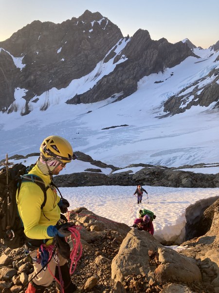
Above this we zig zagged up the Snow Dome. I saw in previous trip reports there were crevasses this time of year, but it was nicely covered for us. There is some bare ice visible but it was easy to avoid. The snow was firm enough for kick steps but a group ahead of us kindly broke trail and we quickly followed up behind them.
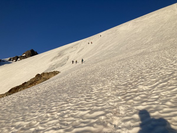
Once up and over Snow Dome, two boot tracks appear. The Crystal Pass route goes climber's left, and the Fourth of July/direct route goes climber's right.
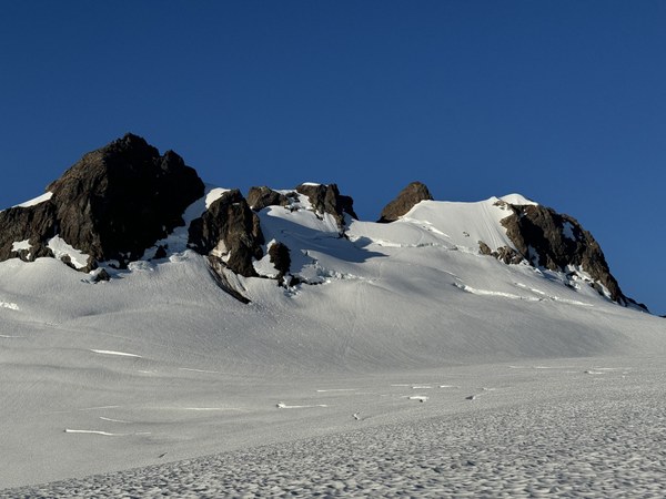
We had been hearing from other groups that Crystal Pass was the way since the direct route no longer was feasible with a large crevasse in the way.
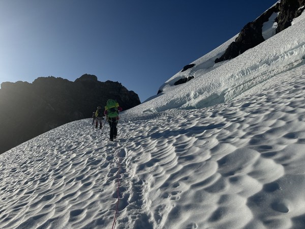
Up and over this notch, then follow the boot pack up and over another rockier notch. We kept crampons on here as well on this small rock scramble.
Then go up one of the paths to the base of the summit climb. Any of these paths work, but we chose the one on the right that goes diagonally then curves left again toward the summit.
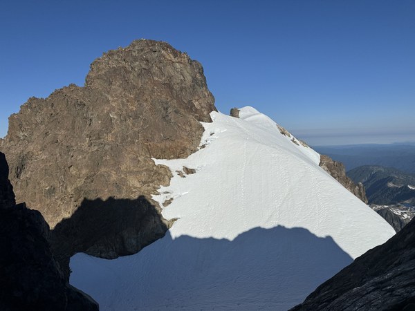
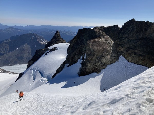
I led the 5.4 rock pitch and set up a handline for the followers. A short scramble later and we were at the top We summited at 8:45am, the first party that morning!
There's a boulder with several pieces of tat in good condition along with a rap ring and quick link. A single 60m double strand (30m length) rappel will get you back to the base. There is another intermediate station for shorter rope rappels.
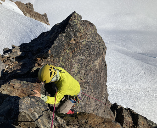
There were many people who showed up soon after us, so we quickly rapped down and went on our way.
TIP: Have climbers go up climbers right (like where the person in yellow is pictured above) as well have their anchor on climbers right. This way, parties on their way down can rappel from the rap rings on climber's left (not pictured, to the right of the photo). The intermediate rap station is also on climber's left, lower down. Otherwise your ropes will get crossed and people will have to wait on each other when it is avoidable.
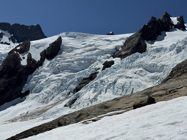
The descent was largely going back the way we came. Quick break at 6000' for water, picked our way across the blue glacier again, ascended up the chossy dirt trail back up to the moraine overlook, and then arrived at camp at 2:25pm for a 12.5 hour summit day. We cleaned up, had an early dinner, and turned in for the night.
Day 3
We packed up and left camp around 6am. Mostly uneventful hike out besides spotting a big toad and fat slug. Back at cars just before 1pm.
Pro-tip, bring post-climb beverages, wet wipes, and a change of clothes.
 Isley Gao