Trip Report
Mount Shuksan/Sulphide Glacier
Shuksan from High Camp with photos and coordinates for the solar toilets!
- Sat, Aug 4, 2018 — Sun, Aug 5, 2018
- Mount Shuksan/Sulphide Glacier
- Climbing
- Successful
-

- Road rough but passable
-
Road - a couple old washouts have been smoothed over, but still kinda deep for lower-clearance vehicles. Our group had a Prius that scraped the rear bumper a couple times on bigger dips in the dirt road.
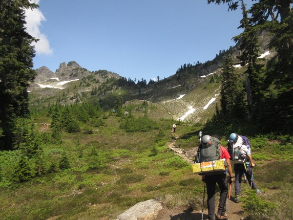
Trail - Great shape all the way to the notch in Shannon Ridge. After the notch, we had a few patches of snow to cross, and then solid snow at about 6,000'. We camped at high camp - 6,400'. But the ranger said that both toilets had been shoveled out -- one at the 6,100' low camp, and an amazing privy at the 6,400 high camp ridgeline. Water was available at 6,000', so we filled bottles before heading to high camp.
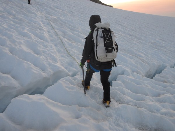
Climb -- From high camp, the route went along the left side of the glacier. There were small crevasses to the right of our ascent line, so we roped up at camp in the morning. That took us up the steepest part of the snow, to about 7,000'. Then we traversed rightward, staying pretty high, and passed much closer to "Point 7848" than many parties do because of small crevasses on any of the lower traverse lines. For example, we were up at about 7,600' as we passed by point 7848, and then dropped a little before heading toward the summit block. Below the summit block, the boot track in the snow headed to the right, and then hooked left again toward the rock gully, because of crevasses and moats toward the left. Even people coming up Fischer Chimneys had to come out toward the northeast, and then hook back northwestward to get on the rock. They weren't wide crevasses, but we did step across a couple like this one.
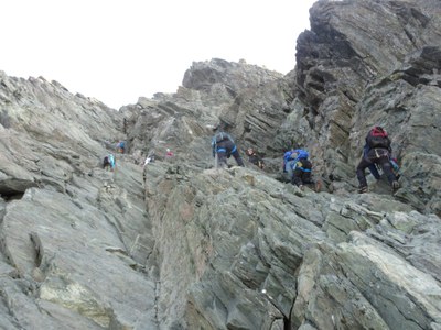
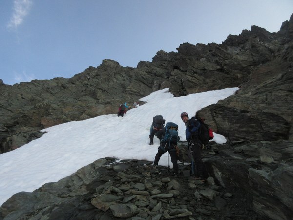
We didn't need crampons in the gully. We crossed one patch of snow right away, and then had rock the rest of the way up.
PERMITTING -- I applied for a pre-reserved permit during the North Cascades lottery in March. Actually, our first choice was Boston Basin, second choice was Ruth-Icy, and third choice was Shannon Ridge/Shuksan. We got our third choice.
I originally intended a group of 9 (3 rope teams), but expanded to 11 as we got closer to the date, pulling in a person who needed glacier credit, and pulling in a sister of another team member. I recommend, however, doing this with a smaller group, like only two rope teams of 7 or 8 because of bottlenecking in the summit gully.
The Sedro Woolley Forest Info Center opened at 8 AM, so we left Seattle at 7, hit Sedro Woolley at 8, reached the trailhead about 9:45, and was hiking by 10:15.
Car to Camp - about 5 hours (Arrived about 3 PM to high camp, 6,400').
High Camp was on snow. It looked like folks at low camp had found some dry sites on rock. But we wanted high camp. We collected water in our extra bladders at 6,000', before ascending the final 400' to high camp.
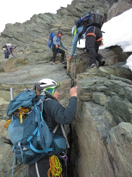
Climb Day - We awoke about 2 AM and were climbing at 3:20 AM. A guided group from Mountain Madness had left low camp earlier and remained in front of us until the summit block. A few other sets of climbers also left ahead of us, or behind us.
I counted about 30 people all day, including our group of 11.
We were roped for glacier travel between camp and summit block in both directions, and carried all three ropes up the gully to use for rappelling later.
The gully climbing went well to the summit, but seriously bottlenecked on the way down. Going up, we all scrambled carefully without needing any ropes or handlines, just a lot of coaching on hand and foot placements. I could understand if people want ropes or handlines in certain parts of this gully.
The last person summitted at 8:15, for about 5 hours camp to summit.
We rested on the summit about 30 minutes as various other parties came or went. The initial rappel station became our first bottleneck, and we began the rappels at 9:30, behind a couple other parties.
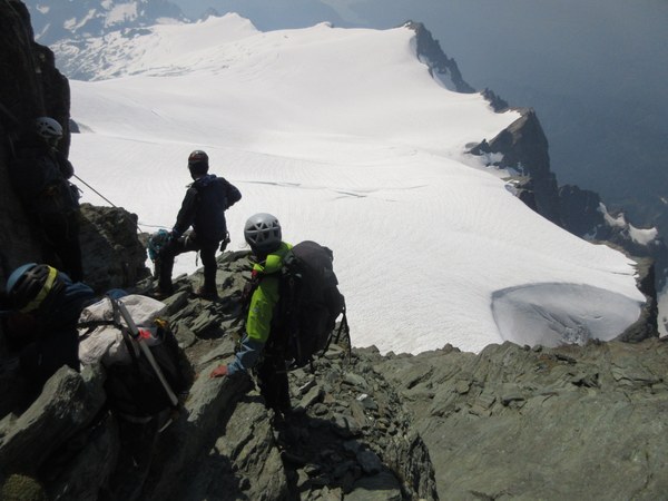
We decided to rappel because folks were tired by now, and downclimbing "class 4" sections isn't as easy as ascending the same sections. We took turns with three glacier ropes, alternating 30 and 15 meter rappels -- a very slow process with this many people.
People stacked up every two raps as we waited for a rope to come down for the next rap. Leaders did a lot of downclimbing to keep things moving and to set up here and there.
The last major rappel went off the SE ridge, almost to the snow on skiers left. We needed one final handline to get carefully onto the snow. For those who are counting, that came to five raps and a handline. I felt good about keeping everyone safe and getting down comfortably, even though it took extra time.
- 30m rappel off the summit.
- 15m rappel, and a little scrambling to the next spot.
- 30m rappel to a good ledge.
- 15m rappel and some more scrambling to a major station on the NE Ridge
- 30m rappel, almost to the snow.
- 15m handline and some scrambling to the snow.
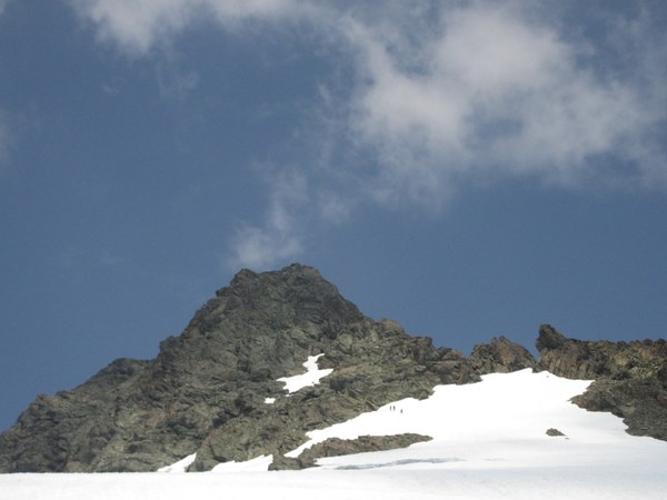
We reached the snow at 12:30. Count that... 3 hours rappelling the gully. We cruised back to camp by 2:30, packed up, and were hiking out at 3:15.
- Base of Gully to Camp - 2 hrs (12:30 to 2:30)
- Camp to Car -- 3.25 hrs (3:15 to 6:30)
WEATHER
Some comments about weather are in order. As a climb leader, weather is probably one of the hardest things to judge when it contains chances of clouds, rain, or wind. Mountains have their own effect on the forecast. The weather called for about 40% chance of rain on Saturday and Sunday due to instability in the upper atmosphere. Freezing level would be at 9,000' in August, believe it or not. It had rained on Friday, so the lower forest was humid, but not too hot.
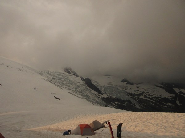
At high camp on Saturday afternoon, we could see small cumulus clouds forming around Mt Baker, but no big concern. The bigger concern was a very large thunder cloud forming to the east. That cloud grew until it covered us as we were sleeping between 8-11 PM. It was huge and dark, sent some light rain our way, and shot some lightning far to the east (8 miles or more away). It cooled things down to the low 40's. By 11 PM, that cloud had disappeared, so we awoke to bright, clear and cool skies.
The Sunday forecast also called for about 30% chance of shower from thunder clouds after 11 AM. This was why I planned to climb very early in the morning. Thankfully, all we saw on Sunday was serious haze from forest fires, creating a very unique views of the North Cascades!
View to the east, deep into North Cascades

View to the West/Southwest - Shannon Ridge, Baker Lake and Baker

Here are GPS Coordinates of the two solar privies -- at low camp and high camp. It was nice to have privies with such excellent views.
- Low Camp Privy -- NAD83, Zone 10U 602639E, 5406355N
- High Camp Privy -- NAD83, Zone 10U, 602139E, 5406295N
 Brian Starlin