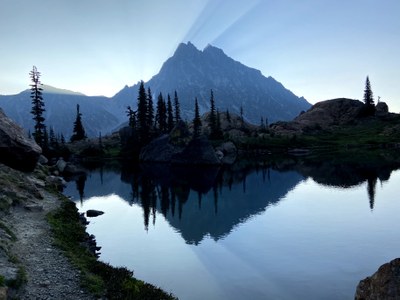
Trip Report
Mount Stuart/West Ridge
A really long, beautiful scramble on a really big mountain.
- Fri, Jul 23, 2021 — Sun, Jul 25, 2021
- Mount Stuart/West Ridge
- Climbing
- Successful
-

- Road suitable for all vehicles
-
Trail to Ingalls Lake and down Long's pass are very smooth. Lower Cascadian Couloir is quite terrible. The only snow on the route is 100ft below the summit and the top of Cascadian Couloir
Fri:
0845: Leave TH
2315 Get to camp around Lake Ingalls
Sat:
0630: Wake up
0745: Base of SW Gully
0930: Top of SW Gully
1115: Long John Tower notch
1230: Pass West Horn
1330: West Ridge Notch
1730: Summit
1900: Top of Cascadian Couloir
2200: Bottom of Cascadian Couloir
Sun:
0000: Top of Long's Pass
0115: Back at TH
I had never climbed Mt Stuart before, and since I can't do the North Ridge yet, I figured I might has well try a easier technical route. Going through the beta it seemed routefinding (particularly between LJT and the West Ridge Notch) would be the crux of our trip. To keep ourselves light we packed trail runners, rock shoes in case, a 30m rope, and a sleeping bag/pad for bivying.
I found that doing ~2 hours of the approach the evening before makes the next day feel much more manageable, and sleeping midway in is much more comfortable sleep that in the car. Thus we left Friday afternoon at 330 pm to get to the trailhead at 6pm. Unfortunately there was a fire on I-90, which delayed us by quite a bit, so we didn't get to camp until around 11pm.
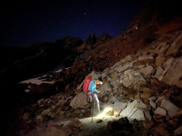
Wandering around in the dark
I forgot how bad the bugs could be until we woke up to find clouds of them swarming around us. It wasn't as bad as at Prusik, but still unpleasant.
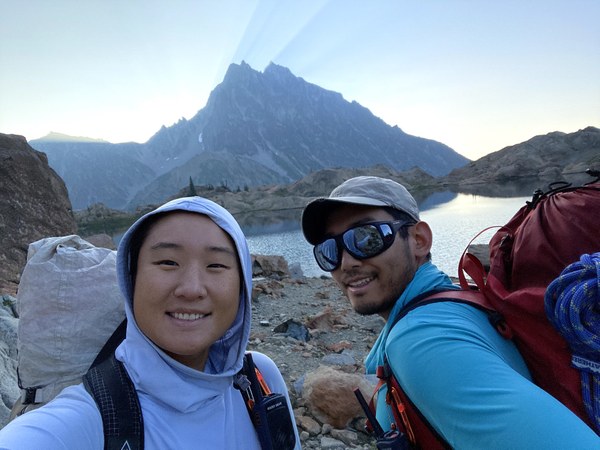
Off to a new day
We saw one other team of 2 pass us on their way to the West Ridge as we filled up water (3L each total). We slowly trudged our way to Stuart Pass, where we saw a pair of empty tents.
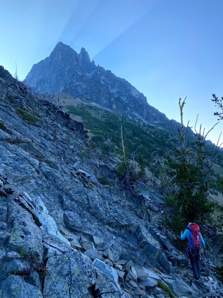
We passed one gully and started up the second one. The scrambling was quite pleasant on extremely good rock. Thinking back on it, this was the best scrambling of the climb. We went on for quite a while until we got to the top of the gully. The beta said to go up a chimney on the right, so we did that while the team ahead of us all the way to the top to the gully and over on the right. The chimney itself wasn't difficult, but my trail runners gave way and I ended up cutting my hand somewhat badly.
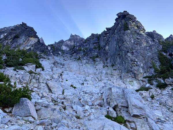
Looking up the Southwest gully
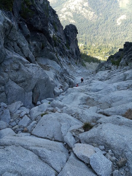
Looking down the gully
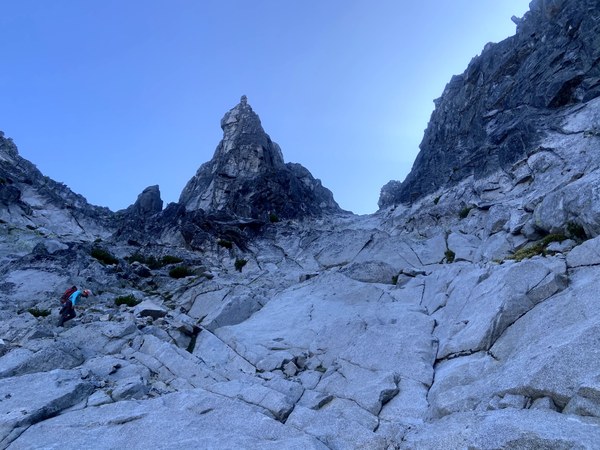
Top of the gully. Go up and right
After using all my bandages we went up and over, where we faced down Long John Tower.
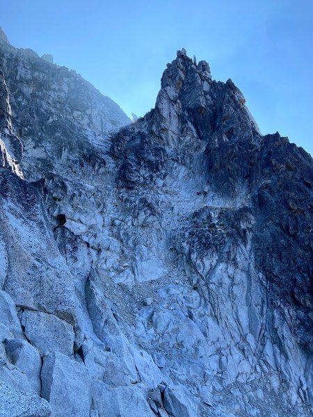
Long John Tower. You can see the other team approaching the right variation
LJT looks very imposing, and the left side looked like difficult slabs. We decided to put rock shoes on and rope up and simul to get to the top. After some deliberating we took the short low 5th dihedral just right of the slabs (which are supposed to be 4th, but looked quite spicy). As we were climbing we met our first free-soloist (Aaron?), a man who had climbed Mt Stuart probably a million times (He said he climb the North Ridge every year. These are life goals). He confirmed that the way across the West Horn was towards the top. I tried listening to his summit block beta, but got too confused at that point.
When we got to the top of the LJT notch we spotted Aaron heading up the ridge, and the other team of two some ways down on the West Ridge, belaying their way up. Here we spotted another free soloist (Ralph). It seems like free soloing is the way to go if you know your way.
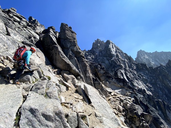
Looking toward the summit. Go straight up the ridge from where I am.
We gained the ridge crest as Aaron crossed the ledge 50 ft below the West Horn. Ralph crossed shortly after. We stayed high on the ridge crest to get to the ledge and did one short pitch to cross the exposed 3rd class.
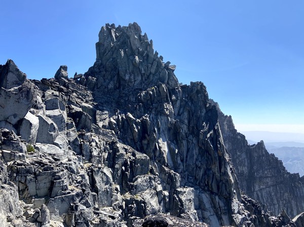
Looking at the West Horn. The ledge to cross is 50ft below the top of the Horn
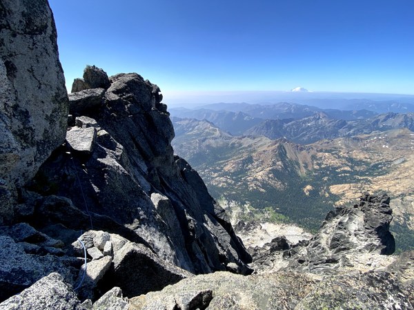
Close of view of the exposed step
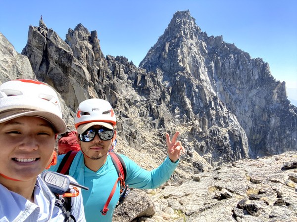
Looking at the rest of the route
From there we went down a bit and traversed to below the anvil (God's Cairn?). Then it was a short scramble up to the West Notch.
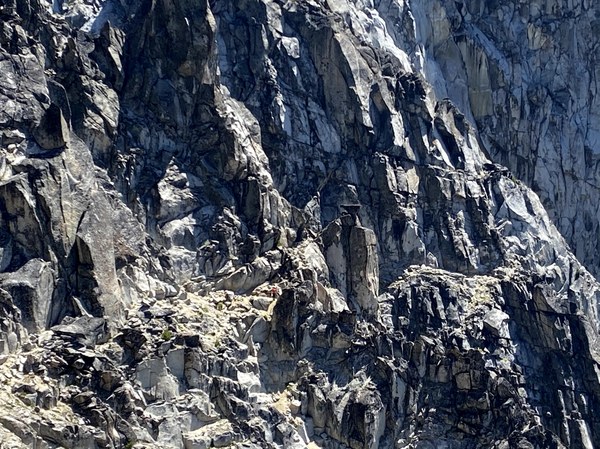
Close up view of the anvil. The other team is approaching the base
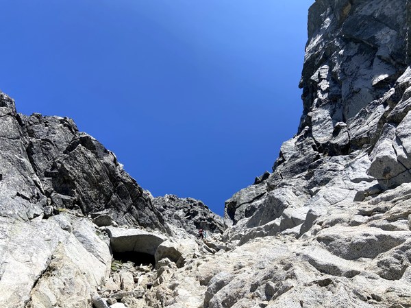
Looking up to the West Ridge Notch
We scrambled another 20ft up to the bivy ledge. Here the beta got confusing, and everyone else was ahead of us so there was no one to follow.
P1: Julia lead 100ft up some scrambly blocks to where you begin to traverse north.
P2: Julia went around the north side for 40 ft, then upwards towards a notch. The 30m rope was barely enough to reach the anchor.
P3: Julia downclimbed over the notch to a sandy bench, then up to a roof, then left.
P4: I led a slab to some easier blocks.
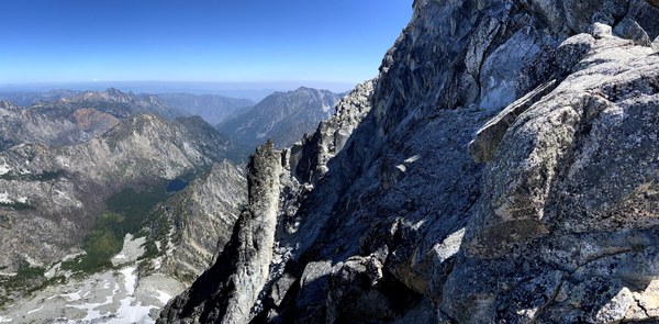
Looking at the traverse to the north side
Here we could see the downclimb to get to the ledge leading to the twin cracks. We made a rappel (instead of downclimb) and got to the ledge.
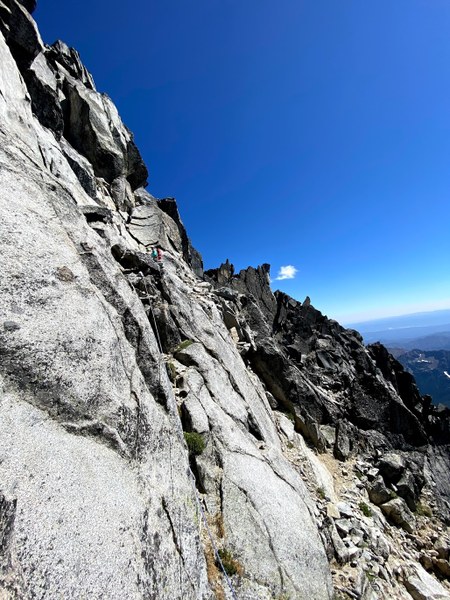
Going up last ledge. The correct path is more right of where I am
Here however, we got impatient and saw a fixed piton and didn't check the beta again. The actual twin cracks were more to climber's right. We however went right up this other set of twin cracks, which were overhanging and did not feel like 5.6 at all (5.9?). I had to aid this section and Julia prusiked up. This ate up more than 2 hours. In hindsight the fixed pieces were obviously bail pieces. One of my nuts got wedged in too hard and now join the rest of them.
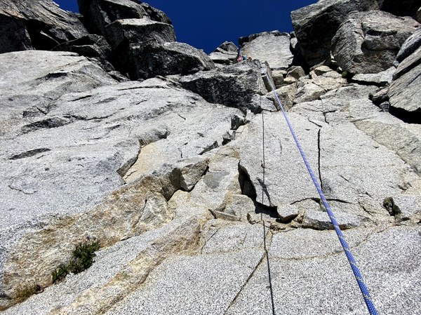
The cracks we went up are up and right of where we are. This is the harder way.
P5: C0 'twin cracks'
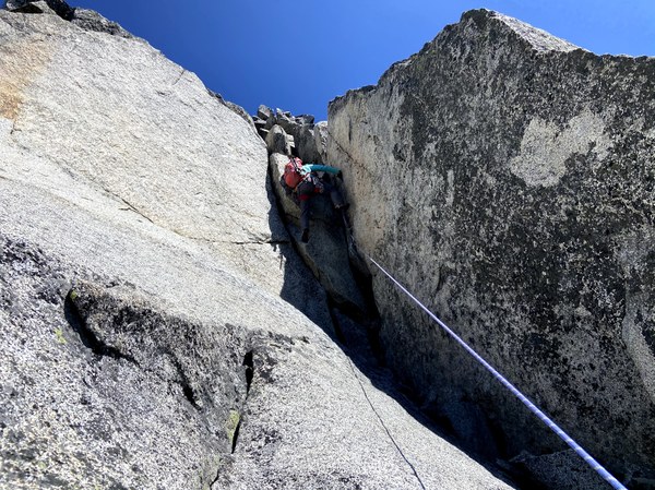
Close up view. Not exactly 5.6
From here it was another pitch to 30 ft below the summit block, and a short scramble to the summit.
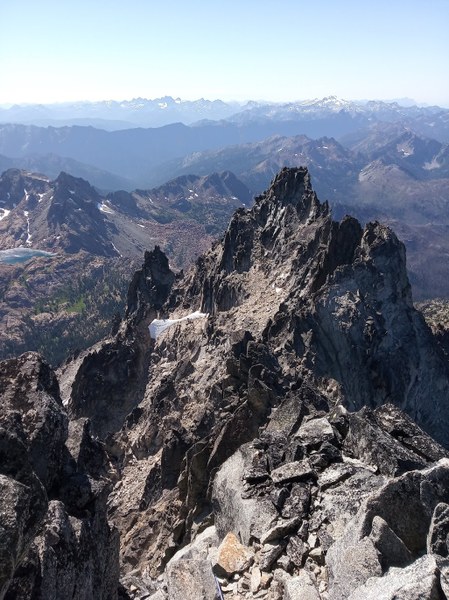
Looking back at the West Ridge
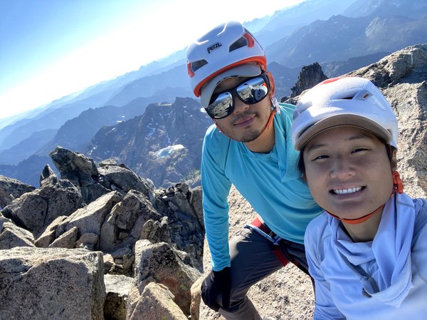
Summit, finally
We topped out as a team of 4 were descending. They had just finished the North Ridge and were going to get snow 100ft down, then go down the West Ridge to their camp at Stuart Pass. So that's whose tents it was..
With every other team long gone, it was finally our turn to descend. The scrambling down to the false summit was quite tedious. Climbing the West Ridge was more like doing a west-east traverse of the mountain. Some of the scrambling needed to get down was quite stiff. On the way there were plenty of cairns and bivy ledges to guide us.
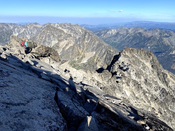
Trying to beat the sunset going down
At the false summit there is one last bivy ledge before the Cascadian Couloir, and a large snowfield which will be there for awhile. We contemplated bivying here, but we really wanted to go down the mountain.
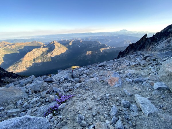
View from the top of Cascadian Couloir
The top quarter was slowly downclimbing loose scree, and the second quarter loose sand, which was alright. Here we found out we were descending the most eastward couloir, which is not what our downloaded tracks went down. On this track the 3rd quarter was going down a stream bed/slabs (which was really tedious), and the last quarter was an overgrown trail.
We filled on water and drank our fill before beginning the brutal ascent back to Long's Pass, and double-timed it back to the car at 1am.
All in all, a long day, but worthwhile trip.
Gear: Cams 0.2-2, nuts, 30m rope, lots of slings. Most people seemed to do this is trail runners or approach shoes.
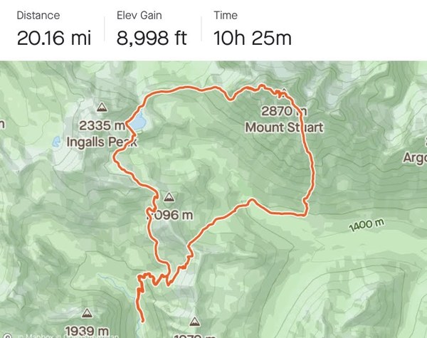
Photo credits: Julia Syi
 Jianing Wang