Trip Report
Mount Triumph/Northeast Ridge
Fantastic moderate multipitch climb along a knife-edge ridge with outstanding views of the North Cascades and Picket Range.
- Thu, Aug 4, 2022 — Sun, Aug 7, 2022
- Mount Triumph/Northeast Ridge
- Climbing
- Successful
-

- Road suitable for all vehicles
-
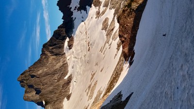
This was a terrific climb but we found the beta and route descriptions confusing and somewhat misleading. Some descriptions report very little snow on the approach from the col and advised against boots and crampons. We crossed steep snow and glacier ice most of the way from the col to the base of the climb (8-4-2022) and were really glad we brought boots, crampons, and ice axe, as the crossing would have been slow and difficult without them. We changed into climbing shoes and started up the slabs just right (north) of the ridge, but the ramp/dihedral to the left (south) of the ridge seemed better and easier to protect. We simulclimbed most of the lower half the route (low 5th class) and belayed the towers and knife-edge ridge due to the exposure. We also belayed the fun off-width crack pitch (5.7) which ends at the great notch. After a short break we headed left on an easy ledge from the great notch and then diagonally left up easy ledges (class 3-4) and heather slopes toward the south ridge. After gaining the ridge we followed it to the summit.
Rapelling down was a challenge. We couldn't find a way to rappel down the way we came up, and ended up rapping from the sketch tat you can see about 100 ft. down and left from the summit. The beta said we needed double ropes but there are two more rap stations to get back to the great notch with a 70m rope. The rapping/downclimbing was fairly straightforward from there until the top of pitch 3, where the rap station is hidden in the bushes off to descender's right. Fortunately there was room for two people to bivy there and we found it in the morning. It might be wise to take photos or set waypoints for rap stations on the way up, to make it easier to find them on the way down.
The south ridge is a completely different climb and appears to be a much shorter, easier, and more direct route back to the col. However you'll have to cross the snowfield and/or glacier to get back to the base of the northeast ridge if you left any gear there.
Approximate timing for us: car to camp 5 hrs., camp to summit 6 hrs., summit to camp 10 hrs., camp to car 5 hrs. Three days total.
Walk-up permits were available on the way in. The road was steep but manageable. We had no trouble parking and there is an outhouse there. Where we camped at the col there were 4 bivy spots, none of them large enough for a tent. We had running water from a melting snowpatch. You can scramble up Thornton Peak from the col in a couple hours and get a great view of the climb.
 David Carrier