Trip Report
Sea Kayak - San Juan Islands from Anacortes
A post trip huddle resulted in no complaints, plenty of smiles and we were all gleefully satisfied with our wonderful weather. A comment was made about the contrasts on Fidalgo Island. I have always felt that way on land but it strikes me how much more evident it is on the water!
- Sat, May 11, 2024 — Sun, May 12, 2024
- Sea Kayak - San Juan Islands from Anacortes
- San Juan Islands from Anacortes
- Sea Kayaking
- Successful
-

- Road suitable for all vehicles
-
CONDITIONS: 5-7 KNOT WESTERLY BREEZE; WW 0-1’ SUNNY, TEMPS 50S-70S, VISIABILITY EXCELLENT
SIGHTED: SEAL, PORPOISE, BLACK OYSTERCATCHER, GREAT BLUE HERON, EAGLE, COMORORANT, SCOTER
DEEP ZOOM: SAT 05/11/24 - TIDES: TURNER BAY TIDES: 9.3 @ 0645 / -2.0 @ 1414 / 10.9 @ 2253
CURRENTS: GUEMAS CHANNEL EAST: S @ 0601 / -2.7 @ 1037 / S @ 1500 / GUEMAS CHANNEL WEST: S @ 0518 / -3.8 @ 1118 / S @ 1458 / GREEN POINT: -3.1 @ 1007 / S @ 1435 / DECEPTION PASS: -7.1 @ 0909/ S @ 1305 / +5.6 @ 1647 / YOKEKO PT: -2.7 @ 1404 / SKAGIT BAY CHANNEL: +2.4 @ 0821 / S @ 1203 / -2.5 @ 1454
It was about 8 AM when Terry and I arrived at Seafarers Park in Anacortes next to the beach and green area with park benches and a picnic table. Henrique and the Stoles were already there; they had spent the night camping at WA Park. Alia arrived soon after we did. It seemed to take me a surprisingly short time to load my boat. I had so much room left in the front that I just shoved the whole small load of wood up in the front.
Once Terry and I had unloaded everything I drove the car over to the harbor master’s office. I stopped along the way and asked a couple of people about the parking; nobody knows. The harbor master told me that the City of Anacortes is in charge of the parking and while there are no signs posted prohibiting overnight parking there aren’t any that allow it either. He told me that we were welcome to park in front of the boat launch and their office as long as it was for a few nights. I got the feeling this was fine outside of the heavy use times. I drove back to tell the others; the consensus was that we would move the cars over there rather than next to the park. It’s on my list to call the City of Anacortes to find out what the policy is.
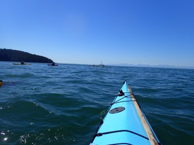
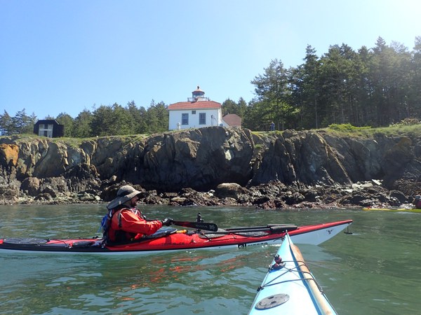
We had a short huddle since most of it had been covered in the itinerary and emails. We launched a little late at 0915. Alia told me before we launched that due to her minimal experience in Deception Pass she was hoping to go through at slack. We got out of the marina area, completed a radio check and I noticed some people coming down the cliffs on the headland. Then it was whipped around the point and into some eddies and chattering water to get into the current that was building fast and would push us over to Washington Park. We pulled out and some went to check out the new bathroom that replaced the Honey Buckets on the east side of the park. Then it was back into our boats to continue on in the rippling water on to Green Point and around Fidalgo Head. There wasn’t much action in the water or on it. There were a few distant kayakers that went into Burrows Bay while we continued on to Burrows Island. There was a crane outside one of the buildings at the lighthouse and we were surprised to see activity there. A guy came out and waved near the front. He told me that some work was going on to clean up the lighthouse; I guess it is time for its once in a decade or so cleanup.

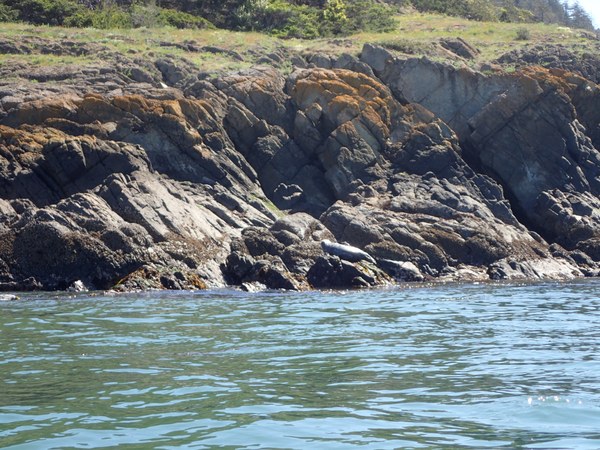
Nobody needed to stop so we proceeded on in the quiet water and bright skies down to Allan Island. I got a picture of a seal snoozing on a rock that happily didn’t move as we went on by as quietly as we could.

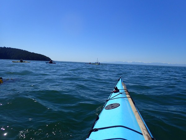
The dying current was still a big help as we headed towards the shore south of Biz Point with a clear view of the Olympics. The warm sunshine and calm water was a nice contrast to the other times I have done this trip in cold rain and messy conditions.

We were going slower than expected so by the time we stopped for lunch on a convenient beach the tide was turning. The water level was too low to go into any of the caves so that saved some time. Bowman Bay and the cove prior to it were busy with cars and boats; a fisherman on a pedal boat made fast time in front of us for much of the way.
It was about 1430 when were moving into Canoe Pass, the north side of Deception Pass. With slack an hour prior I figured that the current was moving around 3 knots and had my tow belt carabiner clipped to the front of my PFD to grab if needed. Henrique and Jerry went first, Lori agreed to stick close by Alia with Terry right behind and me in the rear. When asked I advised them to go up the center and that was a mistake. Alia got caught in a back eddy and was swept a bit behind; I hung back until she was able to get in front of me again. By this time Lori was ahead a ways but I think she hung back, waiting for Alia. I could see Henrique and Jerry already in the pass about in the center. It has been years since I have gone into Canoe or Deception Pass on the flood with any appreciable current and I had forgotten about that eddy on the east end of Pass Island. Instead of hugging the south side of Canoe Pass to hop over the eddy line to maintain a straight line I saw the others getting swept by the current towards the rock wall on the north side. I concentrated on watching Alia who was quickly being pushed forward then rapidly swept to the left with Terry following. I saw her get into a drop and could only see her shoulders and none of her boat but she was able to keep going. I positioned my boat broadside to slow me down so I wouldn’t get too close to them. By the time I got closer they were around the rock and I could see a drop with a whirlpool boiling in the bottom of it between me and the wall with about an inch to spare. I dug hard with my stick on the right side to clear the top of the boil and came around the rock to find Alia in the back eddy in front but Terry’s bow was pinned into a boil and his boat had turned broadside to me. I hollered to Alia to keep paddling and to Terry who turned a startled face at me as I shot behind him and it felt like I missed his rudder by inches. Alia was ok in front with Lori now next to her and I was going to start back paddling when I heard Terry laughing behind me and knew we were all clear. Henrique said later he had clocked us at 9 knots.
We were able to continue fast time towards Yokeko Point and just past it I could see where the gulls were circling around over a patch and knew something was fishy down there. The water chatters as the fast currents—and fish--get squeezed towards the suddenly deeper water off of Hoypus Point on the other side. The water was chattering and swirling again and I saw a motion to my right and a yelp from Terry…two porpoises jumped out of the water right next to him!
Soon we were approaching the west end of Skagit Island and we pulled on over to the left side of it. Terry went on a little ahead at my request and by the time the rest of us got around to the other end he was out of his boat and exploring the campsite. I was disappointed to see a family on the shoreline and another guy at a picnic table at the primo site beside a smoking fire. Jerry got out of his boat and it seemed like I was waiting a long time before they came back, reporting that while there were camping opportunities left it wasn’t much. We would have had to split up our camps and Terry reported the picnic table on the left side was too dilapidated to use.
So it was on to Plan B to Hope Island about a mile to the south. A lone kayaker came out as we approached the campsite on the north side about midway along the shoreline and told us that there was already a party there but had said they were leaving. There is a rope swing hanging from a tree in front of the campsite. We had to climb up an embankment but it wasn’t difficult with some hanging roots and niches just above the driftwood on the beach. The visitors with their four dogs confirmed they were leaving and by the time our boats were unpacked we had the whole place and their cheerfully abandoned fire to ourselves.
A ranger came by in a power boat to collect fees and give information as I was still setting up. While there is supposed to be four sites we figured there was three with a well stocked vault toilet typical in the San Juans. The ranger also said the whole island is now a reserve. The only accessible area is the campground and beach in front of it. While a few faint trails were seen no hiking is allowed.
I was disappointed that I missed my opportunity to camp on Skagit Island and explore the Kukutali Preserve on Kiket Island next door but there wasn’t much to complain about where we were. There are plenty of beautiful trees that provided shade and protection over the mostly level areas to pitch our tents. We had a nice view to the north with the steam cloud coming from the refinery in Padilla Bay smack in the middle. But the sky was blue, the temperature was pleasant and the sunshine was sparkling off the blue water and I marveled that it looked and felt like a summer day in the middle of May!
We moved the boats up on the narrow beach as far as we could push their bows into the embankment below the trees and propped up the back ends on top of the driftwood. Even so I always tie them off so they can’t wander off when the tide comes in.
The rest of the day was spent with pleasant conversation, eating our dinners with our campfire courtesy of the prior visitors and the wood I had brought in my boat. I ate my dinner sandwich and was pleased to see my stove immediately fire up when I boiled the water for my tea. I knew from the night before that my Big Agnes pad worked fine and it was not quite dark when I said good night to the others and curled up in my down sleeping bag in my snug little tent. I was so glad I didn’t have to mess with any tarps!
SUN 05/12/24 - TIDES: TURNER BAY TIDE: 8.7 @ 0719 / -1.2 @ 1501 / SNEEOOSH PT: 9.3 @ 0728 / -1.1 @ 1509 / LA CONNER: 8.5 @ 0749 / -1.5 @ 1516 / SWINOMISH CHANNEL NO: 7.2 @ 0642 / -1.6 @ 1458
CURRENTS: SKAGIT BAY CHANNEL: +2.1 @ 0910 / S @ 1251 / -2.3 @ 1543 FLOWS SOUTH ON EBB / GUEMAS CHANNEL EAST: -0.2 @ 0609 / -2.3 @ 1130 / @ S @ 1537
The area between Skagit and Kiket Island, the east half of Hope on all sides and much of the east half of Skagit Bay below Little Deadman Island is a mud flat on low tide. The south end of a boat channel begins west of Goat Island, continues through Swinomish Channel on the east side of Fidalgo Island and continues about 2 miles north of the Hwy 20 Swinomish Channel Bridge into Padilla Bay. The channel is wide enough for two lanes of boat traffic coming and going with a little bit of clearing on both side. The north and south ends are enclosed in berms and are marked with pilings notated on a chart. The Army Corp of Engineers dredges the channel 15’ down about every five years but my resources reported they were now a year behind because of lack of money. I was also told that it had to be less than 4’ before the boat ramp under the bridge couldn’t be used by power boaters. I was also advised that while it is allowed it is not recommended to leave a car overnight under that bridge.
While empty kayaks only need about 6 inches of water to float I knew from my own experience we needed at least 4’ of water to get across the berm on the south end across from Goat Island on the south end. This could be avoided simply by staying to the right of the piling markers which we did. My main concern was getting to the north end of Swinomish Channel by noon and across Padilla Bay without getting washed up in the mud with loaded boats with a negative tide.
We launched close to the max high tide and would be on the ebb for the rest of the paddling day. In a shallow area the water rises and falls surprisingly quickly so I wanted as much time as possible for our return to Anacortes. We were a little late, launching about 0720. We headed out into bright sunshine and calm water towards the west end of Hope before turning south. A power boat was rushing around, making a racket as it zigzagged across the bay. We had the ebb slightly against us but not enough to be annoying as we continued mid channel before making a left to cut across the edge of the marked area on the chart. We never saw any trace of the berm so I knew we were in good shape so far. After about an hour we stopped for a bio break on Goat Island. There was a large number of kayaks up and down the shore and one member of the party asked if we were going to help the power boat. He said as they had been buzzed by its wake they were not inclined to do so. He pointed towards the power boat we had seen earlier that was now in the extreme southern corner of the flat stuck in the mud. They had at least a 10 hour wait before the water level would rise enough to float that boat. While kayakers have been known to tow power boats out into deeper water we weren’t inclined to do so either. We continued on into Swinomish Channel. It was easy to follow the swirling lines marking the building current. Like Pickering Passage and other narrow natural channels the ebb and flood currents work at both ends with the turn around point moving up and down the passage. Paddlers need to pick their way through the currents to find the best route. We found ours and nobody needed to stop so the current was moving at least two knots by the time we passed the last houses of La Conner. I could see where the wind was moving flags on the poles outside of some of the houses but we were seemed to be protected from it down in the channel.
It was about 11:30 and the Swinomish Bridge in sight about a mile away when we pulled out on the empty sandy east bank for lunch. I noticed that the sand seemed like it was glittering; I don’t know if it was finely ground glass (bad) or fiberglass (worse) or something else (ugh). I also noticed when I moved off from the others to do my business that there was human excrement on the shore. I don’t know if this is from campers, septic tanks or ??? But it confirmed my suspicion that Swinomish is one dirty channel.
After a half hour or so we saddled up and continued on. Nobody needed to stop at the bathroom under the Bridge so we would have the last five miles to go before we would have another chance.
The power boats had become a stream before we left Swinomish Channel and Terry said it looked like an Armada as we continued up the dredged channel through Padilla Bay. The channel got narrower as we continued north and at times my stick was hitting the bottom in between the boat wakes. After about a mile we had a lull in the traffic and fled like “bicyclists across a freeway” to get to the west side before more showed up. The traffic did slack off as we got farther north. But we weren’t going very fast. Industrial smells became noticeable as we got alongside the refinery and I noticed a lot of sea grass along the bottom as the tide was carrying out the water. The refinery has two long loading docks. The east one is about ½ a mile long, the west one at least one mile but the north ends are even. I approached the east dock wondering if we could do a short cut underneath but several prominent signs warned to stay 300’ away from the docks at all times.
It took 2.5 hours in an almost unnoticeable head wind at the very last to get the final approximately five miles to Cap Sante, arriving at 2:30. The extra hour and a half cost us as we were now much farther down on the rocky beach to the staging zone. It took another hour to retrieve the cars, get changed in the fully stocked bathrooms and loaded back up. A post trip huddle resulted in no complaints, plenty of smiles and we were all gleefully satisfied with our wonderful weather. A comment was made about the contrasts on Fidalgo Island. I have always felt that way on land but it strikes me how much more evident it is on the water!
All paddlers performed to the best of their abilities with exceptional group dynamics.
NOTE: After studying the route the next day I realized if the trip is done in reverse it would make it a completely different trip! I will try it that way next year. Also, on the flood it may have been easier to go through Deception Pass instead of Canoe Pass.
 Lisa Johnson