Trip Report
Sea Kayak - South Puget Sound: Olympia to Steilacoom
Excellent conditions for this never-before kayak sailing trip
- Sun, Nov 19, 2023
- Sea Kayak - South Puget Sound: Olympia to Steilacoom
- South Puget Sound: Olympia to Steilacoom
- Sea Kayaking
- Successful
-

- Road suitable for all vehicles
-
Short hand carry down a trail to the water. Ample shore line for several boats. 13.5’ tide height at Totten at 9:30a launch. Could be done at least 1’ lower.
Launched on incoming tide. Paddled around Steamboat Island due to insufficient clearance under causeway bridge, 15’ tide height. Could be done at 13’.
We had enough daylight to get to the landing in Steilacoom with three conservative breaks.

During the fall wind storms the Olympia Branch offers Olympia to Steilacoom downwind trips. They are a stunning way to view the zig-zagging shoreline and views of the Olympics and Rainier while enjoying sporty conditions and wind-wave surfing opportunities. Generally, we launch from either downtown Olympia or Boston Harbor. Yet I wondered if we could traverse the entire South Sound by launching from Totten Inlet. As far as I know this had not been done before in a Mountaineers trip.
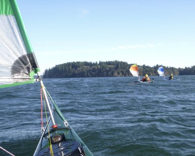
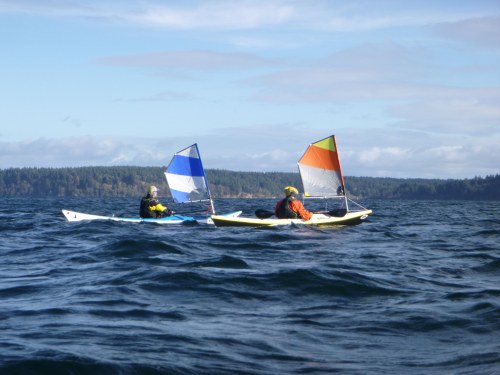
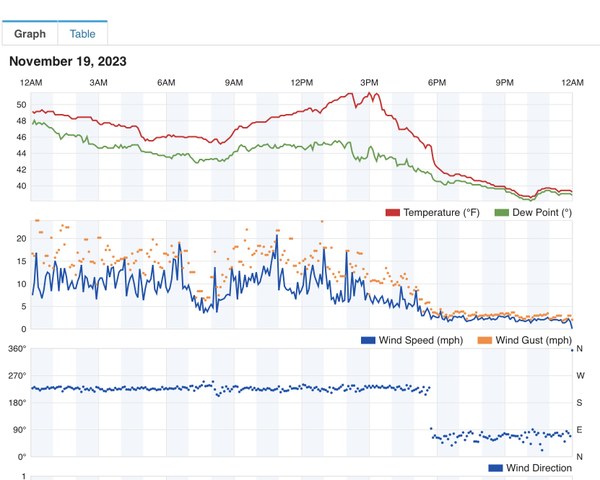
We launched at 9:30 to light rainfall and a rainbow. The sailing conditions were excellent in Totten Inlet with 10kt sustained and gusts around 15kt. I confirmed the wind speed with a handheld anemometer (which would later be my undoing) and data from an amateur weather station on Totten. We had a great view of the Olympics near the opening to Little Skookum Inlet. About halfway up Totten a squall drew near bringing wind, but stayed far enough away not to rain on us. We had many surfing opportunities in the fetch north of Cougar Point. My GPS speed frequently spiked between 6-7kt, with one to 9.5kt! A large sailboat worked its way back and forth. The water was too high (about 15’) to squeeze under the Steamboat Island causeway bridge. This can be done at about 10-13’. It took less than two hours to sail the 9nm to Hope Island, our first break.

The crossing from Hope Island to Dana Passage put the wind to the starboard side. It wasn’t as fast but gave us some help through the 1-1.5’ waves in the bay. Dana Passage was swift with the low sun glimmering off the water. “You were really moving,” an onlooker told me the next day. We covered the 5.5nm from Hope to Johnson Point in an hour and a half.
We took a very quick break in the water at Johnson Point since this would be the last opportunity for a while. The group decided to extend the trip by 1nm and take the southerly route to the tip of Anderson Island. We saw a working boat and a sailboat underway in the bay near Key Peninsula.
I checked the wind speed here and there along the next leg, reading 12kt sustained. A gust caught me with one hand on the anemometer and I capsized. The group had me back in the boat in about two minutes(!) and we were on our way. This is why we train for incident management.
We took another short break on Anderson. It seemed the most intense wind was in Nisqually Reach. Once we headed out toward Ketron Island, the wind subsided and we had a pleasant cruise north sprinting frequently to surf many small waves. GPS indicated 10 spikes to 6kt or better.
The Anderson Island ferry was working back and forth in Balch Passage. As we approached Steilacoom we waited for it to load and depart before landing at precisely 4p.
All in all it was an epic trip with perfect conditions of wind speed and direction, timing of tides, and bright sunshine. With a great group of seasoned kayakers, it was a trip we will not soon forget.
 Caleb Fitts