Trip Report
Silver Star Mountain/Silver Star Creek
Successful climb of Silver Star Mountain threading the needle on weather with winter conditions on the summit block
- Sat, May 18, 2024 — Sun, May 19, 2024
- Silver Star Mountain/Silver Star Creek
- Climbing
- Successful
-

- Road suitable for all vehicles
-
Approach post-2022 fire is through deeply burned forest, hundreds of downed trees, rocky, soil-stripped slopes and boulder fields. Left trending gully had snow from first bench to second but too thin and soft and deep post holing was inevitable.Great snow conditions above 6000 feet. Large slab avalanche in left coulour above camp. Glacier completely snow covered. No crevasses. Summit block has many feet of snow, rhyme ice on rocks and overall winter condtions
Sometimes you don’t know until you go!
I took over a climb of Silver Star Mountain that had to be cancelled due to leader’s injury.
I knew the assistant leader, Rochelle, very well and also knew a couple of other participants and it seemed like a solid crew. A great opportunity to dip my toes again into leading alpine climbs after a couple year’s hiatus in leading (I had still done alpine climbs just private trips).
I had climbed Silver Star Mountain twice before. The first attempt via the Silver Star Creek route was in 2015 with Matty P. as a leader. It was my very first climb with the Mountaineers and sadly it was a turn-around on day 2 from camp due to weather turning. This was pre-2022 fire. I had also successfully climbed it with my partner Brian via the Burgundy Col in early July 2017. I was curious to return as this is a beautiful area and summit.
When I (re)posted the climb and offered to the participants of the cancelled climb, the weather forecast was pretty good and the participants were eager to go but throughout the week the weather forecast deteriorated and by decision time, Thursday evening, is was trending pretty cold (lows in the mid twenties) with chance of precipitation (snow) 70% on Saturday and maybe a weather window early on Sunday. Understandably two participants opted out leaving us with a team of 4. We discussed and decided to give it a go, worst case scenario we would get a good workout and have a nice high alpine camp at 6500 feet. The weather was a complete surprise and much better than forecasted with partly sunny skies both days and only a couple of 10 min flurries each day. Clouds passed by near the summit but visibility was never a problem. The temps were indeed quite cold at night, reaching in the low 20s but we were well-prepared with winter camping gear and passed the night comfortably. The main challenges of the trip were a very tedious and taxing time going though the burnt area and winter conditions at the summit.
The beautiful forest and good boot path I remembered from 2015 were obliterated by the fire, with hundreds of downed burnt trees and rocky terrain as the soil had completely been stripped down in many areas. After reaching the first bench we navigated left (I remembered slide alder and post holing hell from the first time on the climber’s right side) and read of a much better approach staying climber’s left. The ascent from the first bench to the second one on climber’s left went through boulder fields and more burnt forest.
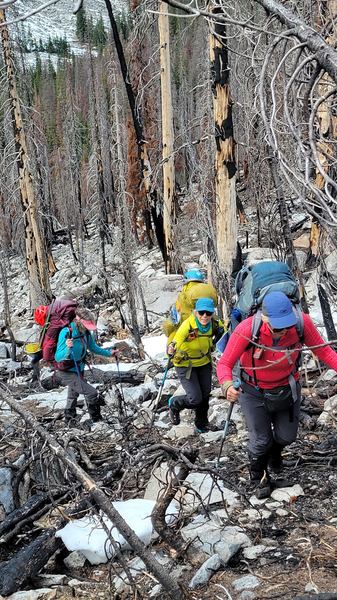
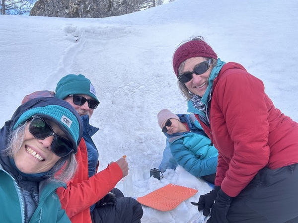
That part was steep and tedious but not too bad but once we hit continuous snow (at about 5700 feet) we had to traverse the slope and had a tricky time with some big post holing This part was very unpleasant. We eventually made it to a good protected camp spot at 6600 feet. It was a bit windy when we arrived, but it calmed down in the evening. We built a little kitchen alcove, had a nice dinner and went to bed early.
Evening at camp
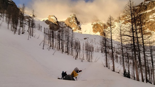
Morning at camp
The next morning, we started our climb donning crampons at 6 AM. The snow was perfect neve with that wonderful crunchy Styrofoam consistency when your crampons bite in so well. Soon we were in the lower left couloir and found a pretty massive slab avalanche that presumably happened last weekend with high temps. I was surprised to see it because skier’s reports I read from the previous weekend did not mention it, so we assumed it happened after the skiers were through (good!) Because the temps were so low and everything was frozen solid, we felt ok traversing below the avalanche scar (more to still come, as cracks indicated).
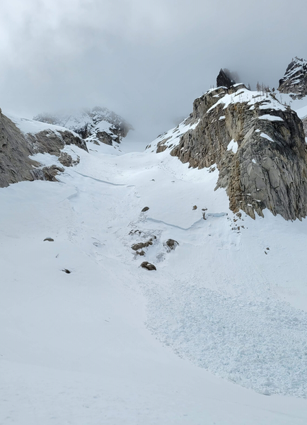 Large slab avalanche (from last weekend) on the left gully leading to the upper glacier basin
We made quick and careful progress here and did not linger. Above that section the glacier was in perfect condition with nice icy snow, zero crevasses and only a few drifts of soft snow. The last major storm in early May really delivered up there. My partner and co-leader Brian and I took turns breaking trail and zig-zagging the 2000 feet to the base of the summit block. We did not rope up for the glacier as there were no crevasses.
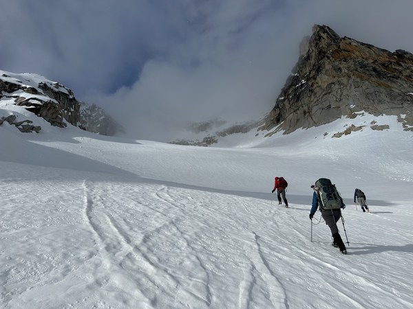
Ascending the upper glacier basin with ski tracks covered by snow drift
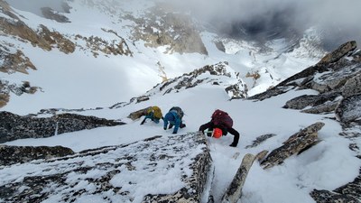
At the col it was breezy and very cold and rhyme ice was coating all the rocks. In between short moments of white-out when clouds were passing by, we saw the summit block and realized it had a LOT of snow. Completely different conditions from when we did that in early July snow- free.
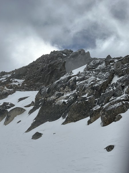
Summit block from the Col
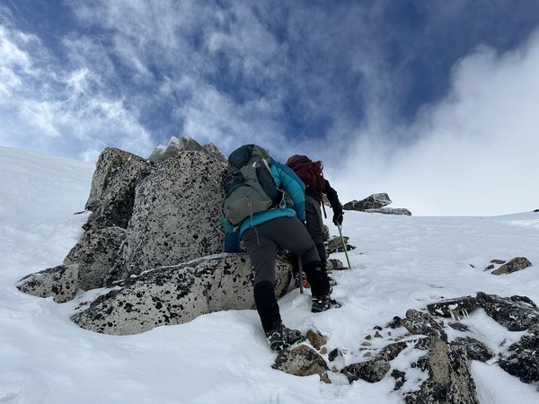
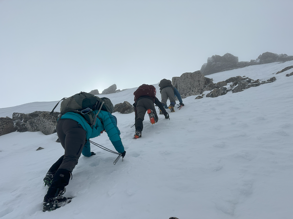
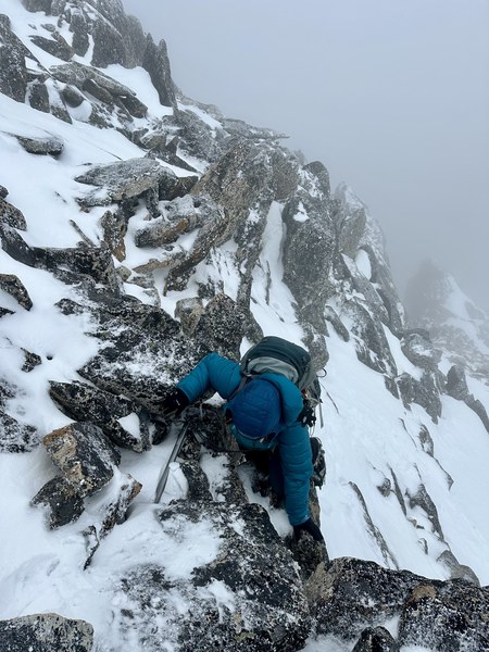
We discussed as a group whether we wanted to attempt it in these winter conditions. Everyone in the group was experienced (two climb leaders and two intermediate students) and willing to at least go up a bit and see. I think if we had any basic climbing students, we may have turned around or if we had time, set up pickets and rope up. We started far right on a short icy step. I went ahead and kicked deep bucket steps and used my slightly curved ice ax in low dagger position. It went in beautifully and I felt confident on my ascent. Once on a little gentler terrain we proceeded up on snow ramps and made a few scrambles moves on small rocky steps, then found more steep icy snow sections to front point until we reached the final section right below the summit.
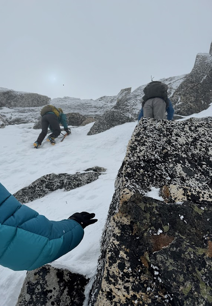
First steep step
Easier ramps in snow
Another steep(ish) section
Andrea making a scramble move over a rocky step
Most rocks were covered in rhyme ice. I had gone over my pictures of the summit from the previous time and the large amount of snow made everything look so much different. We were looking for the easy class 2 ramp on the right side that circumvents the final chimney but all we found was a steep class 5 section that we retreated from.
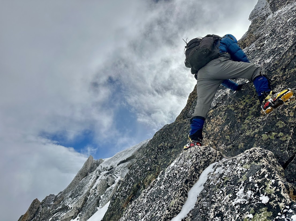
Brian looking for the class 2 ramp and ending up on a class 5 section that he retreated from.
We finally spotted the final chimney and the real summit. Most of the rock leading to the chimney was filled with snow until the last squeeze chimney move.
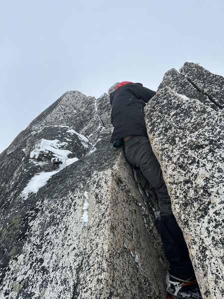 Rochelle in the squeeze chimney
There was a narrow ledge covered by snow where all four of us could barely fit. We took turns reaching for the summit (it’s a pointy spot not a platform of any kind) and then took a couple of summit photos then downclimbed the steep snow sections back to the col.
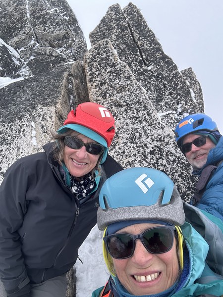 Summit shots at the ledge right below the summit
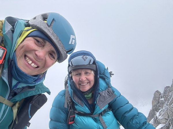
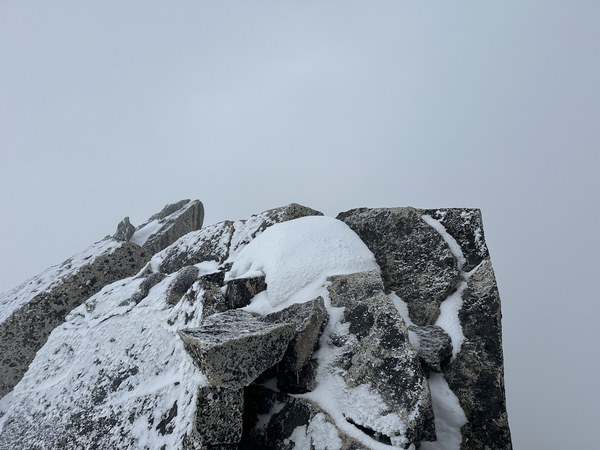
False summit
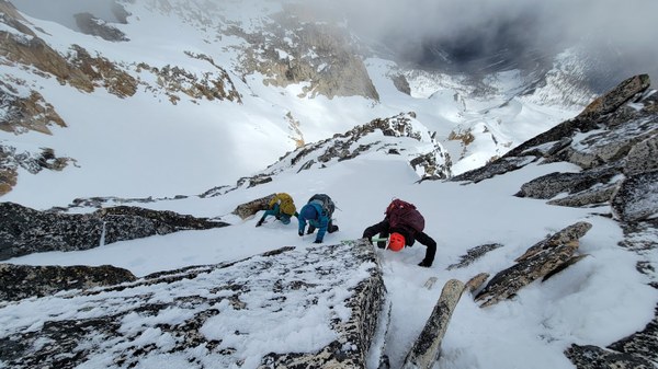
Downclimbing from the summit
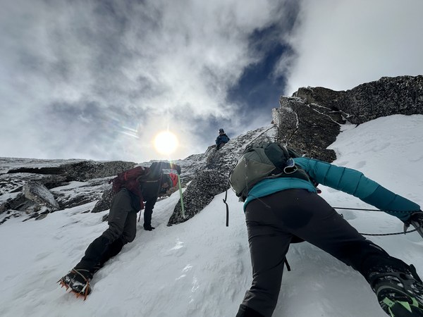
Downclimbing steep snow below the summit
The ascent from camp to col had taken us 2 hours and the summit part (up and down) another two hours. After a short break at the col, we made a quicker descent back to camp, carefully but quickly passing by the avalanche, reaching camp at noon. We took an hour to eat and repack our gear. Since our ascent route to camp from the lower bench had not been so great, we decided to try a different route down following some tracks we had uploaded in Gaia. The first part was mellow snow in open forest. Snow was great, it was pretty and we made fast time until we reached a much steeper area in dense trees. This ended up an interesting section navigating between tree wells, veggie belaying on tree branches, but we finally found some open snow near the bottom of the valley floor.
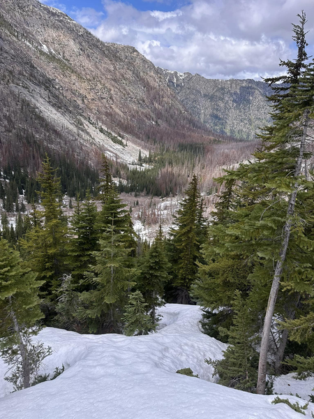
We were excited to get out of the trees, but the snow was too thin and soft, and we started post holing really deeply. At some point, all 4 of us were caught in different deep holes at the same time. We dug ourselves out except for one of us who required a little assistance (the snow was soft, but rocks were wedging her feet) and my shovel came in handy to extricate her leg.

The rest of the descent was uneventful, long and tedious alternating boulder fields, downed trees and slide alder. Each time we saw a more open area, it would get better for a while then got bad again, so we meandered a lot until a more discerning boot path re-emerged. The last mile was steep and rocky from the scorching, soil-stripping fire but we knew we were close to the comforts of the car waiting for us at the bottom.
I would say I would not recommeend attempting Silver Star from the Silver Creek route in the current conditions. Perhaps the lower approach would have been earlier this season, however the summit block may have been even worse. I think those trying to summit Silver Star this season would be better off waiting till snow is gone from the Burgundy Col and the summit and attempt this from the other side. The winter conditions we encountered up high made it more challenging than a basic alpine climb, but we all know that conditions make all the difference.
All in all, still a great climb with a small but experienced team and a great way for me to get back into the alpine and leading climbs.
 Emma Agosta