Trip Report
Sloan Peak/Corkscrew Route via Cougar Creek
Early season conditions made for a slow and difficult day, but spectacular views made it worth our while. Classic type-two adventure for a gorgeous PNW weekend.
- Sat, Jun 25, 2022
- Sloan Peak/Corkscrew Route
- Climbing
- Turned Around
-

- Road rough but passable
-
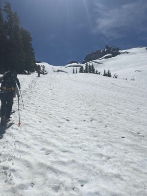
Encountered early season conditions. Logs jams are sufficient for initial creek crossings 0.5 miles from trailhead. Cougar Creek is impassable at 3K ft, but can be crossed at 3.2K ft. Lots of water in drainages and presence of consistent, consolidated snow made route finding slow and difficult, particularly from ~3.6-4.8K both ascending and descending. Didn’t get eyes on Sloan glacier but cracking visible below 5.8K. All indications point to snow remaining on traverse leading to summit.
Ascent
Our group of four arrived at the trailhead the night before and found one other vehicle parked. Trailhead register noted they’d left earlier that day to attempt Sloan, and three prior entries indicated parties made it only as far as the first river crossing. Found a sufficient log jam about 0.5 miles from the trailhead, staying left to continue upstream from where the trail hits the river. We camped at the trailhead, pitching tents just off the parking area as we didn’t anticipate the lot to fill.
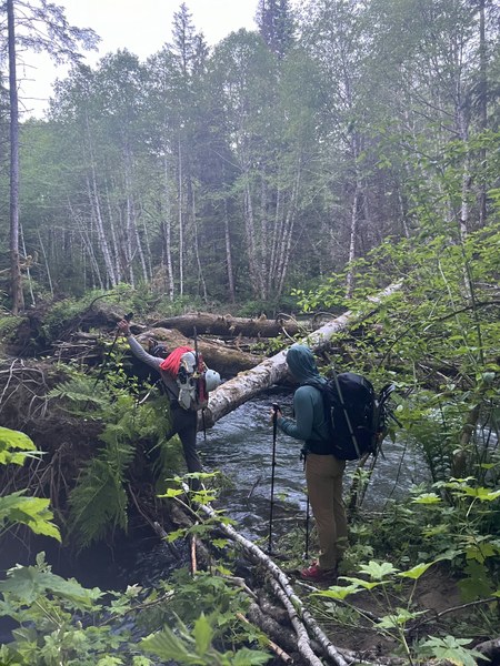
We headed out the next morning at 5a so we had daylight for the river crossing. Crossed the first log jam (one climber found the log pictured sketchy with tired legs and preferred to scoot across on the way back) and found a second log jam due west from the first. At both crossings, water is too high/deep/fast to walk across. Came upon a campsite in the sand bar on the far side the second crossing, presumably the other car parked at the trailhead. We picked up the trail about 400ft upstream from our second crossing.
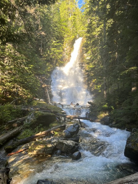
Just before 7a found Cougar Creek impassable at ~3Kft. Two climbers scouted upstream and found slower water at ~3.2K (after a steep 'schwack) for a successful crossing. We traversed at 3.2K and picked the trail back up just before 9a, knowing summit aspirations were toast after losing time finding a creek crossing. Pockets of snow first appeared at ~3.2Kft, becoming consistent at ~3.4Kft. Snow consolidated but punchy over brush/trees/logs. We brought but did not use snowshoes.
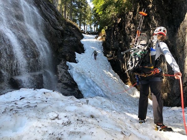
Lots of fast-moving water in drainages and presence of snow made route finding slow and difficult. There are 4-5 streams in the drainage from ~3.6K - 4.8Kft that are not mapped and likely don’t exist or are trivial later in the season but create significant challenges in navigating. This section took us ~3 hours to ascend. We unknowingly diverged from the trail at ~3.6K ft. at a creek crossing, and lack of crossing options led us first through a devil’s club forest and next a snowy gully with a lovely waterfall running down one side. We ran a couple of pickets and belayed each other up to protect against runout and moats forming on either side of the snowpack.
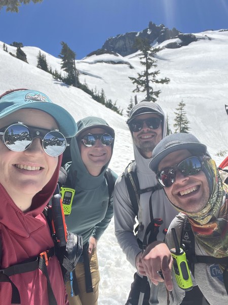
Once above ~4.8Kft continuing to our stopping point at 5.4K was uneventful, ascending in the shade as much as possible. Some cracking is visible below the ridge at ~5.7Kft. Upon our arrival to 5.4K at 1:30p we opted for spectacular views in the shade vs. roping up to ascend the final 400ft to the top of the ridge to get eyes on the Sloan glacier. Our walkie talkies picked up a couple of skiers dropping Glacier Peak, and it was fun to briefly chat with another group sending it on such a beautiful day.
Descent
We began to head down at 2:15p. Descent in snow from 5.4K - 4.8Kft was slushy and fun. We again encountered issues with fast-flowing water and pinch points in descending the drainage from 4.8K - 4Kft, though following a different descent route truer to the trail. Once below ~4Kft creeks consolidated and route finding improved to the bottom of the drainage at 3.6Kft where we picked up the trail. Remaining descent was uneventful, as expected water level had risen noticeably since our morning crossings. We arrived back at the car at 6:35p. We did not encounter the other climbers after passing their campsite that morning, and assume they turned around after finding Cougar Creek impassable at 3K ft the day prior. Car beers were earned and appreciated!
 Claire Kafer