Trip Report
Winter Scramble - Arthur Peak
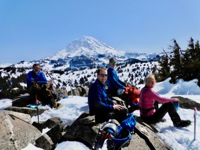
A strong group of 5 had beautiful weather for a long day loop route up to Arthur using the Boundary Trail and the ridge out to Alki Crest for the ascent and the NE ridge for descent. With a mostly level traverse in the trees below Rust Ridge in between. Weather and views were fantastic and snow conditions were very stable.
- Tue, Apr 6, 2021
- Winter Scramble - Arthur Peak
- Arthur Peak
- Scrambling
- Successful
- Road suitable for all vehicles
-
Road washout at Park entrance, parking along road. Sani can outhouse.
Firm compact snow starting at 3500 feet.
6:30 Am Start ~ 7:15 pm Finish. Approximately 13+ miles with 5500 feet of elevation gain and loss.
Experienced group of 5 decided to reverse the loop from the 2018 trip and commit to the Traverse to take advantage of the firmer snow conditions by getting to Rust Ridge earlier, on this Low avy danger day, with loose wet conditions predicted.
Lots of new tree damage from mid Jan wind storm.
We put on Microspikes or crampons at 3800 ft, all switched to Crampons by 4600 ft. Our ambitious group headed up to the false summit of Florence to enjoy the views on this sunny day. It was a great vantage point to view the rest of our route to Arthur. Continuing SE along Alki Crest on the South side of Florence. No boot path from here on. Descended E off the ridge before reaching Point 5255 to gentle terrain. Skirting below Rust Ridge around 4800 ft staying just above the trees. The snow conditions were firm. One of our party forgot their snowshoes, the group managed in crampons with minimal penetration occasionally breaking thru to knee deep snow. Worst case we figured two folks could go on 1 snow shoe each, luckily we did not see conditions needing this.
Wind patterns indicated that snow had been moved up towards Rust ridge, Snow sloughs off the rocky cliff tops throughout the year. Suspect more snow depth below the cliff bands. No Signs of previous avalanche activity on these NW facing slopes. The snow depth at our 1 pm lunch stop below the ridge was over 8 ft. No signs off loose wet avy conditions. We proceeded 1 at a time through 2 areas of terrain concern. Everyone had Avy gear, with the exception of 1 without a beacon.
Continuing to the confluence of the two ridges coming up toward Arthur from the Carbon we turned South for the Final push to Arthur arriving around 2 enjoyed the views and a well-deserved break leaving the Summit at 2:20pm. We descended the extremely steep north ridge towards Falls Creek. We ran into a massive amount of old growth blowdown much higher than anticipated, somewhere around 2800 ft. This made for a terribly slow return to the Carbon Road by 6:15. These are conditions one rarely gets the opportunity to experience, very easy for the party to get a bit separated searching for the path of least resistance thru the massive timber, and prickly lush undergrowth. Occasionally walking hundreds of feet along old fallen trees looking down at the ground 2 to 10 feet below. The ridge to the east coming out at 2800 ft on the Green Lake trail may have been a better option. Enjoyed the easy 2 mile road walk back to the car.
 Turner Bluechel