Trip Report
Winter Scramble Attempt Mt. Senjogatake in Japan's Alps
Ended up as a great winter camping trip, recent storms made travel difficult and avalanche slopes on the upper mountain too likely to summit.
- Fri, Jan 7, 2022 — Sat, Jan 8, 2022
- Hike and Scramble in Japan's Northern Alps
- Scrambling
- Turned Around
-

- Road rough but passable
-
Route had a good deal of fresh snow from recent storms. The approach through the river valley was not bad but once at the saddle and up on the ridge, the wind had deposited quite a bit more snow.
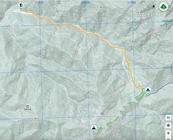
Mt. Senjogatake is a 9,949ft peak north of Japan's second highest mountain, Kitadake (10,473ft). 9,949ft is an unremarkable number in the imperial system, but for Japanese mountaineers this is one of the '3000m' peaks of Japan (3,033m) so it is often a major bucket-list summit, especially in winter. There are two main approaches to this peak, the first being a long, but direct route from the west ridge, and the second being a shorter direct route from the east ridge. In the summer, the base of the east ridge is accessible by bus and hosts a full service mountain hut. However, in the winter this road is closed and adds an additional 12.5 miles and 4,410ft of elevation gain to the climb, making the route total about 19 miles and 8,510ft elevation gain. Most locals do this as a 1 or 2-night climb in the winter, by either route. The orange line shows the winter approach, the green line is the east ridge route to the summit.

The northern river-valley approach and eastern ridge make for the most scenic route and is also the least common, so I decided to take that route starting on a Friday to see if I might be able to have the route to myself before the Saturday crowd arrived. My work scheduled had given me enough time to do a 1-night trip, so not ideal given the distance and winter camping gear requirements, but it was well worth an attempt.
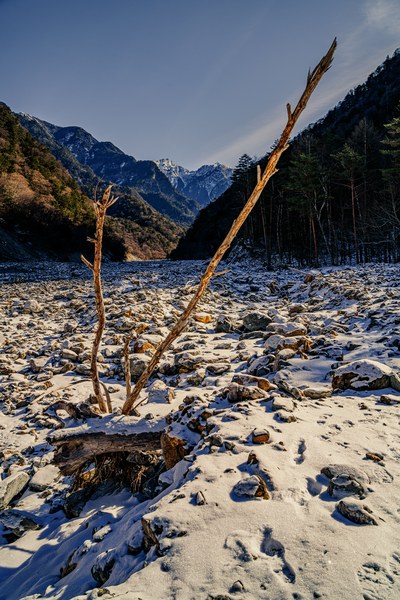
I left my rental home at 3am and arrived at the trailhead just after 6. I got on the trail by 6:30 and started the approach. Overall the approach was easy to navigate, following the riverbed south. The fresh snow had removed previous tracks, so it was not always simple finding the most efficient route through the boulder fields, which were also not comfortable to navigate in mountaineering boots, but I arrived at a bivy site outside a shuttered mountain hut just over the saddle around 6,500ft without too much difficulty. The trail had a few steep sections that were still icy, ascending out of the main river valley into the smaller tributary gully leading towards the mountain. I encountered one pair of climbers on the way in, but didn't speak enough of each-others languages to exchange much information of use.

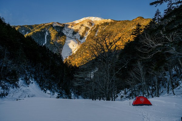
The water was still running at the mountain hut , which was a huge win, not having to melt snow for water. The stream had formed an ice-shell around the spigot so I just needed to chop it away and I had as much water as I needed for the overnight. Temps were pretty chilly, hovering right around my sleep system rating of 0F, but the winds were low so it was a fairly comfortable night.
I started off at 4:00am the next morning to go for the summit. Around 6,750ft the snow became about thigh deep and all previous tracks dissipated; it looked like the last party to attempt Senjogatake had turned around, possibly the pair I had passed on the way in. I kept pushing on for another couple hours until sunrise. At about 7,000ft the snow did not show any signs of thinning out, and once the sun rose and I could see the distance I saw that two sections of the route either went under or on avalanche slopes or would probably require climbing gear, so I decided to call it and turn around.


After packing up the tent I started the long slog back to the car. The uneven rock bed of the river valley was doubly unpleasant in mountain boots on the way out, it was a huge relief to get the feet free once I was done.
 Nathan Derrick